Beaches
Recent Articles
More Articles

Nunagiak, Point Belcher
Nunagiak is an abandoned village at Point Belcher that dates to the prehistorical Thule culture, located about 78 miles (126 km) southwest of Utquiagvik and 15 miles (24 km) northeast of Wainwright, Alaska.
Kashvik Bay, Cape Kubugakli
Cape Kubugakli is a prominent headland on Shelikof Strait that forms the southwest coast of Kashvik Bay and marks the southern coastal boundary of Katmai National Park and Preserve, about 98 miles (158 km) west-northwest of Kodiak and 75 miles (121 km) southeast of King Salmon, Alaska.
Jabbertown, Point Hope
Jabbertown is a historical shore whaling station on the Chukchi Sea coast, about 150 miles (242 km) northwest of Kotzebue and 2.5 miles (4 km) southeast of Point Hope, also known as Tikiġaq or Tigara, Alaska.

Sealing Point, Cape Krusenstern
A sealing observation tower used seasonally by Iñupiat hunters is at the tip of Cape Krusenstern, about 48 miles (77 km) southeast of Kivalina and 35 miles (56 km) northwest of Kotzebue, Alaska.

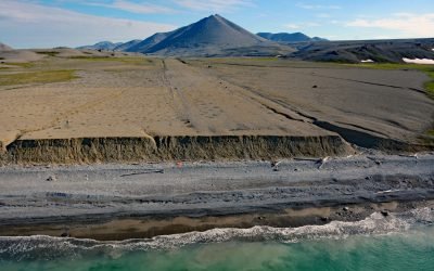
Kustatan, West Foreland
Kustatan is a historical Dena’ina community on West Foreland, on the west side of Cook Inlet near the mouth of the Kustatan River, about 71 miles (115 km) southwest of Anchorage and 20 miles (32 km) northwest of Kenai, Alaska.
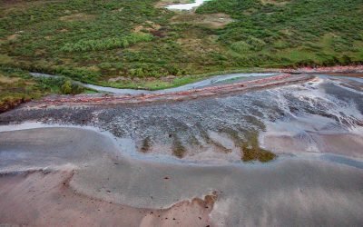
Lost River Mine, York Mountains
Lost River starts at an elevation of 1400 feet (427 m) on the south flank of the York Mountains on the Seward Peninsula and flows south for 9.5 miles (15 km) to the Bering Sea, about 86 miles (138 km) northwest of Nome and 31 miles (50 km) southeast of Wales, Alaska.

Tongue Point, Semiahmoo Spit
Tongue Point is at the end of Semiahmoo Spit, a sand bar of 125 acres (51 ha) and about 1 mile (1.6 km) long that partially encloses Drayton Harbor, about 21 miles (34 km) northwest of Bellingham and 1 mile (1.6 km) west of Blaine, Washington.
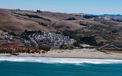
Dillon Beach, Bodega Bay
Dillon Beach is a community situated along Dillon Creek that starts at an elevation of 430 feet (131 m) and flows generally west for 1.3 miles (2 km) to Bodega Bay near the mouth of Tomales Bay, about 43 miles (69 km) north-northwest of San Francisco and 7 miles (11 km) south-southeast of the community of Bodega Bay, California.
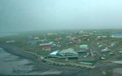
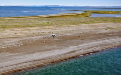
Nelson Lagoon, Bering Sea
Nelson Lagoon is a community situated on the Bering Sea coast of the Alaska Peninsula, on a narrow barrier sand spit forming the embayment of Nelson Lagoon, about 258 miles (415 km) northeast of Dutch Harbor and 24 miles (39 km) west of Port Moller, Alaska.

New Dungeness Light Station, Dungeness Spit
New Dungeness Light Station is located on Dungeness Spit in Dungeness National Wildlife Refuge on the southern coast of the Strait of Juan de Fuca, about 17 miles (27 km) west-northwest of Port Townsend and 7 miles (11 km) north of Sequim, Washington.
About the background graphic
This ‘warming stripe’ graphic is a visual representation of the change in global temperature from 1850 (top) to 2019 (bottom). Each stripe represents the average global temperature for one year. The average temperature from 1971-2000 is set as the boundary between blue and red. The colour scale goes from -0.7°C to +0.7°C. The data are from the UK Met Office HadCRUT4.6 dataset.
Click here for more information about the #warmingstripes.