Beaches
Recent Articles
More Articles
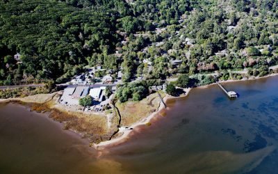
Inverness, Tomales Bay
Inverness is a community on the southwest shore of Tomales Bay, about 19 miles (14.5 km) southeast of Bodega Bay and 3.5 miles (5.6 km) northwest of Point Reyes Station, California.
Indianola, Miller Bay
Indianola is located on the north shore of Port Madison and east shore of Miller Bay on the Port Madison Indian Reservation, about 14 miles (23 km) northwest of Seattle and 4.6 miles (7.4 km) east of Poulsbo, Washington.
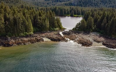
Peterson Lagoon, Eagle Harbor
Peterson Lagoon is the estuary of Peterson Creek that starts from the outlet of Peterson Lake at an elevation of 734 feet (224 m) on Auke Mountain and flows north-northwest for 4 miles (7 km) to the lagoon that connects to Eagle Harbor, about 56 miles (90 km) south-southeast of Haines and 19 miles (31 km) northwest of Juneau, Alaska.
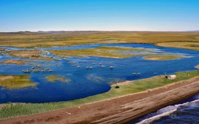
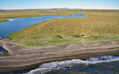
Rabbit Creek, Imik Lagoon
Rabbit Creek starts in the Mulgrave Hills and flows southwest for 23 miles (37 km) through the File Mountains, also known as the Tahinichok Mountains, to the Chukchi Sea at the southern end of Imik Lagoon in Cape Krusenstern National Monument, about 96 miles (155 km) southeast of Point Hope and 53 miles (85 km) northwest of Kotzebue, Alaska.
Aitiligauraq Shelter Cabin, Cape Krusenstern
Aitiligauraq Shelter Cabin is in the Cape Krusenstern National Monument in northwestern Alaska and is situated on the south bank of an unnamed creek that flows west for 5 miles (8 km) from Eigaloruk Mountain to a coastal lagoon, about 110 miles (177 km) southeast of Point Hope and 40 miles (65 km) northwest of Kotzebue, Alaska.
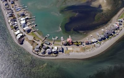
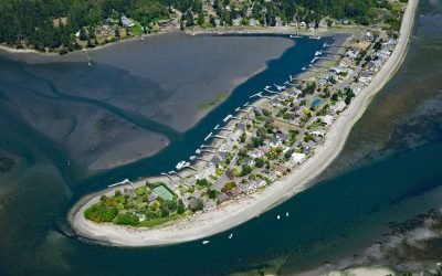
Hedley Spit, Bainbridge Island
Hedley Spit is a sand deposit with an elevation of about 3.5 feet (1 m), located on Bainbridge Island at Point Monroe, north of Faye Bainbridge State Park, about 11 miles (18 km) northwest of Seattle and 1 mile (1.6 km) northeast of Port Madison, Washington.

Cape Douglas, Shelikof Strait
Cape Douglas is a point of land at the base of Mount Douglas on the western shore of Shelikof Strait that forms the southern shore of Sukoi Bay in Katmai National Park and Preserve, about 83 miles (134 km) southwest of Homer and 81 miles (131 km) northwest of Kodiak, Alaska.
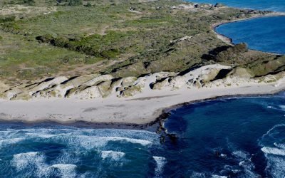
Año Nuevo Dunes, Año Nuevo State Park
Año Nuevo Dunes are in Año Nuevo State Park which is known for pinniped rookeries and seabirds, located on a low, rocky, windswept point, about 55 miles (89 km) south of San Francisco and 21 miles (34 km) northwest of Santa Cruz, California.
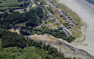
Moclips, Mocrocks Beach
Moclips is a coastal community located between the south shore of the Moclips River and Mocrocks Beach. It is situated about 83 miles (134 km) west of Tacoma and 27 miles (44 km) northwest of Aberdeen, Washington.
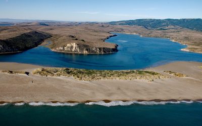
Limantour Estuary, Drakes Bay
Limantour Beach is a long narrow spit in Point Reyes National Seashore between Drakes Bay and Limantour Estuary, about 15 miles (24 km) northwest of Bolinas and 6 miles (10 km) southwest of Point Reyes Station, California.
About the background graphic
This ‘warming stripe’ graphic is a visual representation of the change in global temperature from 1850 (top) to 2019 (bottom). Each stripe represents the average global temperature for one year. The average temperature from 1971-2000 is set as the boundary between blue and red. The colour scale goes from -0.7°C to +0.7°C. The data are from the UK Met Office HadCRUT4.6 dataset.
Click here for more information about the #warmingstripes.