Beaches
Recent Articles
More Articles
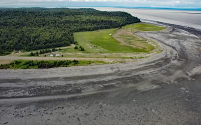
Fire Island, Cook Inlet
Fire Island is about 5.5 miles (8.9 km) long, located at the head of Cook Inlet within the Municipality of Anchorage, about 24 miles (39 km) northwest of Hope and 9 miles (14.5 km) southwest of downtown Anchorage, Alaska.
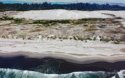
Lanphere Dunes, Arcata Bottoms
Lanphere Dunes are located between the Pacific Ocean and the Mad River Slough that flows through the Arcata Bottoms at the head of Humboldt Bay, about 59 miles (95 km) south of Crescent City and 8 miles (13 km) north of Eureka, California.
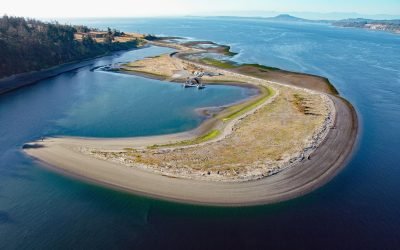
James Spit, Cordova Channel
James Island is one of the Southern Gulf Islands lying in Haro Strait, approximately 1.5 miles (2.4 km) off the coast of Vancouver Island, and 12 miles (19 km) north of Victoria, British Columbia.
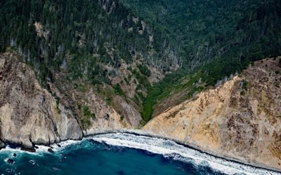
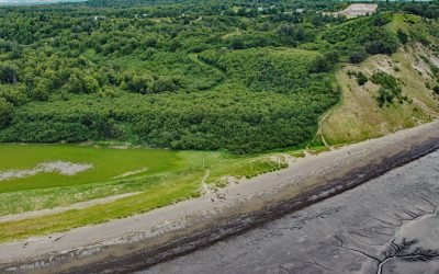
Anderson Gulch, Lost Coast
Anderson Gulch is a small watershed on the Lost Coast of Northern California, between Northport Gulch and Dark Gulch, about 9 miles (15 km) west of Leggett and 2.6 miles (4 km) south-southeast of Wheeler, California.
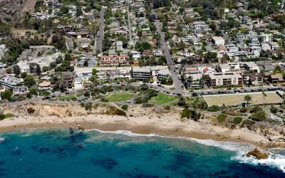
Divers Cove, Laguna Beach
Divers Cove is a small embayment with a beach at the west end of Heisler Park, about 9.3 miles (15 km) southeast of Newport Beach and 0.7 miles (1.1 km) northwest of Laguna Beach, California
Kincaid Park, Point Campbell
Kincaid Park is 1,517 acres (614 ha) located on Point Campbell between Knik and Turnagain Arms of Cook Inlet, 5.2 miles (8 km) southwest of downtown Anchorage, Alaska.
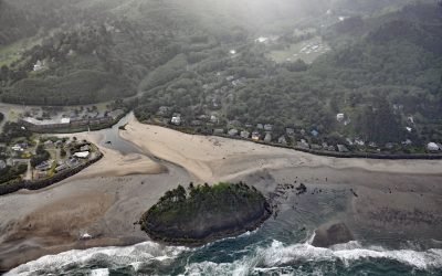
Proposal Rock, Neskowin Creek
Proposal Rock is at the mouth of the Neskowin Creek, about 10 miles (16 km) north-northeast of Lincoln City and 0.5 miles (0.8 km) south-southwest of the community of Neskowin, Oregon.
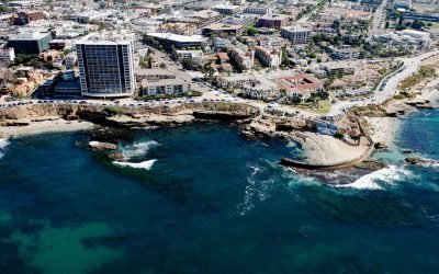
Childrens Pool, La Jolla
Children’s Pool was one of the many gifts that philanthropist Ellen Browning Scripps gave to the community of La Jolla, about 13 miles (21 km) south of Encinitas and 11.4 miles (18 km) northwest of San Diego, California.
About the background graphic
This ‘warming stripe’ graphic is a visual representation of the change in global temperature from 1850 (top) to 2019 (bottom). Each stripe represents the average global temperature for one year. The average temperature from 1971-2000 is set as the boundary between blue and red. The colour scale goes from -0.7°C to +0.7°C. The data are from the UK Met Office HadCRUT4.6 dataset.
Click here for more information about the #warmingstripes.