
British Columbia
Recent Articles
More Articles
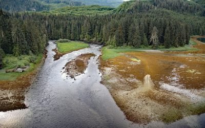
Crab River, Devastation Channel
Crab River flows into Devastation Channel near the entrance to Alan Reach of Gardner Canal, about 81 miles (130km) southeast of Prince Rupert and 28 miles (45km) south-southwest of Kitamaat, British Columbia.
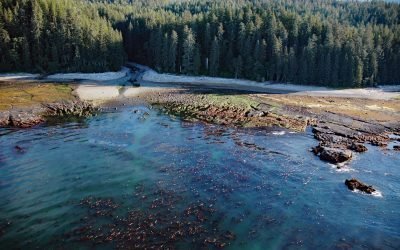
SS Uzbekistan, Darling River
The wreck of the SS Uzbekistan is situated at the mouth of the Darling River, which flows south for 6 miles (10 km) through the heavily logged interior forests of southwestern Vancouver Island, about 31 miles (50 km) northwest of Port Renfrew and 9 miles (15 km) south-southeast of Bamfield, British Columbia.

Europa Reach, Gardner Canal
Europa Reach is one of several named sections along Gardner Canal, a fjord in the Kitimat Ranges, about 97 miles (156 km) southeast of Prince Rupert and 42 miles (68 km) south-southeast of Kitimat, British Columbia.
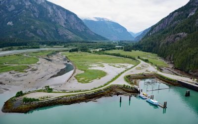
Kemano River, Gardner Canal
The Kemano River flows from the Kitimat Ranges to Kemano Bay on the northern shore of Gardner Canal, about 45 miles (72 km) south-southeast of Kitimat and 10 miles (16 km) southwest of Kemano, British Columbia.
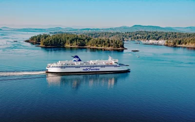
BC Ferries, Gulf Islands
The Gulf Islands and Vancouver Island are connected to the mainland by BC Ferries, the largest ferry line in North America and the second-largest in the world, that provides passenger and vehicle transportation among coastal and island communities in British Columbia.

Stanovan Marine Terminal, Burrard Inlet
The Stanovan Marine Terminal is located on the south shore of Burrard Inlet in Burnaby, at the western end of the Trans Mountain Pipeline, about 7 miles (11 km) northwest of New Westminster and 5.3 miles (8.5 km) east of Vancouver, British Columbia.
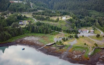
Kitsault, Alice Arm
Kitsault is a historical mining community near the mouth of the Kitsault River at the head of Alice Arm, a fjord and eastern extension of Observatory Inlet, about 86 miles (138 km) north-northeast of Prince Rupert and 38 miles (61 km) southeast of Stewart, British Columbia.
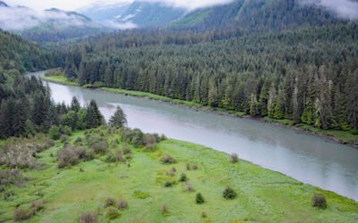
Dala-Kildala Rivers Estuaries Provincial Park, Kildala Arm
Dala-Kildala Rivers Estuaries Provincial Park is located at the head of Kildala Arm, a fjord that extends generally southeast for 10 miles (16 km) from Douglas Channel, about 81 miles (130 km) southeast of Prince Rupert, and 13 miles (21 km) south-southeast of Kitamaat, British Columbia.
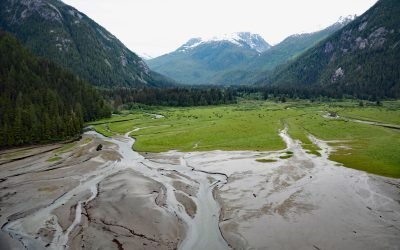
Kowesas River, Chief Mathews Bay
Kowesas River flows generally north for 22 miles (35 km), draining a watershed of 101,807 acres (41,200 ha) in the Coast Mountains before emptying into the head of Chief Mathews Bay, about 112 miles (180 km) southeast of Prince Rupert and 17 miles (27 km) south-southwest of Kemano, British Columbia.
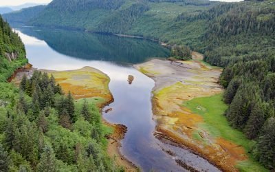
Triumph Bay, Gardner Canal
Triumph Bay is a long narrow embayment located on the south side of Alan Reach in Gardner Canal, British Columbia.
About the background graphic
This ‘warming stripe’ graphic is a visual representation of the change in global temperature from 1850 (top) to 2019 (bottom). Each stripe represents the average global temperature for one year. The average temperature from 1971-2000 is set as the boundary between blue and red. The colour scale goes from -0.7°C to +0.7°C. The data are from the UK Met Office HadCRUT4.6 dataset.
Click here for more information about the #warmingstripes.