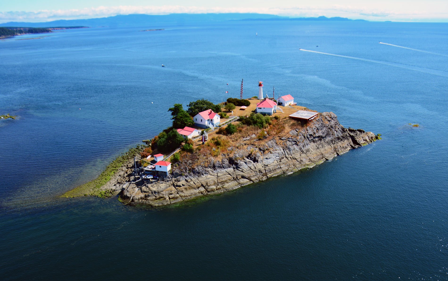
Chrome Island is located 0.15 miles (0.24 km) south of Boyle Point Provincial Park, on the southern tip of Denman Island, and is the site of a historic lighthouse that marks the southern entrance to Baynes Sound, about 72 miles (116 km) west-northwest of Vancouver and 2 miles (3.2 km) east-northeast of Deep Bay, British Columbia. The island was originally named Yellow Island on British Admiralty charts but the name was changed in 1923 to avoid confusion with several other Yellow Islands. Baynes Sound is the channel separating Denman Island from Vancouver Island. Denman Island is one of the northern Gulf Islands in the Strait of Georgia. The rocks forming Denman Island and Chrome Island represent the DeCourcy Formation that consists of conglomerates, sandstones and minor amounts of mudstones. The formation is part of the Nanaimo Group of sedimentary rocks that formed in the Late Cretaceous during a period of cyclic deltaic progradation and marine inundation by changes in sea level. The present-day landscape is a result of major modification of the bedrock by glacial action during the Pleistocene, and more recent physical and chemical weathering, and degradational processes caused by wave action.
Denman Island is the traditional territory of the Pentlatch people who spoke a Comox dialect. Evidence from middens, grave sites, and oral histories indicate that a site called Village Point on Denman Island was inhabited in summer and the people migrated to the area around the junction of the Puntledge and Tsolum Rivers for the winter. Evidence of a long occupation of Denman Island by aboriginal people include petroglyphs on Chrome Island, now under the lighthouse, that reputedly depict a great battle fought against mainland tribes. Village Point was occupied until the 1862 smallpox epidemic severely reduced the population and the survivors moved to join the K’ómoks people in nearby village of Comox on Vancouver Island. This part of the Salish Sea was first visited by Europeans in 1791 when the Spanish ship Santa Saturnina explored the area under the command of Juan Carrasco and navigator José María Narváez. Baynes Sound was named after British Rear Admiral Robert L. Baynes, who commanded the Pacific Station at Esquimault from 1857 to 1860. Denman island was named in 1860 by Captain George H. Richards for Rear Admiral Joseph Denman who was commander of the Pacific Station from 1864 to 1866. The earliest colonial settlers of Denman Island arrived during the 1870s. Some were attracted by the establishment of the Baynes Sound Colliery Company on the Tsable River, across Baynes Sound from Denman Island. Mine construction started in 1873 and coal was shipped in 1876, but the mine was closed in 1877.
Coal mining and logging operations on the east coast of Vancouver Island were in need of deep water ports, and a railway line was built to transport the products to the coast. When Robert Dunsmuir formed the Union Colliery Company in 1887, tracks were laid linking Deep Bay, Fanny Bay, Buckley Bay, and Union Bay. Coal suppliers successfully petitioned for a lighthouse at the entrance to Bayne Sound. The light station was completed in 1890 and first lit on New Year’s Day, 1891. The tower measured 55 feet (17 m) from its base to the lantern, and its signature of three white flashes could be seen for 17 miles (27 km). The light is one of the 12 locations of the British Columbia Shore Station Oceanographic Program that has collected coastal water temperature and salinity measurements for the Department of Fisheries and Oceans since 1961. The lighthouse data constitute some of the longest observational records of marine water properties gathered in Canadian waters. In addition, they were collected following a generally consistent sampling procedure at a set of established locations providing good coverage of the coastline. The result is a data set well suited for examining the variability of regional surface water properties over a wide range of time scales and have been used in several studies on climate variability and trends. Read more here and here. Explore more of Chrome Island and Baynes Sound here:

