
California
Recent Articles
More Articles
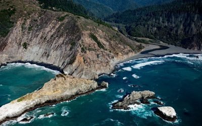
Cottoneva Creek, Rockport Bay
Cottoneva Creek originates at an elevation of approximately 1,300 feet (400 m) in the Coast Range and flows generally south-southwest for 7 miles (11 km) to Rockport Bay, about 11 miles (18 km) southwest of Leggett and 7 miles (11 km) north-northwest of Westport, California.
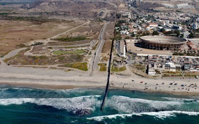
Border Field State Park, Playas de Tijuana
Border Field State Park is part of the Tijuana River National Estuarine Research Reserve, adjacent to the urban neighborhood of Playas de Tijuana, Mexico, located about 12 miles (19 km) south of San Diego, it lies within the city limits of Imperial Beach, California.
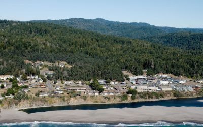
Gualala, Gualala River
The Gualala River flows into the Pacific Ocean at the community of Gualala, approximately 92 miles (148 km) northwest of San Francisco and 40 miles (64 km) south-southeast of Mendocino, California.
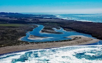
Garcia River, Manchester Beach
The Garcia River flows generally northwest for 44 miles (71 km) to Manchester Beach, north of Point Arena Lighthouse and at Manchester State Park, about 34 miles (55 km) south of Fort Bragg and 4 miles (6.4 km) northwest of the community of Point Arena, California.
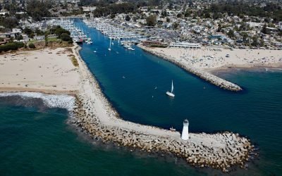
Walton Lighthouse, Santa Cruz Harbor
Walton Lighthouse is situated on the west jetty at the entrance to the Santa Cruz harbor adjacent to Seabright State Beach, about 25 miles (40 km) north-northwest of Monterey and in the city of Santa Cruz, California.
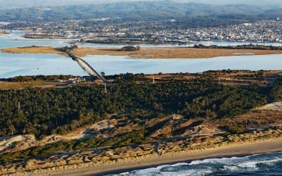
Tuluwat Island, Humboldt Bay
Tuluwat Island, also known as Gunther Island or Indian Island, is the largest of three islands in Humboldt Bay, along with Woodley and Dalby Islands, approximately 5.5 miles (8.8 km) south-southwest of Arcata and within the city limits of Eureka, California.
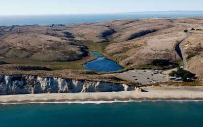
Drakes Beach, Point Reyes National Seashore
Drakes Beach is a remote stretch of sand located in Point Reyes National Seashore at the head of Drakes Bay and adjacent to the Point Reyes State Marine Reserve, about 12 miles (19 km) southwest of Inverness, California.
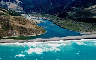
Mattole River, Lost Coast
The Mattole River flows approximately 62 miles (100 km) through the King Range to the Lost Coast at the Punta Gorda State Marine Reserve, about 10 miles (16 km) south of Cape Mendocino and 4 miles (6.4 km) west-southwest of Petrolia, California.
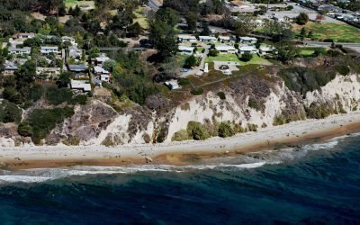
Santa Barbara Lighthouse, Santa Barbara
The Santa Barbara Lighthouse is located between the East Mesa and West Mesa neighborhoods, about 2 miles (3 km) west of Santa Barbara Harbor, in the City of Santa Barbara, California.
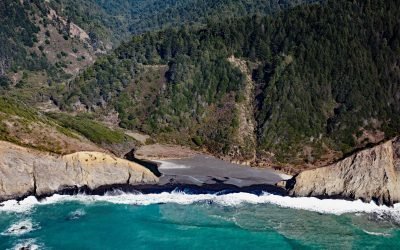
Jackass Creek, Sinkyone Wilderness State Park
Jackass Creek flows generally west for 2.5 miles (4 km) to the Pacific Ocean, about 18 miles (30 km) north-northwest of Westport and 14 miles (22.5 km) southeast of Shelter Cove, California.
About the background graphic
This ‘warming stripe’ graphic is a visual representation of the change in global temperature from 1850 (top) to 2019 (bottom). Each stripe represents the average global temperature for one year. The average temperature from 1971-2000 is set as the boundary between blue and red. The colour scale goes from -0.7°C to +0.7°C. The data are from the UK Met Office HadCRUT4.6 dataset.
Click here for more information about the #warmingstripes.