Canneries
Recent Articles
More Articles

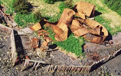
Port Vita, Raspberry Strait
Port Vita is an abandoned herring reduction plant and saltery located on Raspberry Strait, on the northeastern coast of Raspberry Island, about 31 miles (50 km) northwest of Kodiak and 15 miles (24 km) northwest of Port Lions, Alaska.
Port Wakefield, Raspberry Island
Port Wakefield is an abandoned cannery on the east coast of Raspberry Island, about 30 miles (48 km) northwest of Kodiak and 14 miles (23 km) north-northwest of Port Lions, Alaska.
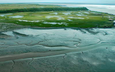
Ekuk Fisheries, Nushagak Bay
Ekuk is a small village located on Ekuk Spit on the eastern shore of Nushagak Bay, a branch of Bristol Bay, about 16 miles (26 km) south-southwest of Dillingham and 1.3 (2.1 km) miles southwest of Clarks Point, Alaska.
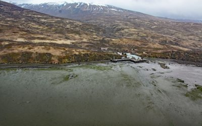
Chignik Fisheries, Chignik Lagoon
Chignik Fisheries is a facility, formerly owned and operated as a cannery by Wards Cove Packing Company, located on the northwest shore of Chignik Lagoon, southwest of Dago Point, about 44 miles (71 km) south of Port Heiden and 36 miles (58 km) northeast of Perryville, Alaska.
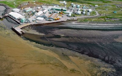
Clark’s Point, Nushagak Bay
Clark’s Point is the site of a historic community and salmon cannery located on the eastern shore of Nushagak Bay at the mouth of Clark Slough, about 57 miles (92 km) west-northwest of Naknek and 14 miles (23 km) south-southwest of Dillingham, Alaska.
About the background graphic
This ‘warming stripe’ graphic is a visual representation of the change in global temperature from 1850 (top) to 2019 (bottom). Each stripe represents the average global temperature for one year. The average temperature from 1971-2000 is set as the boundary between blue and red. The colour scale goes from -0.7°C to +0.7°C. The data are from the UK Met Office HadCRUT4.6 dataset.
Click here for more information about the #warmingstripes.