Canneries
Recent Articles
More Articles

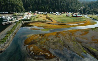
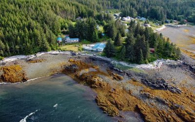
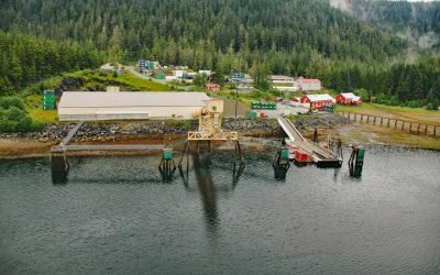
Whalers Cove, Killisnoo Island
Whalers Cove is a bight on the northeastern shore of Killisnoo Island located in Chatham Strait along the central west coast of Admiralty Island in the Alexander Archipelago of Southeast Alaska, about 42 miles (68 km) northeast of Sitka and 2.5 miles (4 km) south of Angoon, Alaska.
Pelican, Lisianski Inlet
Pelican is a small community located on the east side of Lisianski Inlet on the north coast of Chichagof Island in the Alexander Archipelago of Southeast Alaska, about 71 miles (114 km) north-northwest of Sitka and 17 miles (27 km) south of Elfin Cove, Alaska.
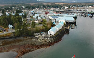
Petersburg, Mitkof Island
Petersburg is a community on the north end of Mitkof Island where the northern entrance to Wrangell Narrows meets Frederick Sound, about 116 miles (187 km) southeast of Juneau and 32 miles (52 km) northwest of Wrangell, Alaska.
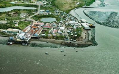
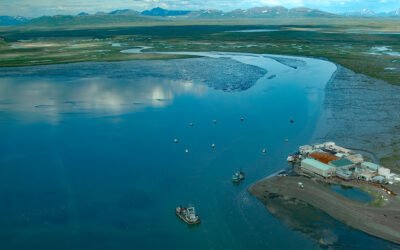
Egegik, Bristol Bay
Egegik is a small Yup’ik village on the south bank of Egegik Bay on the eastern shore of Bristol Bay, about 69 miles (111 km) southeast of Dillingham and 37 miles (60 km) south-southwest of Naknek, Alaska.
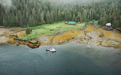
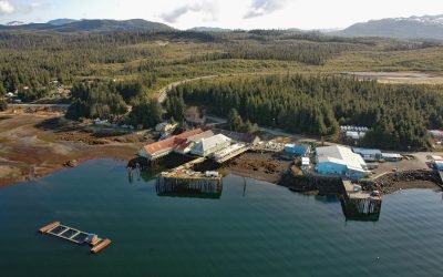
Saltery Cove, Skowl Arm
Saltery Cove is an embayment that extends southeast for 1.5 miles (2.4 km) off Skowl Arm on the east coast of Prince of Wales Island, about 26 miles (42 km) west of Ketchikan and 10 miles (16 km) south-southeast of the Organized Village of Kasaan, Alaska.
Kasaan, Prince of Wales Island
Kasaan is a small community on the north shore of Kasaan Bay and the southern shore of the Kasaan Peninsula, on the east coast of Prince of Wales Island, about 65 miles (105 km) south of Wrangell and 33 miles (53 km) west-northwest of Ketchikan, Alaska.
Kake, Kupreanof Island
Kake is a Tlingit village on the northeastern shore of Keku Strait, on the northwest shore of Kupreanof Island in the Alexander Archipelago of Southeast Alaska, about 95 miles (153 km) south-southeast of Juneau and 39 miles (63 km) west-northwest of Peterburg, Alaska.
Togiak River, Bristol Bay
Togiak River starts at Togiak Lake and flows southwest for 37 miles (60 km) to a wetland marsh about 4 miles (6 km) wide where the river channel splits, with the east channel flowing past the village of Twin Hills to Togiak Bay, and the main channel flowing 11 miles (18 km) to Togiak Bay near the village of Togiak on Bristol Bay, about 129 miles (208 km) southeast of Bethel and 66 miles (106 km) west of Dillingham, Alaska.
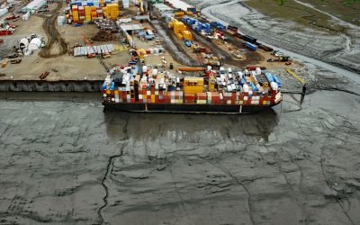
Ship Creek, Knik Arm
Ship Creek flows generally northwest for about 28 miles (45 km) from the Chugach Mountains to Knik Arm, about 22 miles (35 km) southwest of the village of Knik and 0.5 miles (0.8 km north of downtown Anchorage, Alaska.
Greens Creek Mine, Hawk Inlet
Greens Creek Mine is the fifth-largest silver producer in the world, located on the eastern shore of Hawk Inlet on Admiralty Island, about 77 miles (124 km) north-northeast of Sitka and 18 miles (29 km) southwest of Juneau, Alaska.
About the background graphic
This ‘warming stripe’ graphic is a visual representation of the change in global temperature from 1850 (top) to 2019 (bottom). Each stripe represents the average global temperature for one year. The average temperature from 1971-2000 is set as the boundary between blue and red. The colour scale goes from -0.7°C to +0.7°C. The data are from the UK Met Office HadCRUT4.6 dataset.
Click here for more information about the #warmingstripes.