
Climate Change
Recent Articles
More Articles
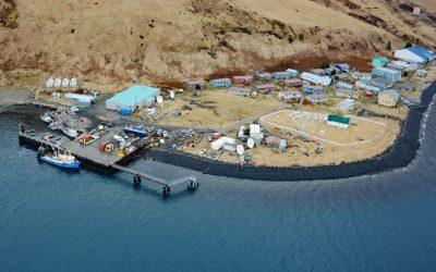
Akutan Village, Akutan Island
Akutan is a community on the northern shore of Akutan Harbor, on Akutan Island, one of the Krenitzin Islands in the Fox Islands group of the Eastern Aleutians, about 766 miles (1,233 km) southwest of Anchorage and 35 miles (56 km) east of Unalaska, Alaska.
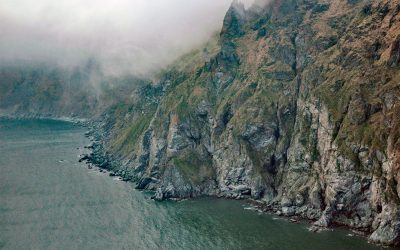
Cape Newenham, Togiak Bay
Cape Newenham is a massive headland on the eastern shore of the Bering Sea, situated between Kuskokwim Bay to the north and Togiak Bay to the south, about 149 miles (240 km) south of Bethel and 69 miles (111 km) southwest of Togiak, Alaska.
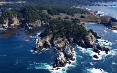
Point Lobos, Carmel Bay
Point Lobos is a rocky headland at the south end of Carmel Bay between Cypress Cove to the north and Headland Cove to the south on the central coast of California, about 19 miles (31 km) north-northwest of Big Sur and 2.5 miles (4 km) southwest of Carmel, California.
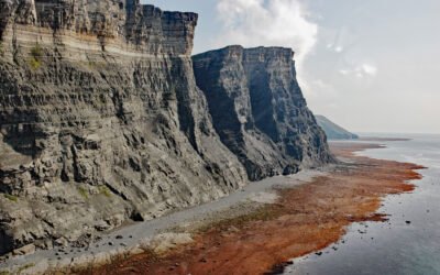
Fortification Bluff, Kamishak Bay
Fortification Bluff is a sea cliff more than 3 miles (4.8 km) long that rises almost vertically to 1,200 feet (366 m) on the south face of Step Mountain in Kamishak Bay, on the Cook Inlet shore of the Alaska Peninsula, about 125 miles (201 km) northwest of Kodiak and 82 miles (132 km) west-southwest of Homer, Alaska.
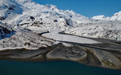
Dirty Glacier, Harriman Fjord
The Dirty Glacier flows generally north for about 1.7 miles (2.7 km) from an elevation of 3,800 feet (1,158 m) in the Chugach Mountains of western Prince William Sound to its terminus at an outwash plain about 1 mile (1.6 km) from the head of Harriman Fjord, about 71 miles (114 km) west-southwest of Valdez and 16 miles (26 km) northeast of Whittier, Alaska.
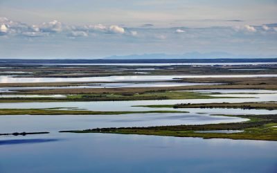
Selawik River, Kotzebue Sound
The Selawik River is about 140 miles (226 km) long, originating in the Purcell Mountains near the Zane Hills, and flows generally west through the Selawik National Wildlife Refuge to Selawik Lake that drains into Hotham Inlet on Kotzebue Sound, about 65 miles (105 km) southeast of Kotzebue and 9 miles (14.5 km) west of the village of Selawik, Alaska.
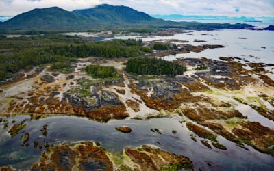
Randall Island, Dundas Archipelago
Randall Island is part of the Dundas Archipelago, a group of islands in Hecate Strait on the west side of Chatham Sound between Brown and Caamaño Passages, about 74 miles (119 km) southeast of Ketchikan and 22 miles (35 km) west-northwest of Prince Rupert, British Columbia.
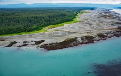
Ancon Rock, Point Gustavus
Ancon Rock is a reef located about 0.5 miles (0.8 km) off Point Gustavus on the eastern shore, at the entrance to Glacier Bay within Glacier Bay National Park and Preserve, about 55 miles (89 km) west of Juneau and 8.5 miles (12 km) southwest of Gustavus, Alaska.
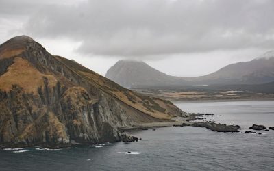
Barren Islands, Kodiak Archipelago
Barren Islands are the northernmost of the Kodiak Archipelago, located near Lower Cook Inlet, between Stevenson Entrance to the south and Kennedy Entrance to the north, about 80 miles (129 km) north of Kodiak and 56 miles (90 km) southwest of Homer, Alaska.
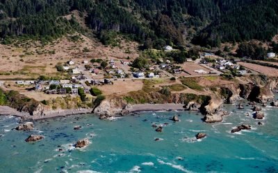
Westport, Mendocino Coast
Westport is a historic timber export community on the Mendocino coast, where lumber schooners were loaded using long chutes built across nearshore rocks, about 83 miles (134 km) south-southeast of Eureka and 13 miles (21 km) north of Fort Bragg, California.
About the background graphic
This ‘warming stripe’ graphic is a visual representation of the change in global temperature from 1850 (top) to 2019 (bottom). Each stripe represents the average global temperature for one year. The average temperature from 1971-2000 is set as the boundary between blue and red. The colour scale goes from -0.7°C to +0.7°C. The data are from the UK Met Office HadCRUT4.6 dataset.
Click here for more information about the #warmingstripes.