
Climate Change
Recent Articles
More Articles
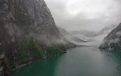
Fords Terror, Endicott Arm
Fords Terror is a fjord in the Coast Mountains of Southeast Alaska that trends generally south for 8 miles (13 km) to Endicott Arm, about 64 miles (103 km) southeast of Juneau and 57 miles (92 km) north-northwest of Petersburg, Alaska.

Ultramarine Glacier, Blue Fjord
Ultramarine Glacier is located at the head of Blue Fjord, a glacial estuary that trends generally north for 4.5 miles (7.3 km) to Port Nellie Juan in western Prince William Sound on the east coast of the Kenai Peninsula, about 87 miles (140 km) west of Cordova and 26 miles (42 km) southeast of Whittier, Alaska.
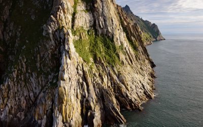
King Island, Bering Sea
King Island is about 1.7 miles (2.7 km) long and 1.4 miles (2.3 km) wide with steep rocky cliffs on all sides and a summit elevation of about 1,050 feet (320 m), located in the northern Bering Sea, about 86 miles (139 km) northwest of Nome, and 44 miles (71 km) south of Cape Prince of Wales, Alaska.
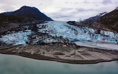
Lamplugh Glacier, Glacier Bay National Park and Preserve
Lamplugh Glacier is situated on the western shore of Glacier Bay at the entrance to Johns Hopkins Inlet in Glacier Bay National Park and Preserve, about 109 miles (175 km) southeast of Yakutat and 55 miles (89 km) northwest of Gustavus, Alaska.
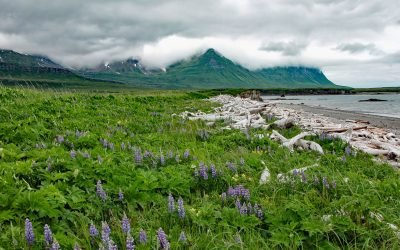
Sukoi Bay, Cape Douglas
Sukoi Bay is situated at Cape Douglas on the western shore of Shelikof Strait, in Katmai National Park and Preserve, about 121 miles (195 km) east of King Salmon and 83 miles (134 km) southwest of Homer, Alaska.
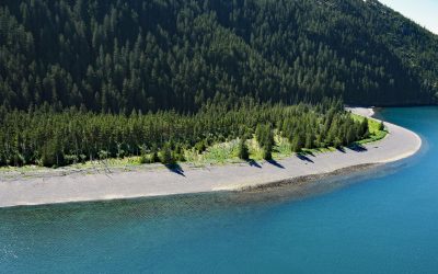
Verdant Cove, Kenai Fjords National Park
Verdant Cove is on the western shore of Aialik Bay in Kenai Fjords National Park at the northern entrance to Dora Passage, about 64 miles (103 km) east of Homer and 30 miles (48 km) south-southwest of Seward, Alaska.
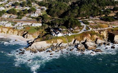
Point Montara Lighthouse, Montara
Point Montara Lighthouse is located in the coastal community of Montara, about 18 miles (29 km) south-southwest of San Francisco and 7 miles (11 km) northwest of Half Moon Bay, California.
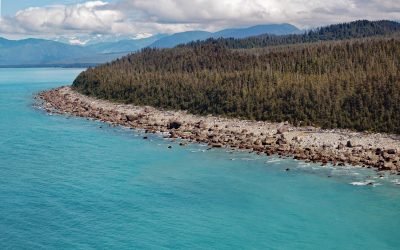
Cape Fairweather, Glacier Bay National Park and Preserve
Cape Fairweather is a point of land created by an ancient terminal moraine at the base of the Fairweather Glacier in Glacier Bay National Park and Preserve, about 131 miles (211 km) west-northwest of Juneau and 82 miles (132 km) southeast of Yakutat, Alaska.
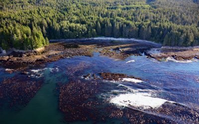
Botanical Beach, Juan de Fuca Provincial Park
Botanical Beach is located on San Juan Point in Botany Bay at the northern end of Juan de Fuca Provincial Park on the south coast of Vancouver Island, about 50 miles (80 km) west-northwest of Victoria and 2 miles (3 km) south-southwest of Port Renfrew, British Columbia.
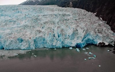
Chenega Glacier, Nassau Fjord
Chenega Glacier starts at an elevation of over 5,000 feet (1524 m) in the Sargent Icefield in Chugach National Forest and flows northeast for 10 miles (16 km) and then east for 4 miles (6 km) to Nassau Fjord on the western shore of Prince William Sound on the Kenai Peninsula, about 93 miles (150 km) west-southwest of Cordova and 37 miles (60 km) south-southeast of Whittier, Alaska.
About the background graphic
This ‘warming stripe’ graphic is a visual representation of the change in global temperature from 1850 (top) to 2019 (bottom). Each stripe represents the average global temperature for one year. The average temperature from 1971-2000 is set as the boundary between blue and red. The colour scale goes from -0.7°C to +0.7°C. The data are from the UK Met Office HadCRUT4.6 dataset.
Click here for more information about the #warmingstripes.