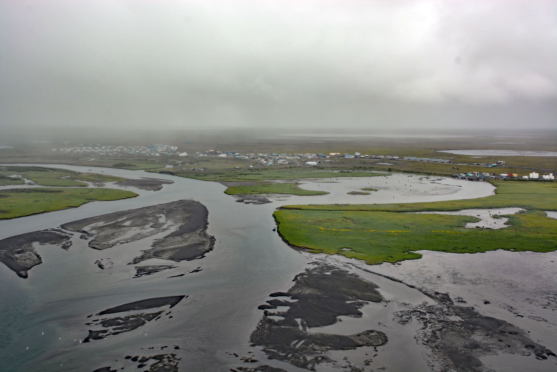
Quinhagak, or Kwinhagak, is a Central Yup’ik community situated on the Yukon-Kuskokwim Delta near the mouth of the Kanektok River, about 73 miles (118 km) south of Bethel and 45 miles (72 km) north of Goodnews Bay, Alaska. The name is anglicized from the Yup’ik ‘Kuinerraq’ meaning ‘new river channel’. Kanektok River starts from a series of tributary streams in the Ahklun Mountains with headwaters near elevations of 2300 feet (701 m) and flow generally northwest to Kagati Lake at an elevation of 1059 feet (323 m), and the river then flows westward for 75 miles (121 km) draining a watershed of 481,280 acres (194,767 ha) to the eastern shore of Kuskokwim Bay at Quinhagak. The Yukon-Kuskokwim Delta consists mostly of tundra covered in marshes, lakes, bogs, and streams during the warm months, and during the winter is a landscape dominated by ice and snow drifts. Permafrost is found at soil depths below 10 to 35 inches (25-90 cm) making it impossible for trees to grow. Instead, bare and sometimes rocky land can only support low-growing plants such as dwarf shrubs, sedges, grasses, mosses, and lichens. The permafrost contains large amounts of stored methane and carbon dioxide making the tundra soil a carbon sink if it stays frozen.
The archaeological record suggests that a village existed at the mouth of the Kanektok River mouth since 1,000 AD. In 1826, Gavril Sarychev with the Imperial Russian Navy may have been the first European to make contact with the villagers. When fur traders with the Russian-American Company subsequently began exploring southwestern Alaska, they met Yup’ik people who told horrific tales of internecine violence and revenge that became known as the Bow and Arrow Wars. Oral histories recorded by the Bureau of Indian Affairs after the passage of Alaska Native Claims Settlement Act in 1971 corroborate a time of burned homes, murdered families, and entire communities forced to flee. Since 2009, archaeologists working at the Nunalleq archaeological site near Quinhagak have unearthed human skeletons, animal and plant remains, and tens of thousands of artifacts including remarkably preserved weapons, tools, artwork, and housewares that are providing an unusually comprehensive look at life in prehistoric Alaska including hard evidence of prehistoric warfare in the Yup’ik inhabited region. After the Alaska Purchase in 1867, the Alaska Commercial Company sent annual supply ships to Quinhagak with goods for trading posts farther up the Kuskokwim River. In 1893, a Moravian Mission and between 1906 and 1909, over 2,000 reindeer were brought in to the Quinhagak area in an attempt to introduce reindeer herding, which was ultimately unsuccessful.
Until 2016, the village supported a commercial salmon fishery but today most households rely on subsistence hunting and gathering supplemented by seasonal wage work. Quinhagak relies on air transportation for passenger mail and cargo service. A gravel airstrip is owned and maintained by the village and float planes land on the Kanektok River. A harbor and dock serve barge deliveries of heavy goods at least twice a year. Small boats with outboard engines, all-terrain vehicles, and snow machines are used for local transportation. Winter trails to Eek and Goodnews Bay are maintained and marked. Quinhagak has lost considerable infrastructure and cultural resources to shoreline erosion, mostly caused by storm surges in Kuskokwim Bay. Erosion along the riverbanks also occurs, especially during spring break-up when ice jams cause flooding that thaws permafrost. In 2012, a state report listed Quinhagak’s sewer lagoon and multipurpose building as top priorities for replacement or repair because of erosion and thawing permafrost. Erosion now threatens the airstrip, water treatment plant, and sewer system creating a public health problem with an estimated replacement cost of $15 million. Read more here and here. Explore more of Quinhagak and Kanektok River here:

