Communities
Recent Articles
More Articles
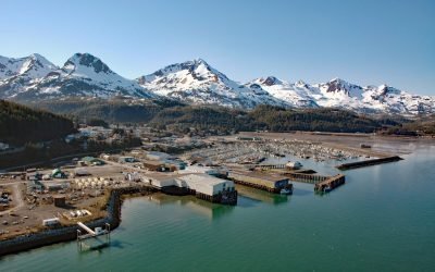
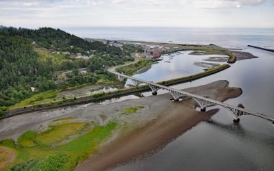
Cordova, Orca Inlet
Cordova is a community on the southeastern shore of Orca Inlet across from Hawkins Island in eastern Prince William Sound, about 100 miles (160 km) east-southeast of Whittier and 45 miles (72 km) south-southeast of Valdez, Alaska.
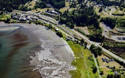
Blyn, Sequim Bay
Blyn is a small community located where Jimmycomelately Creek flows into Sequim Bay on the northern coast of the Olympic Peninsula, about 13 miles (21 km) southwest of Port Townsend and 7 miles (11 km) southeast of Sequim, Washington.
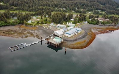
Port Graham, Kachemak Bay
Port Graham is a deglaciated fjord at the southern entrance to Kachemak Bay with an Alutiiq Sugpiaq community with the same name, on the southwestern end of the Kenai Peninsula, about 23 miles (37 km) south-southwest of Homer and 3.4 miles (5.5 km) east of Nanwalek, Alaska.
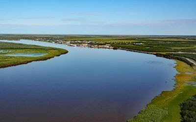
Emmonak, Yukon River Delta
Emmonak is a Yup’ik community located in the Yukon River Delta, approximately 14 miles (23 km) upstream from the Bering Sea, about 92 miles (148 km) west-southwest of Saint Michael and 20 miles (32 km) northeast of Nunam Iqua, Alaska.
Rogue River, Gold Beach
The Rogue River flows west for 215 miles (346 km) to the Pacific Ocean, about 23 miles (37 km) south-southeast of Port Orford and at Gold Beach, Oregon.
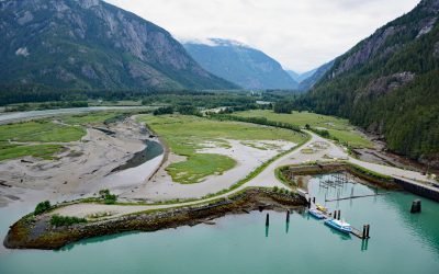
Kemano River, Gardner Canal
The Kemano River flows from the Kitimat Ranges to Kemano Bay on the northern shore of Gardner Canal, about 45 miles (72 km) south-southeast of Kitimat and 10 miles (16 km) southwest of Kemano, British Columbia.
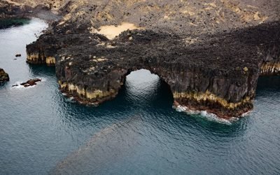
Lava Point, Akutan Island
Lava Point is a headland on the northwest coast of Akutan Island consisting of about 988 acres (400 ha) of jagged basalt extruded during eruptions of Akutan Volcano, about 26 miles (42 km) northeast of Dutch Harbor and 12 miles (19 km) west-northwest of Akutan Village, Alaska.
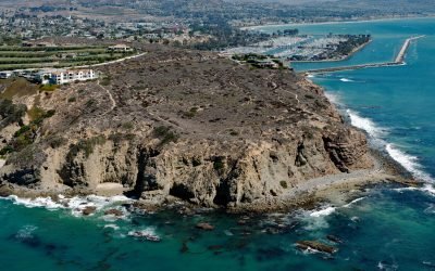
Dana Point Headlands, San Juan Capistrano
Dana Point is a prominent headland situated between Dana Point Harbor to the south and Strand Beach to the north, about 50 miles (80 km) southeast of Los Angeles and 4 miles (6 km) southwest of San Juan Capistrano, California.
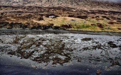
Belkofski, Alaska Peninsula
Belkofski is an abandoned Aleut Unangan village situated on the south coast of the Alaska Peninsula between Belkofski Bay to the southwest and Volcano Bay to the northeast, about 62 miles (100 km) southwest of Sand Point and 11 miles (18 km) east-northeast of King Cove, Alaska.
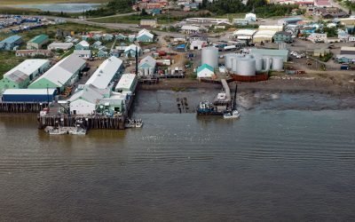
Dillingham, Nushagak Bay
Dillingham is a community on the south side of Snag Point at the confluence of the Wood and Nushagak Rivers, at the head of Nushagak Bay on the north coast of Bristol Bay, about 248 miles (400 km) west-southwest of Homer and 166 miles (270 km) southeast of Bethel, Alaska.
About the background graphic
This ‘warming stripe’ graphic is a visual representation of the change in global temperature from 1850 (top) to 2019 (bottom). Each stripe represents the average global temperature for one year. The average temperature from 1971-2000 is set as the boundary between blue and red. The colour scale goes from -0.7°C to +0.7°C. The data are from the UK Met Office HadCRUT4.6 dataset.
Click here for more information about the #warmingstripes.