Communities
Recent Articles
More Articles
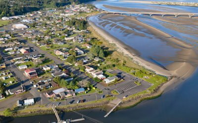
Waldport, Alsea Bay
Waldport is a community situated on the southern shore of Alsea Bay, an estuary of the Alsea River, about 15 miles (24 km) south of Newport and 8 miles (13 km) north of Yachats, Oregon.

Stanovan Marine Terminal, Burrard Inlet
The Stanovan Marine Terminal is located on the south shore of Burrard Inlet in Burnaby, at the western end of the Trans Mountain Pipeline, about 7 miles (11 km) northwest of New Westminster and 5.3 miles (8.5 km) east of Vancouver, British Columbia.
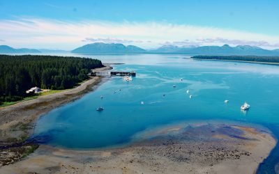
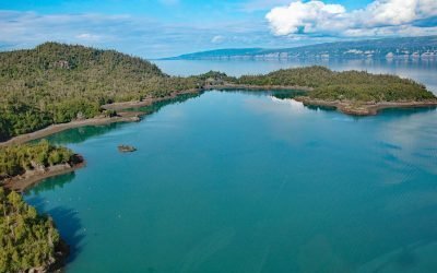
Bartlett Cove, Glacier Bay National Park and Preserve
Bartlett Cove is an estuary of the Bartlett River that extends northeast for 2 miles (3.2 km) from the eastern shore of Glacier Bay in Glacier Bay National Park and Preserve, about 155 miles (250 km) southeast of Yakutat and 6 miles (10 km) northwest of Gustavus, Alaska.
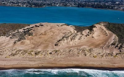
Morro Dunes, Los Osos
Morro Dunes form a barrier spit separating Morro Bay to the east from the Pacific Ocean to the west, about 6 miles (10 km) south-southwest of the community of Morro Bay and 2 miles (3.2 km) west of Los Osos, California.
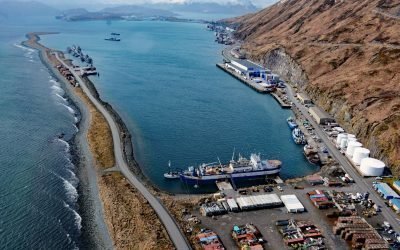
Dutch Harbor, Amaknak Island
Dutch Harbor is an anchorage and fish processing facility on the east coast of Amaknak Island, bordered by Mount Ballyhoo to the west and a gravel spit to the east that forms the natural harbor, about 33 miles (53 km) southwest of Akutan and 3 miles (5 km) north-northeast of Unalaska, Alaska.
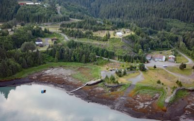
Kitsault, Alice Arm
Kitsault is a historical mining community near the mouth of the Kitsault River at the head of Alice Arm, a fjord and eastern extension of Observatory Inlet, about 86 miles (138 km) north-northeast of Prince Rupert and 38 miles (61 km) southeast of Stewart, British Columbia.
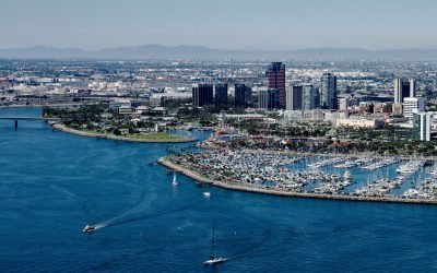
Los Angeles River, Long Beach
Los Angeles River starts at the confluence of Bell Creek and Arroyo Calabasas that drain from the Simi Hills and Santa Monica Mountains respectively, and flows generally southeast for 30 miles (48 km) through the San Fernando Valley and downtown Los Angeles and then south for 20 miles (32 km) to San Pedro Bay at Long Beach, California.
Afognak Village, Marmot Bay
Afognak, located at the head of Marmot Bay on the southeast coast of Afognak Island in the Kodiak Archipelago, is a historic village abandoned after the 1964 tsunami, about 122 miles (196 km) south-southwest of Homer and 20 miles (32 km) northwest of Kodiak, Alaska. Read more here: https://coastview.org/2025/04/28/afognak-village-afognak-strait/
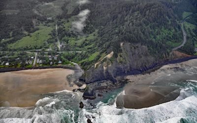
Arch Cape Creek, Arch Cape
Arch Cape is a small community at the mouth of Arch Cape Creek named after a natural sea arch in a basalt headland, about 25 miles (40 km) north-northwest of Tillamook and 6.5 miles (10 km) south of Cannon Beach, Oregon.
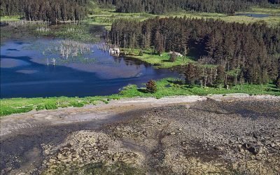
Bear Cove, Kachemak Bay
Bear Cove is a small embayment on the Kenai Peninsula that extends southeast for 1.5 miles (2.4 km) from the southeastern coast of Kachemak Bay between Bear Island to the south and Chugachik Island to the north, about 57 miles (92 km) south of Kenai and 18 miles (29 km) northeast of Homer, Alaska.
About the background graphic
This ‘warming stripe’ graphic is a visual representation of the change in global temperature from 1850 (top) to 2019 (bottom). Each stripe represents the average global temperature for one year. The average temperature from 1971-2000 is set as the boundary between blue and red. The colour scale goes from -0.7°C to +0.7°C. The data are from the UK Met Office HadCRUT4.6 dataset.
Click here for more information about the #warmingstripes.