Communities
Recent Articles
More Articles
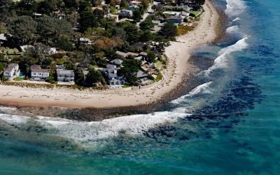
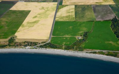
Rincon Creek, Santa Barbara Channel
Rincon Creek is a stream that begins in the Santa Ynez Mountains near Divide Peak, at an elevation of 4,800 feet (1,463 m), and drains a watershed of 9,352 acres (3,785-ha) while flowing generally south for 10 miles (16 km) to the Santa Barbara Channel at Rincon Point, about 12 miles (19 km) northwest of Ventura and 3 miles (5 km) southeast of Carpinteria, California.
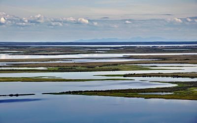
Selawik River, Kotzebue Sound
The Selawik River is about 140 miles (226 km) long, originating in the Purcell Mountains near the Zane Hills, and flows generally west through the Selawik National Wildlife Refuge to Selawik Lake that drains into Hotham Inlet on Kotzebue Sound, about 65 miles (105 km) southeast of Kotzebue and 9 miles (14.5 km) west of the village of Selawik, Alaska.
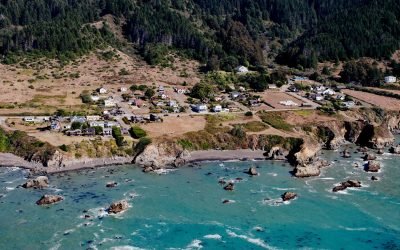
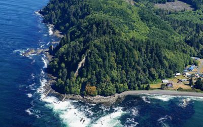
Westport, Mendocino Coast
Westport is a historic timber export community on the Mendocino coast, where lumber schooners were loaded using long chutes built across nearshore rocks, about 83 miles (134 km) south-southeast of Eureka and 13 miles (21 km) north of Fort Bragg, California.
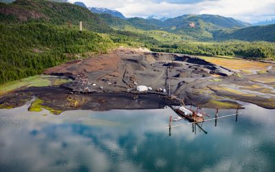
Anyox, Observatory Inlet
Anyox, an abandoned mining community in the Coast Mountains, lies at the mouth of Anyox Creek on Granby Bay in Observatory Inlet, about 79 miles (127 km) north-northeast of Prince Rupert and 37 miles (60 km) south of Stewart, British Columbia.
Ebey’s Landing, Whidbey Island
Ebey’s Landing is a beach on the southwest coast of Whidbey Island, on Admiralty Inlet in northern Puget Sound, about 45 miles (72 km) north-northwest of Seattle and 2 miles (3.2 km) south-southwest of Coupeville, Washington.
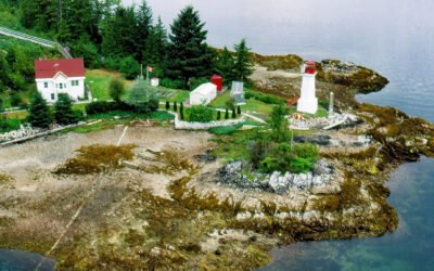
Dryad Point, Campbell Island
Dryad Point is on the northeastern point of Campbell Island and is the site of a historic lighthouse that marks the intersection of Lama Passage to the east and Seaforth Channel to the north on the Inside Passage, about 173 miles (278 km) southeast of Prince Rupert and 2 miles (3.2 km) northeast of Bella Bella, British Columbia.
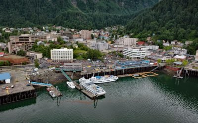
Juneau, Gastineau Channel
Juneau is the state capital, situated at the mouth of Gold Creek on Gastineau Channel, about 93 miles (150 km) northeast of Sitka and 87 miles (140 km) south-southeast of Skagway, Alaska.
Slip Point, Clallam Bay
Slip Point sits on the southern shore of the Strait of Juan de Fuca at the eastern end of Clallam Bay on the Olympic Peninsula, about 39 miles (63 km) west-northwest of Port Angeles and 0.7 miles (1 km) northeast of the community of Clallam Bay, Washington.
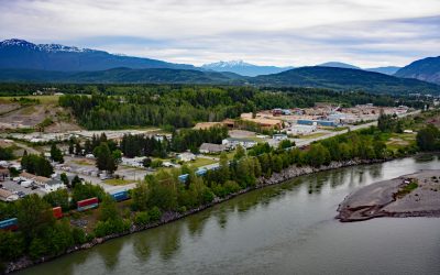
Terrace, Skeena River
Terrace, a community at the confluence of the Skeena and Kitsumkalum Rivers, lies about 71 miles (114 km) east-northeast of Prince Rupert and 64 miles (103 km) southwest of Hazelton, British Columbia.
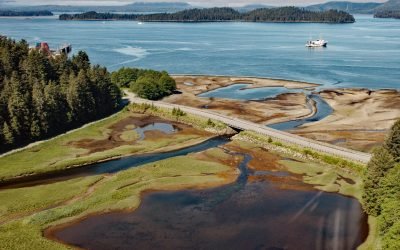
Old Sitka, Starrigavan Bay
Old Sitka is the site of a historical Russian settlement called Redoubt Saint Archangel Michael on the southern shore of Starrigavan Bay in Sitka Sound on the west coast of Baranof Island, about 232 miles (373 km) southeast of Yakutat and 5.5 miles (9 km) north of Sitka, Alaska.
About the background graphic
This ‘warming stripe’ graphic is a visual representation of the change in global temperature from 1850 (top) to 2019 (bottom). Each stripe represents the average global temperature for one year. The average temperature from 1971-2000 is set as the boundary between blue and red. The colour scale goes from -0.7°C to +0.7°C. The data are from the UK Met Office HadCRUT4.6 dataset.
Click here for more information about the #warmingstripes.