Communities
Recent Articles
More Articles
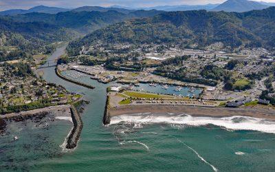
Brookings, Chetco River
Brookings is a community at the mouth of the Chetco River, which flows from the Southern Oregon Coast Range to the Pacific Ocean, about 21 miles (34 km) north-northwest of Crescent City, California and 26 miles (42 km) south-southeast of Gold Beach, Oregon.
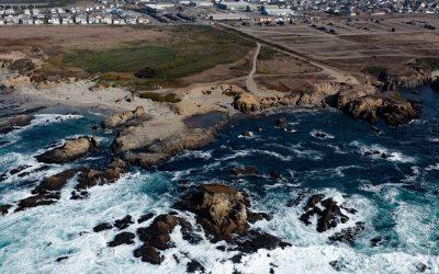
Glass Beach, Noyo Headlands Park
Glass Beach is situated in the northern section of Noyo Headlands Park in the community of Fort Bragg, which is between Pudding Creek to the north and Noyo River to the south, about 95 miles (153 km) south-southeast of Eureka and 10 miles (16 km) north of Mendocino, California.
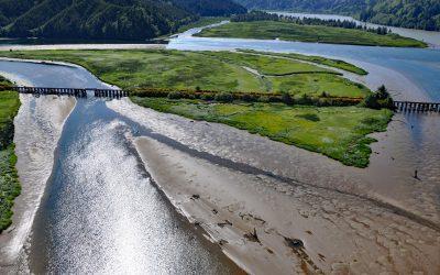
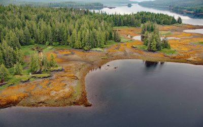
Blacks Island, Smith River
Blacks Island is situated at the confluence of the Smith River and the Umpqua River, on the historic spur line of the Southern Pacific Railroad connecting Eugene with Coos Bay, about 1.7 miles (2.7 km) southeast of Gardiner and 1 mile (1.6 km) northeast of Reedsport, Oregon.
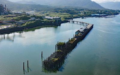
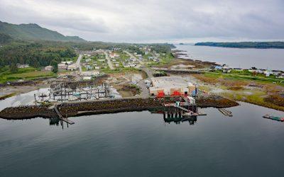
Port Edward, Porpoise Harbour
Port Edward is a community located on the eastern shore of Porpoise Harbour on the Tsimshian Peninsula near the mouth of the Skeena River, about 98 miles (158 km) southeast of Ketchikan and 9 miles (15 km) south of Prince Rupert, British Columbia.
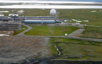
North Warning System, Barter Island
The North Warning System at Barter Island is a long-range radar facility on the Beaufort Sea coast, situated between Arey Lagoon to the west and Kaktovik Lagoon to the east and adjacent to the village of Kaktovik, about 273 miles (440 km) northwest of Inuvik, Northwest Territories, and 112 miles (180 km) east of Deadhorse, Alaska.
Whale Passage, Prince of Wales Island
Whale Passage is a waterway about 10 miles (16 km) long and the site of a historic logging camp, situated between Thorne Island to the east and Prince of Wales Island to the west, about 40 miles (65 km) southwest of Wrangell and 11 miles (18 km) west-northwest of Coffman Cove, Alaska.
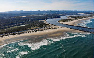
Siuslaw River, Florence
Siuslaw River starts at an elevation of 636 feet (194 m) in the Coast Range and flows generally west-northwest for 110 miles (177 km) to the Pacific Ocean at Florence, draining a watershed of 494,720 acres (200,206 ha), about 53 miles (85 km) west of Eugene and 43 miles (69 km) south of Newport, Oregon.
Lax Kw’alaams, Port Simpson
Lax Kw’alaams is a Tsimshian community on Port Simpson, an embayment on the eastern coast of Chatham Sound between Flewin Point to the north and Finlayson Island to the south, about 76 miles (123 km) southeast of Ketchikan, and 18 miles (29 km) north-northwest of Prince Rupert, British Columbia.
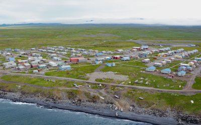
Savoonga, Saint Lawrence Island
Savoonga is a Siberian Yupik community situated on the north flank of the Kookooligit Mountains at Savoonga Point on the north coast of Saint Lawrence Island in the Bering Sea, about 164 miles (265 km) southwest of Nome and 39 miles (63 km) east of Gambell, Alaska.
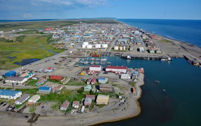
Nome, Norton Sound
Nome is a community at the mouth of the Snake River on the south coast of the Seward Peninsula on Norton Sound, about 289 miles (466 km) northwest of Bethel and 185 miles (298 km) southwest of Kotzebue, Alaska.
About the background graphic
This ‘warming stripe’ graphic is a visual representation of the change in global temperature from 1850 (top) to 2019 (bottom). Each stripe represents the average global temperature for one year. The average temperature from 1971-2000 is set as the boundary between blue and red. The colour scale goes from -0.7°C to +0.7°C. The data are from the UK Met Office HadCRUT4.6 dataset.
Click here for more information about the #warmingstripes.