Communities
Recent Articles
More Articles
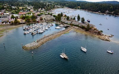
Ganges Harbour, Salt Spring Island
Ganges Harbour is an embayment on the eastern coast of Salt Spring Island that extends 5 miles northwest from Captain Passage, about 35 miles (57 km) southwest of Vancouver, and 15 miles (24 km) north-northwest of Sidney, British Columbia.
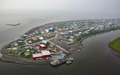
Unalakleet, Norton Sound
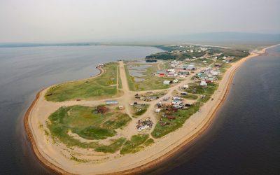
Unalakleet is an Iñupiaq-Yup’ik community built on an ancient beach ridge with an elevation of 7 feet (2 m) at the mouth of the Unalakleet River on the eastern coast of Norton Sound, about 145 miles (234 km) southeast of Nome, and 36 miles (58 km) south-southeast of Shaktoolik, Alaska.
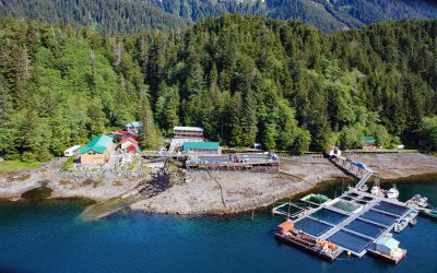
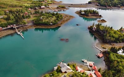
Port Armstrong, Baranof Island
Port Armstrong is an embayment on the southeast coast of Baranof Island, that extends west-southwest for 1.6 miles (2.6 km) from Point Eliza on Chatham Strait, and the site of a historical whaling station and present-day salmon hatchery, about 59 miles (95 km) south-southeast of Sitka and 4 miles (6.5 km) north of Port Alexander, Alaska.
Kitimat, Douglas Channel
Kitimat is a designed community for employees of an aluminum smelter situated on the alluvial fan of the Kitimat River at the head of Douglas Channel, about 71 miles (115 km) east-southeast of Prince Rupert and 32 miles (52 km) south of Terrace, British Columbia.
Golovin, Norton Sound
Golovin is a community on the northern shore of Norton Sound in the Bering Sea and situated on a sand spit between Golovnin Lagoon to the north and Golovnin Bay to the south, about 71 miles (114 km) east of Nome and 24 miles (38 km) west-southwest of Elim, Alaska.
Point Roberts, Strait of Georgia
Point Roberts is a community situated on 3,136 acres (1,269 ha) of the southern tip of the Tsawwassen Peninsula and represents an exclave of the United States in the Strait of Georgia, about 32 miles (52 km) northwest of Bellingham and 15 miles (24 km) west of Blaine, Washington.
San Elijo Lagoon, Cardiff
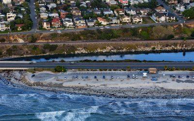
San Elijo Lagoon is 915 acres (370 ha) of tidal wetlands formed by Escondido Creek that drains a watershed of 54,000 acres (22,000 ha) and flows generally southwest for 26 miles (42 km) to the Pacific Ocean at Cardiff, or Cardiff-by-the-Sea, a beach community in Encinitas, about 89 miles (144 km) southeast of Los Angeles and 21 miles (34 km) north-northwest of San Diego, California.
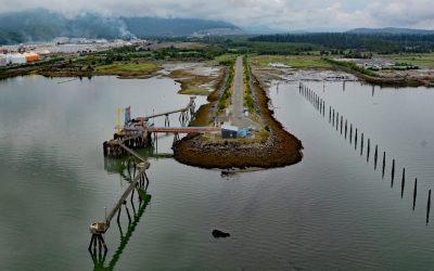
Fort Stevens, Point Adams
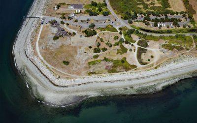
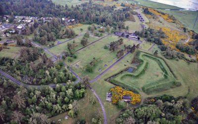
Fort Stevens was constructed during the American Civil War as an earthwork battery on the south shore at the mouth of the Columbia River on Point Adams, about 15 miles (24 km) north of Seaside and 6 miles (10 km) west-northwest of Astoria, Oregon.
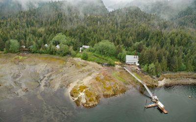
Halibut Cove, Ismailof Island
Halibut Cove is a small community lining the shores of The Narrows, a protected waterway separating Ismailof Island to the north from the Kenai Peninsula to the south, on the southeastern shore of Kachemak Bay, about 20 miles (32 km) northeast of Seldovia and 11 miles (18 km) east-southeast of Homer, Alaska.
Gwent Cove, Pearse Canal
Gwent Cove is a small community at the site of the historical Hidden Inlet fishing village and cannery located adjacent to and west of the entrance to Hidden Inlet, an estuary that trends generally north for 6 miles (9.7 km) from the western shore of Pearse Canal, 45 miles (72 km) north of Prince Rupert and 61 miles (98 km) southeast of Ketchikan, Alaska.
About the background graphic
This ‘warming stripe’ graphic is a visual representation of the change in global temperature from 1850 (top) to 2019 (bottom). Each stripe represents the average global temperature for one year. The average temperature from 1971-2000 is set as the boundary between blue and red. The colour scale goes from -0.7°C to +0.7°C. The data are from the UK Met Office HadCRUT4.6 dataset.
Click here for more information about the #warmingstripes.