Communities
Recent Articles
More Articles
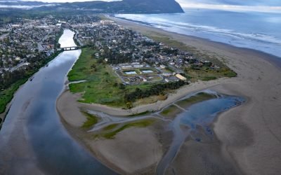
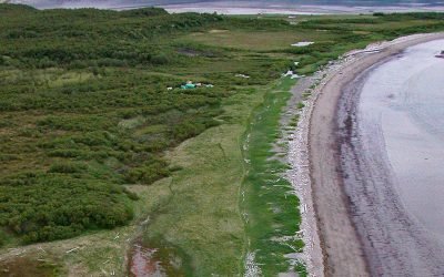
Necanicum River, Seaside
Necanicum River is approximately 21 miles (34 km) long draining a watershed of 84 square miles (21,756 ha), and forms the first estuary south of the Columbia River about 70 miles (113 km) northwest of Portland and 13 miles (21 km) southwest of Astoria at the coastal community of Seaside, Oregon.
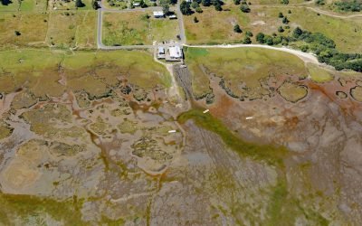
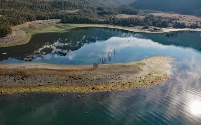
Oysterville, Willapa Bay
Oysterville is located in Willapa Bay on the Long Beach Peninsula, about 28 miles (45 km) north-northwest of Astoria and 17 miles (27 km) southwest of Raymond, Washington.
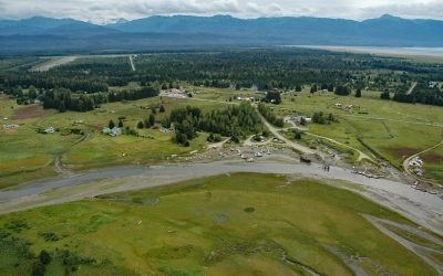
Gustavus, Icy Strait
Gustavus is a community on the north shore of Icy Strait, at the mouth of the Salmon River and across from Pleasant Island, about 48 miles (77 km) west-northwest of Juneau, and 28 miles (45 km) northeast of Elfin Cove, Alaska.
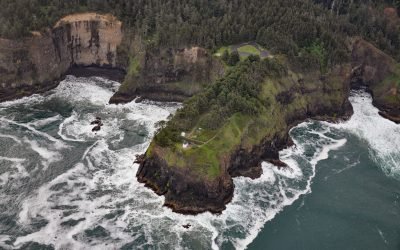
Cape Meares Lighthouse, Cape Meares
Cape Meares is the site of a historic lighthouse on a prominent headland that forms a high steep bluff on the south end of Tillamook Bay, about 48 miles (77 km) south of Astoria and 7 miles (11 km) west-northwest of Tillamook, Oregon.
Ellamar, Prince William Sound
Ellamar is a historic mining camp on Virgin Bay in Prince William Sound, at the base of Ellamar Mountain, about 20 miles (32 km) southwest of Valdez and 2 miles (3.2 km) northwest of Tatitlek, Alaska.
Douglas, Katmai National Park and Preserve
Douglas is a historical village in Katmai National Park and Preserve, also called Kaguyak but not to be confused with Kaguyak on Kodiak Island, situated on the Shelikof Strait coast of the Alaska Peninsula, about 112 miles (181 km) southwest of Homer and 100 miles (161.km) east of King Salmon, Alaska.
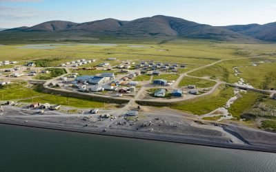
Brevig Mission, Port Clarence
Brevig Mission is an Iñupiat village located on Brevig Lagoon, on the north shore of Port Clarence, about 151 miles (244 km) southwest of Kotzebue and 81 miles (130 km) northwest of Nome, Alaska.
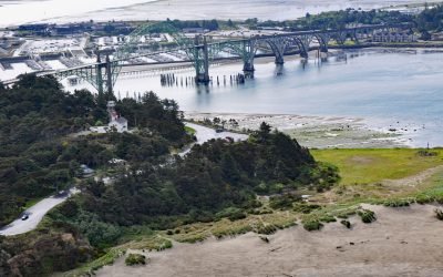
Yaquina Bay Light, Newport
Yaquina Bay Light is located on the north shore of the entrance to Yaquina Bay, about 40 miles (65 km) west of Corvallis and 1 mile (1.6 km) southwest of Newport, Oregon.
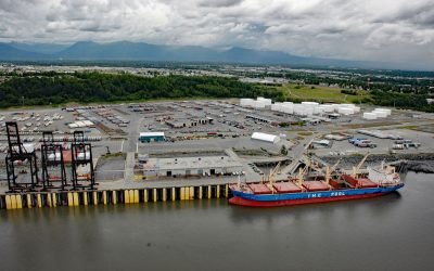
Port of Anchorage, Cook Inlet
Port of Anchorage is on the southeastern shore of Knik Arm at the head of Cook Inlet, about 75 miles (121 km) north of Seward and 1.5 miles (2.4 km) north of downtown Anchorage, Alaska.

Kipnuk, Kuguklik River
Kipnuk is a Central Yup’ik village situated on a sharp bend of the Kuguklik River, 5 miles (8 km) upstream from the estuary in Kinak Bay on the Bering Sea, about 98 miles (158 km) southwest of Bethel and 18 miles (29 km) south-southeast of Chefornak, Alaska.
About the background graphic
This ‘warming stripe’ graphic is a visual representation of the change in global temperature from 1850 (top) to 2019 (bottom). Each stripe represents the average global temperature for one year. The average temperature from 1971-2000 is set as the boundary between blue and red. The colour scale goes from -0.7°C to +0.7°C. The data are from the UK Met Office HadCRUT4.6 dataset.
Click here for more information about the #warmingstripes.