Communities
Recent Articles
More Articles
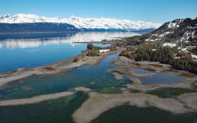
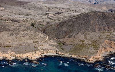
Golden Mine, Port Wells
Golden is a historical mining community on Port Wells, a fjord in northwestern Prince William Sound, about 60 miles (97 km) southwest of Valdez and 27 miles (44 km) northeast of Whittier, Alaska.
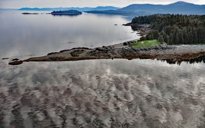
Cape Fanshaw, Frederick Sound
Cape Fanshaw is a low wooded point at the junction of Stephens Passage and Frederick Sound, about 83 miles (134 km) south of Juneau and 68 miles (110 km) east-northeast of Sitka, Alaska.
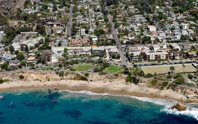
Divers Cove, Laguna Beach
Divers Cove is a small embayment with a beach at the west end of Heisler Park, about 9.3 miles (15 km) southeast of Newport Beach and 0.7 miles (1.1 km) northwest of Laguna Beach, California
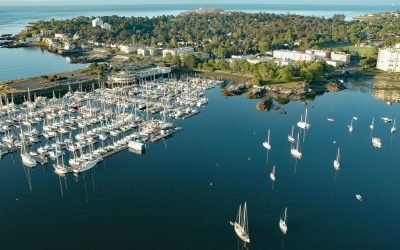
Turkey Head, Oak Bay
Turkey Head is a small peninsula that forms a natural harbour on the southern shore of Oak Bay, 3 miles (4.8 km) east of downtown Victoria, British Columbia.
Harmony Headlands, Point Estero
Harmony Headlands State Park preserves an undeveloped parcel of Pacific coastline between Point Estero to the south and Natalie’s Cove to the north, about 7 miles (11 km) west-northwest of Cayucos and 3 miles (5 km) south-southeast of Harmony, California.
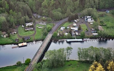
Taylors Landing, Alsea River
Taylors Landing is a small community near the head of the tide on the Alsea River in the Coast Range, about 17.4 miles (28 km) west of Alsea and 6.4 miles (10 km) east-southeast of Waldport, Oregon.
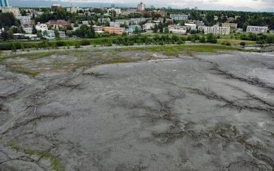
Bootleggers Cove, Anchorage
Bootleggers Cove is a coastal neighborhood located along the tidal flats of Cook Inlet between Westchester Lagoon and downtown Anchorage, Alaska.
Shaktoolik, Norton Sound
Shaktoolik is a small community now located on a spit forming Shaktoolik Bay, on the eastern shore of Norton Sound, about 56 miles (90 km) southeast of Golovin and 35 miles (56 km) north-northwest of Unalakleet, Alaska.
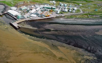
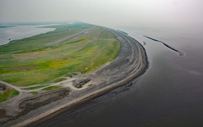
Ekuk Fisheries, Nushagak Bay
Ekuk is a small village located on Ekuk Spit on the eastern shore of Nushagak Bay, a branch of Bristol Bay, about 16 miles (26 km) south-southwest of Dillingham and 1.3 (2.1 km) miles southwest of Clarks Point, Alaska.
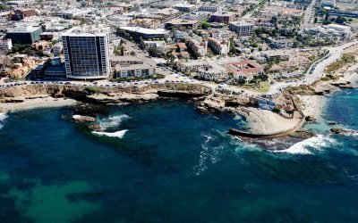
Childrens Pool, La Jolla
Children’s Pool was one of the many gifts that philanthropist Ellen Browning Scripps gave to the community of La Jolla, about 13 miles (21 km) south of Encinitas and 11.4 miles (18 km) northwest of San Diego, California.
About the background graphic
This ‘warming stripe’ graphic is a visual representation of the change in global temperature from 1850 (top) to 2019 (bottom). Each stripe represents the average global temperature for one year. The average temperature from 1971-2000 is set as the boundary between blue and red. The colour scale goes from -0.7°C to +0.7°C. The data are from the UK Met Office HadCRUT4.6 dataset.
Click here for more information about the #warmingstripes.