Communities
Recent Articles
More Articles
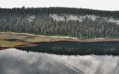
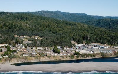
Fossil Bluffs, Kuiu Island
Fossil Bluffs is on the northeast shore of Halleck Harbor near the northern entrance of Saginaw Bay on Kuiu Island, about 42 miles (68 km) southeast of Sitka and 17 miles (27 km) southwest of Kake, Alaska.
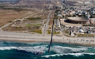
Border Field State Park, Playas de Tijuana
Border Field State Park is part of the Tijuana River National Estuarine Research Reserve, adjacent to the urban neighborhood of Playas de Tijuana, Mexico, located about 12 miles (19 km) south of San Diego, it lies within the city limits of Imperial Beach, California.
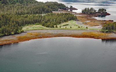
Portlock Cannery, Port Chatham
Portlock is a historical salmon cannery in Port Chatham, an embayment on the southern coast of the Kenai Peninsula, about 102 miles (164 km) north-northeast of Kodiak and 10 miles (16 km) south-southeast of Port Graham, Alaska.
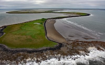
Cape Etolin, Nunivak Island
Cape Etolin is a point of land extending about 4.6 miles (7.4 km) north into the Bering Sea on the northern coast of Nunivak Island, about 50 miles (80 km) west of Nightmute on the mainland and 4 miles (6 km) north-northeast of Mekoryuk, Alaska.
Gualala, Gualala River
The Gualala River flows into the Pacific Ocean at the community of Gualala, approximately 92 miles (148 km) northwest of San Francisco and 40 miles (64 km) south-southeast of Mendocino, California.

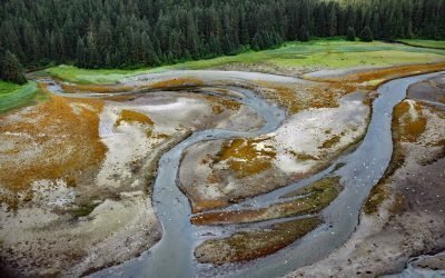
Claxton, Telegraph Passage
Claxton is a historical salmon cannery and community at the mouth of Claxton Creek on the eastern shore of Telegraph Passage in the Skeena River estuary, about 66 miles (106 km) southwest of Terrace and 19 miles (31 km) south-southeast of Prince Rupert, British Columbia.

Anacortes Ferry Terminal, Guemes Channel
Anacortes ferry terminal is located at Ship Harbor, an embayment on the northwestern shore of Fidalgo Island and the southern shore of Guemes Channel, about 85 miles (137 km) north of Seattle and 3.7 miles (6 km) west of the community of Anacortes, Washington.
Osland, Smith Island
Osland was once an active fishing and boatbuilding community on the east coast of Smith Island at the mouth of the Skeena River, about 68 miles (109 km) southwest of Terrace and 14 miles (23 km) south-southeast of Prince Rupert, British Columbia.
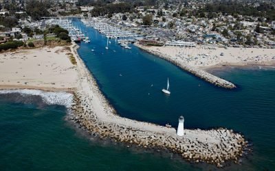
Walton Lighthouse, Santa Cruz Harbor
Walton Lighthouse is situated on the west jetty at the entrance to the Santa Cruz harbor adjacent to Seabright State Beach, about 25 miles (40 km) north-northwest of Monterey and in the city of Santa Cruz, California.
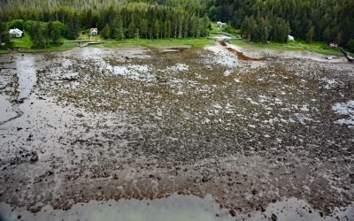
Sumdum Mine, Sanford Cove
Sumdum is a historical mine and community located at the head of Sanford Cove, an embayment on the southern shore of Endicott Arm, about 64 miles (103 km) north-northwest of Petersburg and 55 miles (89 km) southeast of Juneau, Alaska.
About the background graphic
This ‘warming stripe’ graphic is a visual representation of the change in global temperature from 1850 (top) to 2019 (bottom). Each stripe represents the average global temperature for one year. The average temperature from 1971-2000 is set as the boundary between blue and red. The colour scale goes from -0.7°C to +0.7°C. The data are from the UK Met Office HadCRUT4.6 dataset.
Click here for more information about the #warmingstripes.