Historical Sites
Recent Articles
More Articles
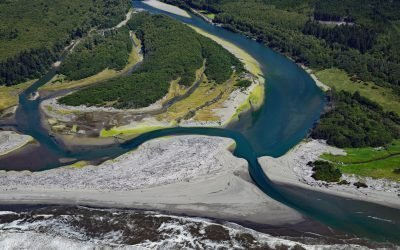
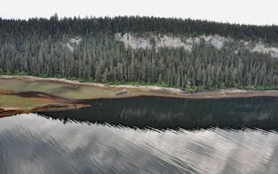
Queets River, Olympic National Park
The Queets River flows approximately 53 miles (85 km), mostly through Olympic National Park, to the Pacific Ocean, about 60 miles (96 km) southwest of Aberdeen and 5 miles (8 km) south of Kalaloch, Washington.
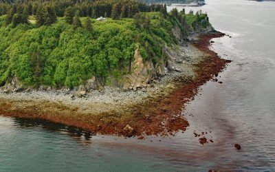
Seldovia Point, Kachemak Bay
Seldovia Point is a headland on the Kenai Peninsula at the northeast entrance to Seldovia Bay on the southern shore of Kachemak Bay, about 13.5 miles (22 km) southwest of Homer and 2.2 miles (3.5 km) north of Seldovia, Alaska.
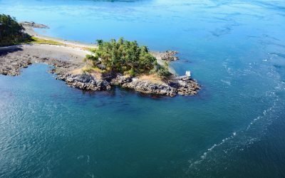
HMCS Mackenzie, Cornet Island
HMCS Mackenzie was a destroyer scuttled in Haro Strait, between Cornet and Gooch Islands in the Southern Gulf Islands, approximately 18 miles (29 km) north-northeast of Victoria and 5 miles (8 km) east-northeast of Sidney, British Columbia.
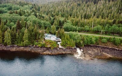
Whitman Creek, Revillagigedo Island
Whitman Creek is on the southeast coast of Revillagigedo Island, about 14 miles (23 km) north of Metlakatla and 7 miles (11 km) east-southeast of Ketchikan, Alaska.
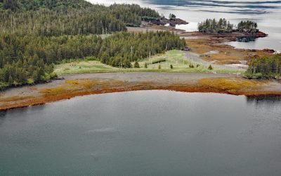
Fossil Bluffs, Kuiu Island
Fossil Bluffs is on the northeast shore of Halleck Harbor near the northern entrance of Saginaw Bay on Kuiu Island, about 42 miles (68 km) southeast of Sitka and 17 miles (27 km) southwest of Kake, Alaska.
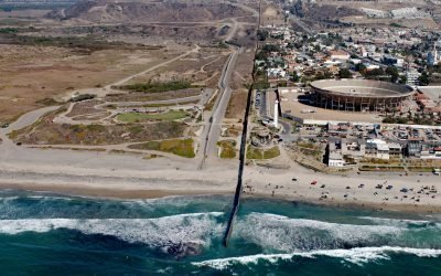
Border Field State Park, Playas de Tijuana
Border Field State Park is part of the Tijuana River National Estuarine Research Reserve, adjacent to the urban neighborhood of Playas de Tijuana, Mexico, located about 12 miles (19 km) south of San Diego, it lies within the city limits of Imperial Beach, California.

Tiger Glacier, Icy Bay
Tiger Glacier flows east for 8 miles (13 km) to a tidewater terminus at the head of Icy Bay in Prince William Sound, approximately 98 miles (158 km) southwest of Valdez and 42 miles (68 km) east-southeast of Whittier, Alaska.
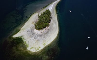
Cutts Island, Carr Inlet
Cutts Island is a state park located about 0.5 miles (0.8 km) off the eastern shore of Carr Inlet in South Puget Sound, approximately 12 miles (19 km) northwest of Tacoma and 5 miles (8 km) west of Gig Harbor, Washington.
Portlock Cannery, Port Chatham
Portlock is a historical salmon cannery in Port Chatham, an embayment on the southern coast of the Kenai Peninsula, about 102 miles (164 km) north-northeast of Kodiak and 10 miles (16 km) south-southeast of Port Graham, Alaska.

Canadian Fishing Company, Prince Rupert
The Canadian Fishing Company operates fish processing plants on Prince Rupert Harbour at Seal Cove and at George Hills Way, about 89 miles (143 km) southeast of Ketchikan and 72 miles (116 km) west-southwest of Terrace, British Columbia.
About the background graphic
This ‘warming stripe’ graphic is a visual representation of the change in global temperature from 1850 (top) to 2019 (bottom). Each stripe represents the average global temperature for one year. The average temperature from 1971-2000 is set as the boundary between blue and red. The colour scale goes from -0.7°C to +0.7°C. The data are from the UK Met Office HadCRUT4.6 dataset.
Click here for more information about the #warmingstripes.