Historical Sites
Recent Articles
More Articles
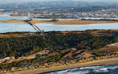
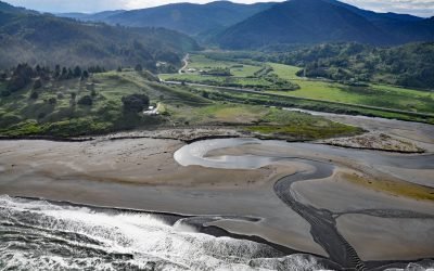
Tuluwat Island, Humboldt Bay
Tuluwat Island, also known as Gunther Island or Indian Island, is the largest of three islands in Humboldt Bay, along with Woodley and Dalby Islands, approximately 5.5 miles (8.8 km) south-southwest of Arcata and within the city limits of Eureka, California.
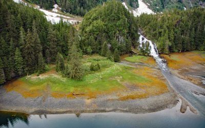
Cliff Falls, Deep Cove
Cliff Falls is the outlet for Cliff Lake, located at the head of Deep Cove, approximately 1.1 miles (1.8 km) west of Patterson Point, about 41 miles (66 km) south-southeast of Sitka, and 17.5 miles (28 km) north-northwest of Port Armstrong, Alaska.
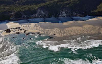
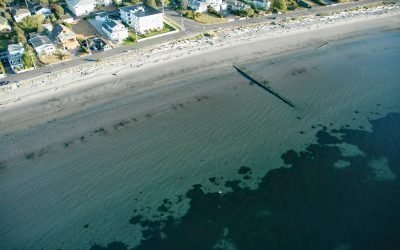
Hobbit Beach, Heceta Head
Hobbit Beach is a secluded strand located just north of Heceta Head, about 13 miles (21 km) north of Florence and 12.5 miles (20 km) south of Yachats, Oregon.
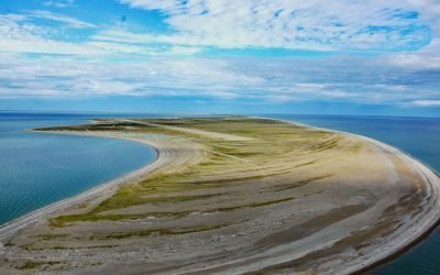
Point Spencer, Port Clarence
Point Spencer is the north end of a spit about 19 miles (31 km) long, between the Bering Sea and Port Clarence, on the Seward Peninsula, about 14 miles (23 km) west of Teller, Alaska.
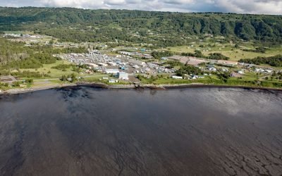
Ophir, Euchre Creek
Ophir is a small community on Euchre Creek in Curry County, about 0.5 miles (0.8 km) upstream from the Pacific Ocean, and 4 miles (6.5 km) northeast of the community of Nesika Beach, Oregon.
Millers Landing, Kachemak Bay
Millers Landing is on the north shore of Kachemak Bay, on the Kenai Peninsula, about 4 miles (6.5 km) northwest of Homer, Alaska.
Willows Beach, Oak Bay
Willows Beach is a beachfront neighborhood between Bowker Creek and Cattle Point at the head of Oak Bay in Victoria, British Columbia.
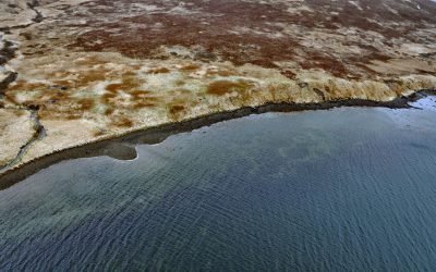
Morzhovoi, Bechevin Bay
Morzhovoi is an abandoned village on the southern shore of Trader Cove and the eastern shore of Bechevin Bay, on the Alaska Peninsula, about 5.5 miles (8.9 km) northeast of False Pass, Alaska.

Mush Bay, East Arm Uganik Bay
Mush Bay is a local name for a shallow embayment on the western shore of the East Arm of Uganik Bay on Kodiak Island’s west coast, about 22 miles (35 km) northeast of Larsen Bay and 40 miles (65 km) west-southwest of Kodiak, Alaska.

Morse and Muir Glaciers, Glacier Bay National Park and Preserve
Morse and Muir glaciers terminate at the head of Muir Inlet in Glacier Bay National Park and Preserve, approximately 53 miles (85 km) north of Gustavus, Alaska.
About the background graphic
This ‘warming stripe’ graphic is a visual representation of the change in global temperature from 1850 (top) to 2019 (bottom). Each stripe represents the average global temperature for one year. The average temperature from 1971-2000 is set as the boundary between blue and red. The colour scale goes from -0.7°C to +0.7°C. The data are from the UK Met Office HadCRUT4.6 dataset.
Click here for more information about the #warmingstripes.