Historical Sites
Recent Articles
More Articles
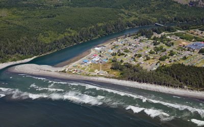
Taholah, Quinault River
Taholah is a community located at the mouth of the Quinault River on lands of the Quinault Indian Nation, about 9 miles (14 km) north of Moclips and 41 miles (66 km) north of Hoquiam on the Olympic Peninsula, Washington.
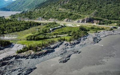
Aurora Lagoon, Kachemak Bay
Aurora Lagoon is on the southern shore of Kachemak Bay, on the Kenai Peninsula, about 15 miles (24 km) northeast of Homer, Alaska.
Malachan, Nitinat Lake
Malachan is a Ditidaht community of the Nuu-chah-nulth First Nation located at the head of Nitinat Lake on the west coast of Vancouver Island, 37 miles (60 km) southeast of Bamfield, and 93 miles (150 km) northwest by road from Victoria, British Columbia.
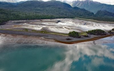
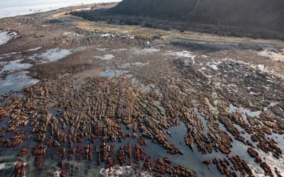
Copper City, Hetta Inlet
Copper City is an abandoned mining community located on the eastern shore of Hetta Inlet, on the southwest coast of Prince of Wales Island, about 5.5 miles (9 km) north of Lime Point and 10 miles (16 km) southeast of Hydaburg.
Cape Cleare, Montague Island
Cape Cleare is a headland on the southwest end of Montague Island, at the entrance to Montague Strait that leads to Prince William Sound, about 60 miles (97 km) southeast of Seward, Alaska.
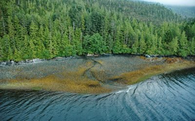
Mattole River, Lost Coast
The Mattole River flows approximately 62 miles (100 km) through the King Range to the Lost Coast at the Punta Gorda State Marine Reserve, about 10 miles (16 km) south of Cape Mendocino and 4 miles (6.4 km) west-southwest of Petrolia, California.

Amherst Glacier, College Fjord
Amherst Glacier flows northwest for 4 miles (6.5 km) from the Chugach Mountains to a terminus lake, located 5.5 miles (9 km) northeast of Point Pakenham in College Fjord, the northwestern-most part of Prince William Sound, and 52 miles (83 km) southwest of Valdez, Alaska.
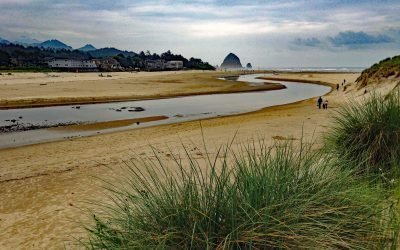
Ecola Creek, Cannon Beach
Ecola Creek flows into the Pacific Ocean at the northern edge of Cannon Beach, a small resort community approximately 30 miles (48 km) north of Tillamook and 8 miles (12 km) south of Seaside, Oregon.
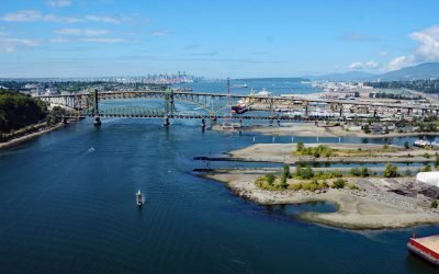
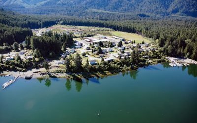
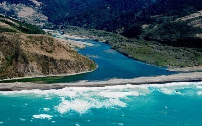
Seymour River, Burrard Inlet
The Seymour River flows from a large reservoir into Burrard Inlet in North Vancouver, British Columbia.
Bird Point, Turnagain Arm
Bird Point is on the north shore of Turnagain Arm in Cook Inlet, 4 miles (6.5 km) southwest of the community of Bird Creek, and 7.5 miles (13 km) west of Girdwood, Alaska.
About the background graphic
This ‘warming stripe’ graphic is a visual representation of the change in global temperature from 1850 (top) to 2019 (bottom). Each stripe represents the average global temperature for one year. The average temperature from 1971-2000 is set as the boundary between blue and red. The colour scale goes from -0.7°C to +0.7°C. The data are from the UK Met Office HadCRUT4.6 dataset.
Click here for more information about the #warmingstripes.