Historical Sites
Recent Articles
More Articles
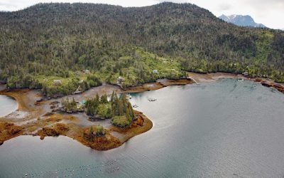
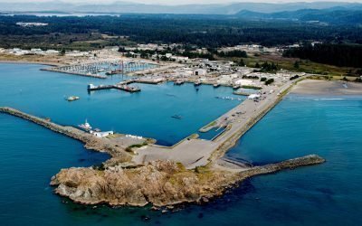
Peterson Bay, Kachemak Bay
Peterson Bay extends approximately 2 miles (3.2 km) from Peterson Point into the Kenai Peninsula on the southeastern shore of Kachemak Bay in lower Cook Inlet, about 18 miles (29 km) northeast of Seldovia and 10 miles (16 km) southeast of Homer, Alaska.
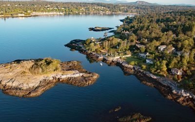
Flower Island, Ten Mile Point
Flower Island is a small, uninhabited islet located about 250 feet (80 m) offshore from the southern end of Ten Mile Point, roughly 15 miles (24 km) south-southeast of Sidney and 4 miles (6 km) east-northeast of Victoria, British Columbia.
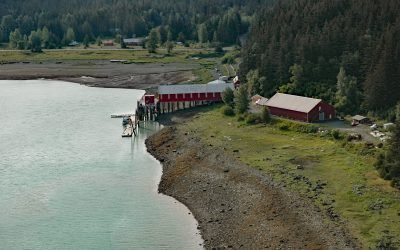
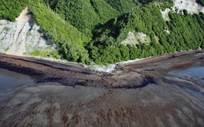
Cape Fox Packing Company Cannery, Boca de Quadra
The Cape Fox Packing Company operated a cannery from 1883 to 1886 on the north shore of Boca de Quadra, a fjord on the Portland Peninsula, about 59 miles (95 km) north-northwest of Prince Rupert and 36 miles (58 km) southeast of Ketchikan, Alaska.
Letnikof Cove, Chilkat Inlet
Letnikof Cove is a small embayment about 0.5 miles (0.8 km) across on the eastern shore of Chilkat Inlet, approximately 70 miles (113 km) north-northwest of Juneau and 5 miles (8 km) south-southeast of Haines, Alaska.
Whaler Island, Crescent City
Whaler Island, about 700 feet (215m) across, lies 0.4 miles (0.65km) offshore and is now connected to the mainland by a paved road on an artificial breakwater, about 16 miles (26km) north-northwest of Klamath and 1.4 miles (2.3km) southeast of Crescent City, California.
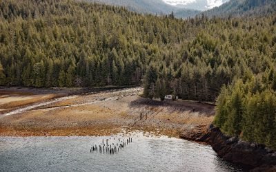
Union Bay Cannery, Ernest Sound
Union Bay is located on the lower Cleveland Peninsula at the southern entrance to Ernest Sound, between Lemesurier Point to the west and Union Point to the east, about 3 miles (4.8 km) northeast of Meyers Chuck and 34 miles (55 km) northwest of Ketchikan, Alaska.
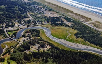
Copalis River, Copalis Beach
The Copalis River flows southwest for 22 miles (35 km) to the community of Copalis Beach, then another 2 miles (3.2 km) to the Pacific Ocean at Griffith-Priday State Park, about 21 miles (34 km) northwest of Hoquiam and 5 miles (8 km) south of Pacific Beach, Washington.
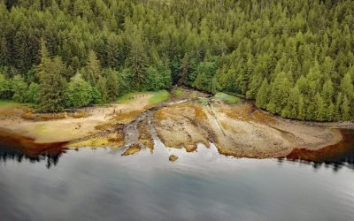
Cottonwood Creek, Kachemak Bay
Cottonwood Creek is a stream on the Kenai Peninsula in Kachemak Bay State Park that flows south for about 2 miles (3.2 km) to the northern shore of Kachemak Bay, about 13 miles (21 km) northeast of Homer and 6 miles (10 km) southwest of Voznesenka, Alaska.
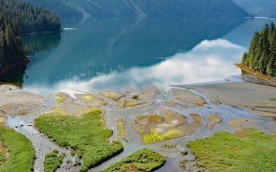
Foch Lagoon, Foch-Gilttoyees Provincial Park
Foch Lagoon is about 1 mile (1.6 km) wide and extends for 5 miles (8 km) northwest from the western shore of Douglas Channel in Foch-Gilttoyees Provincial Park and Protected Area, about 60 miles (97 km) southeast of Prince Rupert and 25 miles (40 km) southwest of Kitimat, British Columbia.

Fish Creek, Harrison Bay
Fish Creek flows generally northeast for approximately 110 miles (177 km) to Harrison Bay at the western edge of the Colville River Delta, about 141 miles (230 km) southeast of Utqiaġvik and 12 miles (19 km) north-northwest of Nuiqsut, Alaska.
About the background graphic
This ‘warming stripe’ graphic is a visual representation of the change in global temperature from 1850 (top) to 2019 (bottom). Each stripe represents the average global temperature for one year. The average temperature from 1971-2000 is set as the boundary between blue and red. The colour scale goes from -0.7°C to +0.7°C. The data are from the UK Met Office HadCRUT4.6 dataset.
Click here for more information about the #warmingstripes.