Historical Sites
Recent Articles
More Articles
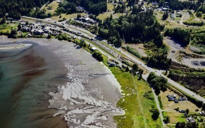
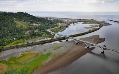
Blyn, Sequim Bay
Blyn is a small community located where Jimmycomelately Creek flows into Sequim Bay on the northern coast of the Olympic Peninsula, about 13 miles (21 km) southwest of Port Townsend and 7 miles (11 km) southeast of Sequim, Washington.

Europa Reach, Gardner Canal
Europa Reach is one of several named sections along Gardner Canal, a fjord in the Kitimat Ranges, about 97 miles (156 km) southeast of Prince Rupert and 42 miles (68 km) south-southeast of Kitimat, British Columbia.
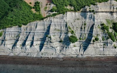
Port Graham, Kachemak Bay
Port Graham is a deglaciated fjord at the southern entrance to Kachemak Bay with an Alutiiq Sugpiaq community with the same name, on the southwestern end of the Kenai Peninsula, about 23 miles (37 km) south-southwest of Homer and 3.4 miles (5.5 km) east of Nanwalek, Alaska.
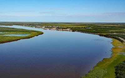
Emmonak, Yukon River Delta
Emmonak is a Yup’ik community located in the Yukon River Delta, approximately 14 miles (23 km) upstream from the Bering Sea, about 92 miles (148 km) west-southwest of Saint Michael and 20 miles (32 km) northeast of Nunam Iqua, Alaska.
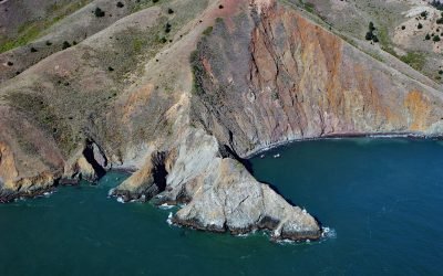
Point Diablo, Marin Headlands
Point Diablo extends about 600 feet (183 m) south from the Marin Headlands roughly midway between Point Bonita to the west and Lime Point to the east, about 6 miles (10 km) northwest of San Francisco and 2.7 miles (4 km) south-southwest of Sausalito, California.
Kirschner Lake, Kamishak Bay
Kirschner Lake is located on the northern shore of Kamishak Bay and the western coast of lower Cook Inlet at an elevation of approximately 80 feet (24 m), about 110 miles (177 km) northeast of King Salmon and 86 miles (138 km) west-southwest of Homer, Alaska.
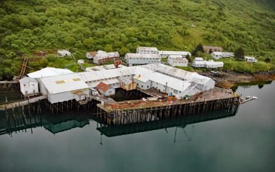
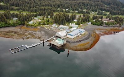
Port O’Brien, Uganik Bay
Port O’Brien is a remote salmon cannery located on the eastern shore of Northeast Arm Uganik Bay on the northwest coast of Kodiak Island, about 147 miles (236 km) south-southwest of Homer and 34 miles (55 km) west of Kodiak, Alaska.
Rogue River, Gold Beach
The Rogue River flows west for 215 miles (346 km) to the Pacific Ocean, about 23 miles (37 km) south-southeast of Port Orford and at Gold Beach, Oregon.
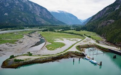
Kemano River, Gardner Canal
The Kemano River flows from the Kitimat Ranges to Kemano Bay on the northern shore of Gardner Canal, about 45 miles (72 km) south-southeast of Kitimat and 10 miles (16 km) southwest of Kemano, British Columbia.
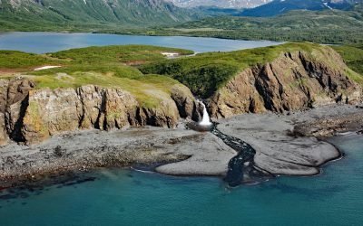
Falls Creek, Kachemak Bay
Falls Creek is located on the Kenai Peninsula, flowing generally south for 3.2 miles (5 km) to the northwestern shore of Kachemak Bay, approximately 17 miles (27 km) northeast of Homer and 2.5 miles (4 km) southwest of Kachemak Selo, Alaska.
About the background graphic
This ‘warming stripe’ graphic is a visual representation of the change in global temperature from 1850 (top) to 2019 (bottom). Each stripe represents the average global temperature for one year. The average temperature from 1971-2000 is set as the boundary between blue and red. The colour scale goes from -0.7°C to +0.7°C. The data are from the UK Met Office HadCRUT4.6 dataset.
Click here for more information about the #warmingstripes.