Historical Sites
Recent Articles
More Articles
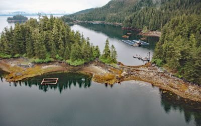
Hidden Falls Hatchery, Kasnyku Bay
The Hidden Falls Fish Hatchery is located in Tongass National Forest on the northeast coast of Baranof Island, at the head of Kasnyku Bay off Chatham Strait, about 22 miles (35 km) south-southeast of Angoon and 21 miles (34 km) northeast of Sitka, Alaska.
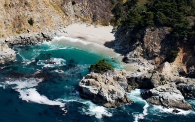
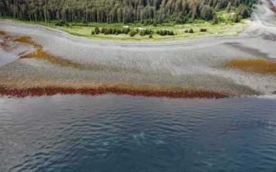
McWay Creek, Julia Pfeiffer Burns State Park
McWay Creek drains a watershed of approximately 1,730 acres (700 ha) and flows southwest for 2.5 miles (4 km) through Julia Pfeiffer Burns State Park and McWay Canyon one Big Sur coast, about 30 miles (48 km) south-southeast of Carmel and 12 miles (19 km) northwest of Lucia, California.
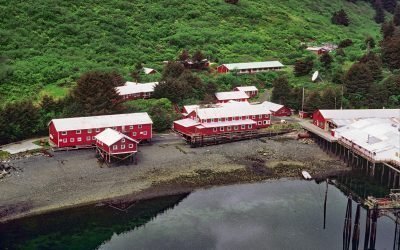
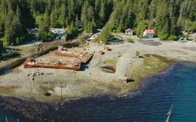
Port Bailey, Dry Spruce Bay
Port Bailey is a historical cannery in Dry Spruce Bay on the Kupreanof Peninsula of Kodiak Island, about 130 miles (209 km) south-southwest of Homer and 26 miles (42 km) west-northwest of Kodiak, Alaska.
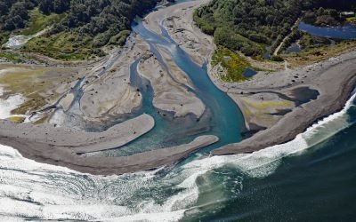
Elwha River, Angeles Point
The Elwha River starts from a perennial snowfield at an elevation of 4,763 feet (1,452 m) in the Olympic Mountains and flows generally north for 45 miles (72 km) to Angeles Point at Freshwater Bay on the southern shore of the Strait of Juan de Fuca, about 33 miles (53 km) east-southeast of Clallam Bay and 6 miles (10 km) west-northwest of Port Angeles, Washington.
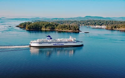
BC Ferries, Gulf Islands
The Gulf Islands and Vancouver Island are connected to the mainland by BC Ferries, the largest ferry line in North America and the second-largest in the world, that provides passenger and vehicle transportation among coastal and island communities in British Columbia.
Barabara Point, Kachemak Bay
Barabara Point is on the Kenai Peninsula between McDonald Spit to the east and Seldovia Point to the west in Kachemak Bay, about 12 miles (19 km) south-southwest of Homer and 4 miles (6.5 km) northeast of Seldovia, Alaska.
Port Althorp, Chichagof Island
Port Althorp is an embayment and the site of a historical salmon cannery on the north coast of Chichagof Island, about 155 miles (250 km) southeast of Yakutat and 29 miles (47 km) southwest of Gustavus, Alaska.
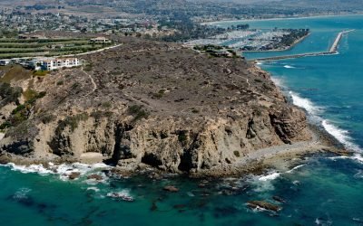
Dana Point Headlands, San Juan Capistrano
Dana Point is a prominent headland situated between Dana Point Harbor to the south and Strand Beach to the north, about 50 miles (80 km) southeast of Los Angeles and 4 miles (6 km) southwest of San Juan Capistrano, California.
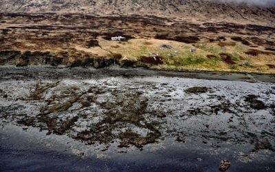
Belkofski, Alaska Peninsula
Belkofski is an abandoned Aleut Unangan village situated on the south coast of the Alaska Peninsula between Belkofski Bay to the southwest and Volcano Bay to the northeast, about 62 miles (100 km) southwest of Sand Point and 11 miles (18 km) east-northeast of King Cove, Alaska.
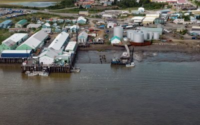
Dillingham, Nushagak Bay
Dillingham is a community on the south side of Snag Point at the confluence of the Wood and Nushagak Rivers, at the head of Nushagak Bay on the north coast of Bristol Bay, about 248 miles (400 km) west-southwest of Homer and 166 miles (270 km) southeast of Bethel, Alaska.
About the background graphic
This ‘warming stripe’ graphic is a visual representation of the change in global temperature from 1850 (top) to 2019 (bottom). Each stripe represents the average global temperature for one year. The average temperature from 1971-2000 is set as the boundary between blue and red. The colour scale goes from -0.7°C to +0.7°C. The data are from the UK Met Office HadCRUT4.6 dataset.
Click here for more information about the #warmingstripes.