Historical Sites
Recent Articles
More Articles
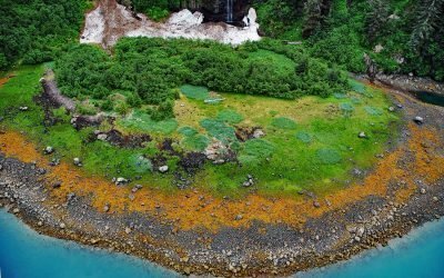
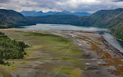
Whale Bay, Prince William Sound
Whale Bay lies on the northeastern coast of the Kenai Peninsula in Prince William Sound, extending 4 miles (6.5 km) northeast to the southern end of Knight Island Passage, about 88 miles (141 km) west-southwest of Cordova and 45 miles (73 km) east of Seward, Alaska.
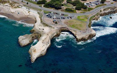
Lighthouse Point Park, Point Santa Cruz
Lighthouse Point Park is located on Point Santa Cruz, adjacent to Lighthouse Field State Beach at the northern boundary of Monterey Bay, about 25 miles (40 km) north-northwest of Monterey and in Santa Cruz, California.
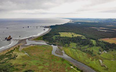
Sixes River, Cape Blanco
Sixes River drains a watershed of about 85,832 acres (34,735 ha) and flows generally west for about 31 miles (50 km) through coastal forests in southwestern Oregon and enters the Pacific Ocean just north of Cape Blanco, about 19 miles (31 km) south-southwest of Bandon and 8 miles (13 km) north-northwest of Port Orford, Oregon.
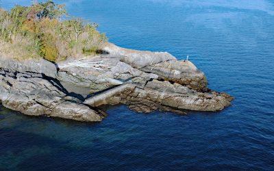
Cormorant Point, Gordon Head
Cormorant Point is a headland between Cordova Bay and Margaret Bay in Saanich’s Gordon Head neighborhood, about 11 miles (18 km) south-southeast of Sidney and 5.5 miles (8.9 km) north-northeast of Victoria, British Columbia.
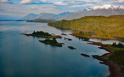
Halibut Cove Lagoon, Kachemak Bay
Halibut Cove Lagoon is a semi‐enclosed embayment 0.7 miles (1 km) wide at the head of Halibut Cove on Kachemak Bay’s southeast shore, on the Kenai Peninsula, about 20 miles (32 km) northeast of Seldovia and 13 miles (21 km) southeast of Homer, Alaska.
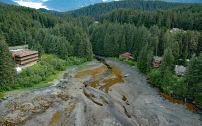
Auke Creek, Mendenhall Peninsula
Auke Creek lies on the west coast of the Mendenhall Peninsula at the head of Auke Bay—a three‐mile (5 km) inlet at the northern end of Stephens Passage, about 66 miles (106 km) south‐southeast of Haines and 10 miles (16 km) northwest of Juneau, Alaska.
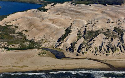
Oso Flaco Creek, Guadalupe-Nipomo Dunes
Oso Flaco Creek drains a watershed of approximately 7,400 acres (2,995 ha) consisting mostly of agricultural land before forming Oso Flaco Lake, now part of the Oso Flaco Lake Natural Area in the Guadalupe-Nipomo Dunes, and then flows into the Pacific Ocean, about 68 miles (109 km) northwest of Santa Barbara and 5 miles (8 km) south of Oceano, California.
Hastings Arm, Observatory Inlet
Hastings Arm extends 14 miles (23 km) north from Observatory Inlet into the Coast Mountains and terminates at the mouth of the Kshwan River, about 23 miles (37 km) south‐southeast of Stewart and 17 miles (27 km) northwest of Kitsault, British Columbia.
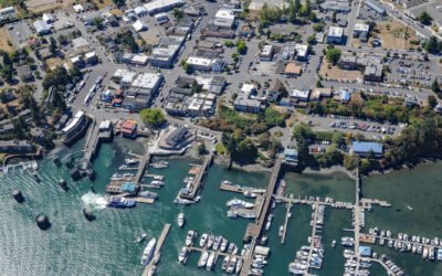
Friday Harbor, San Juan Island
Friday Harbor is a community at the head of a protected embayment on the eastern coast of San Juan Island, the archipelago’s second-largest and most populous island, about 18 miles (29 km) northeast of Victoria and 18 miles (29 km) west of Anacortes, Washington.
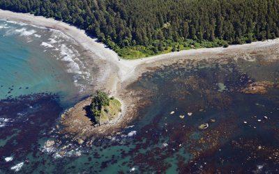
Ozette Village, Cape Alava
Ozette is a historical Makah village at Cape Alava, the Olympic Peninsula’s westernmost point, about 19 miles (31 km) north-northwest of La Push and 15 miles (24 km) south-southwest of Neah Bay, Washington.
About the background graphic
This ‘warming stripe’ graphic is a visual representation of the change in global temperature from 1850 (top) to 2019 (bottom). Each stripe represents the average global temperature for one year. The average temperature from 1971-2000 is set as the boundary between blue and red. The colour scale goes from -0.7°C to +0.7°C. The data are from the UK Met Office HadCRUT4.6 dataset.
Click here for more information about the #warmingstripes.