Historical Sites
Recent Articles
More Articles
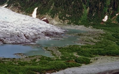
Bainbridge Glacier, Port Bainbridge
Bainbridge Glacier originates on Pinnacle Mountain at the edge of the Sargent Icefield on the Kenai Peninsula, and flows east for 10 miles (16 km) to Port Bainbridge, about 47 miles (76 km) south-southeast of Whittier and 36 miles (58 km) east of Seward, Alaska.
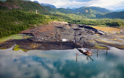
Anyox, Observatory Inlet
Anyox, an abandoned mining community in the Coast Mountains, lies at the mouth of Anyox Creek on Granby Bay in Observatory Inlet, about 79 miles (127 km) north-northeast of Prince Rupert and 37 miles (60 km) south of Stewart, British Columbia.
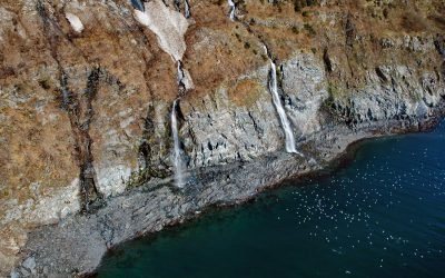
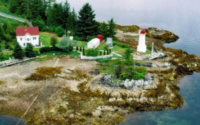
Rookery Falls, Passage Canal
Rookery Falls is on the northern shore of Passage Canal in Prince William Sound, about 50 miles (80 km) southeast of Anchorage and 1.7 miles (1.9 km) north-northeast of Whittier, Alaska.
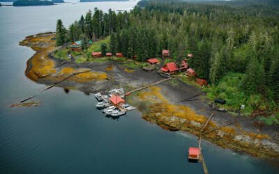
Cannery Cove, Pybus Bay
Cannery Cove is an embayment on the western shore of Pybus Bay in the Kootznoowoo Wilderness, on the southern coast of Admiralty Island, about 70 miles (113 km) south of Juneau and 24 miles (39 km) north-northwest of Kake, Alaska.
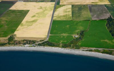
Ebey’s Landing, Whidbey Island
Ebey’s Landing is a beach on the southwest coast of Whidbey Island, on Admiralty Inlet in northern Puget Sound, about 45 miles (72 km) north-northwest of Seattle and 2 miles (3.2 km) south-southwest of Coupeville, Washington.
Takli Island, Amalik Bay
Takli Island is in Amalik Bay, between Cape Ilktugitak to the southwest and Cape Atushagvik to the northeast, along the Shelikof Strait coast of the Alaska Peninsula in Katmai National Park and Preserve, about 154 miles (248 kilometers) southwest of Homer and 81 miles (130 kilometers) west-northwest of Kodiak, Alaska.
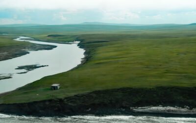
Pitmegea River, Cape Sabine
The Pitmegea River originates at an elevation of about 1,300 feet (396 meters) in the De Long Mountains of the western Brooks Range, and flows northwest for 37 miles (60 kilometers) to the Chukchi Sea at Cape Sabine, about 70 miles (113 kilometers) south-southwest of Point Lay and 66 miles (106 kilometers) northeast of Point Hope, Alaska.
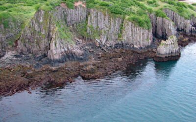
Dryad Point, Campbell Island
Dryad Point is on the northeastern point of Campbell Island and is the site of a historic lighthouse that marks the intersection of Lama Passage to the east and Seaforth Channel to the north on the Inside Passage, about 173 miles (278 km) southeast of Prince Rupert and 2 miles (3.2 km) northeast of Bella Bella, British Columbia.
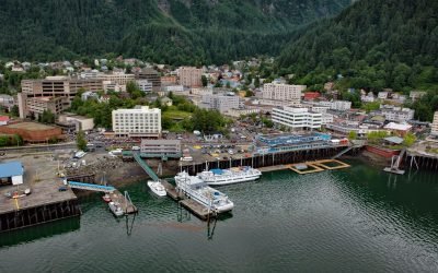
Juneau, Gastineau Channel
Juneau is the state capital, situated at the mouth of Gold Creek on Gastineau Channel, about 93 miles (150 km) northeast of Sitka and 87 miles (140 km) south-southeast of Skagway, Alaska.
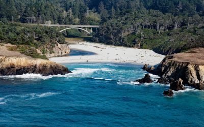
Jug Handle Cove, Ecological Staircase
Jug Handle Cove is a California State Natural Preserve made up of a series of ancient marine terraces, known as the Ecological Staircase, which exhibit different stages of ecological succession at the mouth of Jug Handle Creek, about 5 miles (8 km) south of Fort Bragg and 5 miles (8 km) north of Mendocino, California.
About the background graphic
This ‘warming stripe’ graphic is a visual representation of the change in global temperature from 1850 (top) to 2019 (bottom). Each stripe represents the average global temperature for one year. The average temperature from 1971-2000 is set as the boundary between blue and red. The colour scale goes from -0.7°C to +0.7°C. The data are from the UK Met Office HadCRUT4.6 dataset.
Click here for more information about the #warmingstripes.