Historical Sites
Recent Articles
More Articles
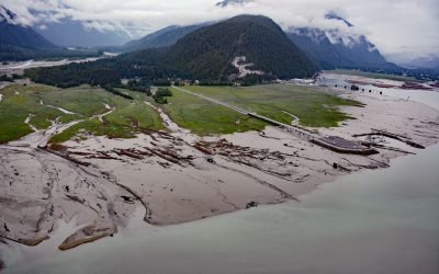
Hyder, Portland Canal
Hyder is a small community at the mouth of the Salmon River, on the western shore and near the head of Portland Canal, about 75 miles (121 km) northeast of Ketchikan and 2.5 miles (4 km) south-southwest of Stewart, British Columbia.
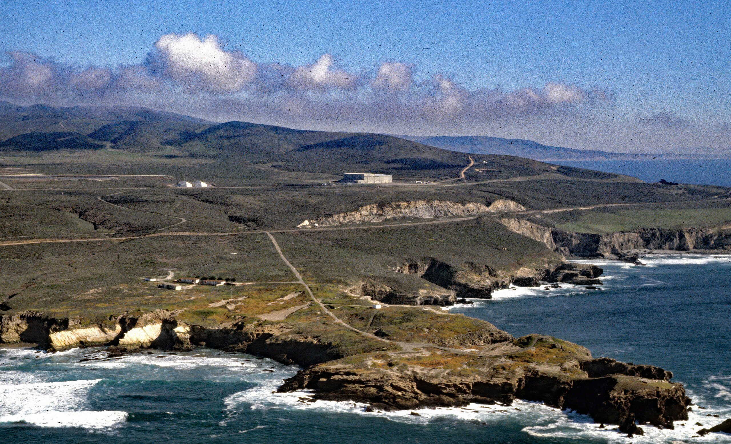
Point Arguello, Vandenberg Space Launch Complex
Point Arguello is a prominent headland and the site of Vandenberg Space Launch Complex, as well as a historical cattle ranch, lighthouse station, and a Loran station, about 55 miles (89 km) west-northwest of Santa Barbara and 12 miles (19 km) southwest of Lompoc, California.
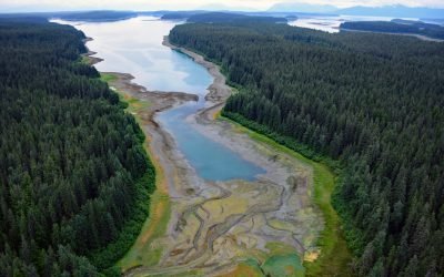
Hutchins Bay, Beardslee Islands
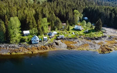
Hutchins Bay is on the eastern shore of Glacier Bay, partially surrounding the Beardslee Islands in Glacier Bay National Park and Preserve, about 155 miles (249 km) southeast of Yakutat and 8 miles (13 km) north of Gustavus, Alaska.
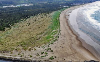
South Beach, Yaquina Bay South Jetty
South Beach is a state park south of the jetty protecting the mouth of Yaquina Bay and extending for 1 mile (1.6 km) along the Pacific coast, about 12 miles (19 km) north of Waldport and 2 miles (3.2 km) south-southwest of Newport, Oregon.
Metlakatla, Annette Island
Metlakatla is a Tsimshian community situated on Port Chester, an embayment on the west coast of Annette Island, about 75 miles (121 km) northwest of Prince Rupert and 16 miles (26 km) south-southeast of Ketchikan, Alaska.
Vancouver, Fraser River Delta
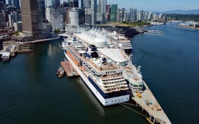
Vancouver is a coastal seaport located on the Burrard Peninsula in the Fraser River Delta, between Burrard Inlet to the north and the Fraser River to the south, about 60 miles (97 km) north-northeast of Victoria and 38 miles (61 km) east-northeast of Nanaimo, British Columbia.
Geikie Inlet, Glacier Bay
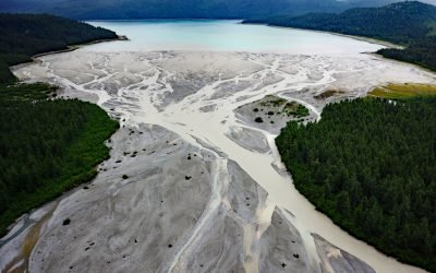
Geikie Inlet is a fjord about 8 miles (13 km) long that trends generally northeast from the mouth of the Geikie River to the western coast of Glacier Bay, in Glacier Bay National Park and Preserve, about 130 miles (209 km) southeast of Yakutat and 32 miles (51 km) northwest of Gustavus, Alaska.
Loring, Naha Bay
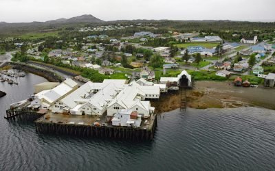
Loring is a small community at the site of a historical salmon cannery on the west coast of Revillagigedo Island, at the head of Naha Bay and near the mouth of the Naha River, about 66 miles (106 km) south-southeast of Wrangell and 17 miles (27 km) north of Ketchikan, Alaska.
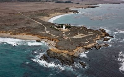
Point Piedras Blancas, San Simeon
Point Piedras Blancas is a prominent headland and the site of a historic light station within the California Coastal National Monument, and surrounded by the Hearst San Simeon State Park, about 73 miles (117 km) south-southeast of Monterey and 6 miles (10 km) west-northwest of San Simeon, California.
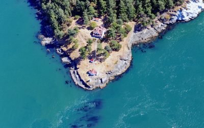
Turn Point, Boundary Pass
Turn Point is a headland with a historic light station on the northwest coast of Stuart Island overlooking Haro Strait to the west and Boundary Pass to the north, located on property that is part of the San Juan Islands National Monument, about 34 miles (55 km) west of Bellingham and 15 miles (24 km) northwest of Friday Harbor, Washington.
About the background graphic
This ‘warming stripe’ graphic is a visual representation of the change in global temperature from 1850 (top) to 2019 (bottom). Each stripe represents the average global temperature for one year. The average temperature from 1971-2000 is set as the boundary between blue and red. The colour scale goes from -0.7°C to +0.7°C. The data are from the UK Met Office HadCRUT4.6 dataset.
Click here for more information about the #warmingstripes.