Historical Sites
Recent Articles
More Articles
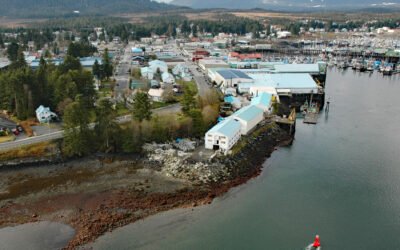
Petersburg, Mitkof Island
Petersburg is a community on the north end of Mitkof Island where the northern entrance to Wrangell Narrows meets Frederick Sound, about 116 miles (187 km) southeast of Juneau and 32 miles (52 km) northwest of Wrangell, Alaska.

Columbia Glacier, Prince William Sound
Columbia Glacier starts from ice fields at elevations over 9,000 feet (2743 m) near Mount Witherspoon in the Chugach Mountains and flows east and then generally south for 23 miles (37 km) to Columbia Bay on the north coast of Prince William Sound, about 62 miles (100 km) northeast of Whittier and 23 miles (37 km) west of Valdez, Alaska.
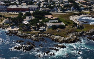
Hopkins Marine Station, Point Cabrillo
Hopkins Marine Station is a laboratory of Stanford University located on Point Cabrillo in Monterey Bay and adjacent to the Monterey Bay Aquarium in Pacific Grove, about 14 miles (23 km) south-southwest of Moss Landing and 1.5 miles (2.4 km) north-northwest of Monterey, California.
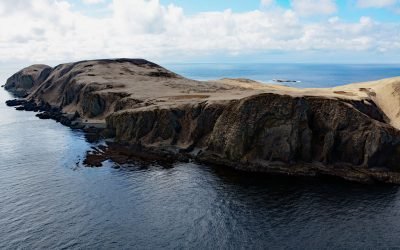
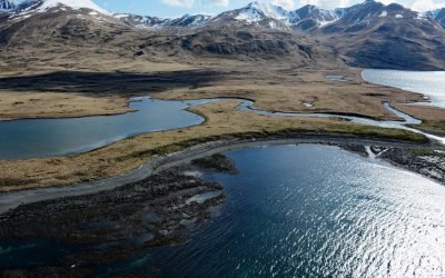
Anangula Island, Bering Sea
Anangula Island, also known as Ananiuliak Island, is situated in the Bering Sea and is one of the Fox Islands in the eastern Aleutian Islands, separated from Umnak Island by a channel about 0.93 miles (1.50 km) wide, about 116 miles (187 km) southwest of Dutch Harbor and 4.6 miles (7.4 km) north-northwest of Nikolski, Alaska.
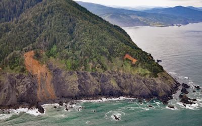
Humbug Mountain, Port Orford
Humbug Mountain rises 1,758 feet (536 m) from sea level on the southern coast of Oregon and lies entirely within Humbug Mountain State Park, about 21 miles (34 km) north of Gold Beach and 6 miles (10 km) south of Port Orford, Oregon.
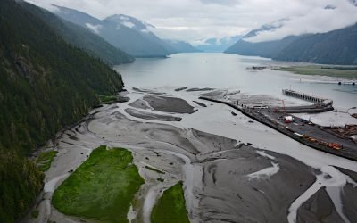
Portland Canal, International Boundary
Portland Canal is a deglaciated fjord that extends south-southwest for 65 miles (105 km) from the community of Stewart in the north to the head of Portland Inlet in the south, forming part of the international boundary between Southeast Alaska and British Columbia, Canada.
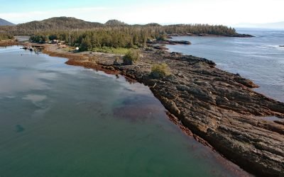
Port Alexander, Baranof Island
Port Alexander is an embayment and small community on the southern tip of Baranof Island in the Alexander Archipelago of Southeast Alaska, about 133 miles (214 km) northwest of Ketchikan and 62 miles (100 km) south-southeast of Sitka, Alaska.
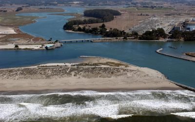
Elkhorn Slough, Moss Landing
Elkhorn Slough is an estuary about 7 miles (11 km) long that connects with Monterey Bay at the community of Moss Landing, about 17 miles (27 km) southeast of Santa Cruz and 16 miles (26 km) north-northeast of Monterey, California.
Kashega, Unalaska Island
Kashega is an abandoned Unangan Aleut village on the Bering Sea coast of Unalaska Island, situated on a spit between Brennan Lake and Kashega Bay, about 79 miles (127 km) northeast of Nikolski and 39 miles (63 km) southwest of Dutch Harbor, Alaska.
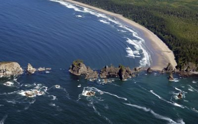
Point of Arches, Olympic National Park
Point of Arches and the adjacent Shi Shi Beach represent a unique section of shoreline located at the edge of the Olympic National Park.
About the background graphic
This ‘warming stripe’ graphic is a visual representation of the change in global temperature from 1850 (top) to 2019 (bottom). Each stripe represents the average global temperature for one year. The average temperature from 1971-2000 is set as the boundary between blue and red. The colour scale goes from -0.7°C to +0.7°C. The data are from the UK Met Office HadCRUT4.6 dataset.
Click here for more information about the #warmingstripes.