Historical Sites
Recent Articles
More Articles

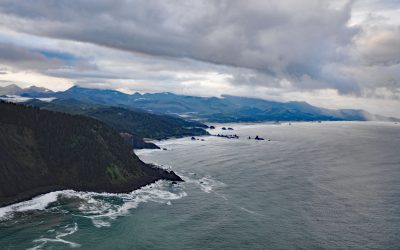
Rudyerd Bay, Misty Fjords National Monument
Rudyerd Bay is a deglaciated fjord in the Coast Range of Southeast Alaska in Misty Fjords National Monument, about 89 miles (143 km) north-northwest of Prince Rupert and 39 miles (63 km) northeast of Ketchikan, Alaska.
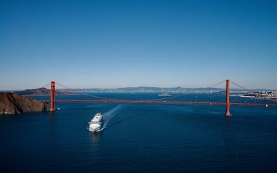
The Golden Gate, San Francisco Bay
The Golden Gate is a turbulent strait about 1 mile (1.6 km) wide, between Lime Point to the north and Fort Point to the south, that connects San Francisco Bay to the Pacific Ocean, about 4 miles (6.4 km) west-northwest of downtown San Francisco and 2.2 miles (3.5 km) south of Sausalito, California.
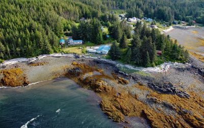
Kasaan, Prince of Wales Island
Kasaan is a small community on the north shore of Kasaan Bay and the southern shore of the Kasaan Peninsula, on the east coast of Prince of Wales Island, about 65 miles (105 km) south of Wrangell and 33 miles (53 km) west-northwest of Ketchikan, Alaska.
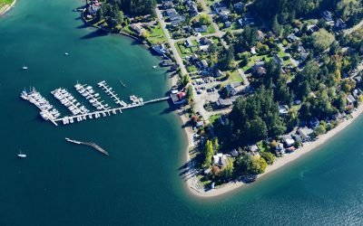
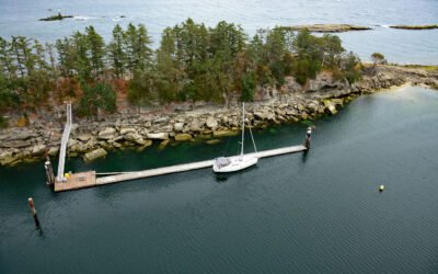
Dofflemyer Point, Boston Harbor
Dofflemyer Point is located in the community of Boston Harbor, on the eastern shore of South Puget Sound, and defines the entrance to Budd Inlet, about 23 miles (37 km) west-southwest of Tacoma and 7 miles (11 km) north of Olympia, Washington.

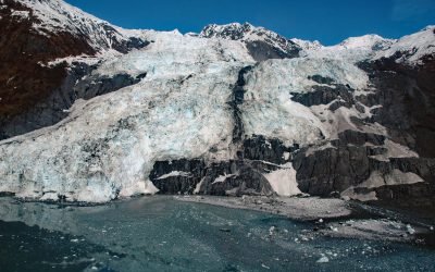
Beloit Glacier, Blackstone Bay
Beloit Glacier flows northeast for about 2 miles (3.2 km) from an unnamed ice field on the Kenai Peninsula to Blackstone Bay in Prince William Sound, about 86 miles (138 km) southwest of Valdez and 9 miles (15 km) south of Whittier, Alaska.
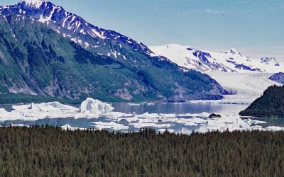
Bryn Mawr Glacier, College Fjord
Bryn Mawr Glacier flows southeast for about 4.5 miles (7 km) to Harvard Arm of College Fjord in northwestern Prince William Sound, about 52 miles (84 km) west of Valdez and 44 miles (71 km) northeast of Whittier, Alaska.
Tillamook Head, Ecola State Park
Tillamook Head is a steep rocky promontory with an elevation of approximately 1,200 feet (366 m), located in Ecola State Park, about 5 miles (8 km) southwest of Seaside and 4 miles (6.4 km) north-northwest of Cannon Beach, Oregon.
Kendrick Island, Wakes Cove Provincial Park
Kendrick Island is surrounded by Wakes Cove Provincial Park near the eastern entrance to Gabriola Passage, 0.1 miles (0.2 km) off the northeast coast of Valdes Island, about 28 miles (45 km) southwest of Vancouver and 12 miles (19 km) east-southeast of Nanaimo, British Columbia.
Excelsior Glacier, Johnstone Bay
Excelsior Glacier flows south for about 8 miles (13 km) from the Sargent Icefield on the Kenai Peninsula to its terminus at Big Johnstone Lake, formerly called Excelsior Lake, about 28 miles (45 km) west-southwest of Chenega Bay and 26 miles (42 km) southeast of Seward, Alaska.
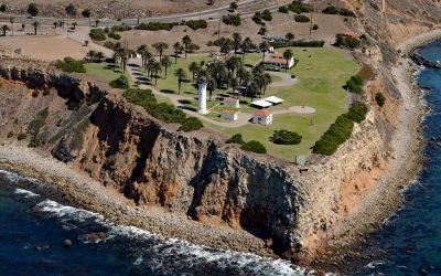
Point Vicente, Palos Verdes Peninsula
Point Vicente is on the Palos Verdes Peninsula between Long Point to the southeast and Resort Point to the northwest, about 20 miles (32 km) south-southeast of Santa Monica and 12.5 miles (20 km) west of Long Beach, California.
About the background graphic
This ‘warming stripe’ graphic is a visual representation of the change in global temperature from 1850 (top) to 2019 (bottom). Each stripe represents the average global temperature for one year. The average temperature from 1971-2000 is set as the boundary between blue and red. The colour scale goes from -0.7°C to +0.7°C. The data are from the UK Met Office HadCRUT4.6 dataset.
Click here for more information about the #warmingstripes.