Historical Sites
Recent Articles
More Articles
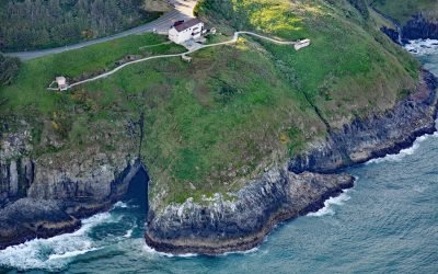
Sea Caves, Sea Lion Point
Sea Lion Caves are a connected system of sea caves and caverns open to the Pacific Ocean at Sea Lion Point, about 36 miles (58 km) south of Newport and 11 miles (18 km) north of Florence, Oregon.
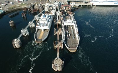
Swartz Bay, North Saanich
Swartz Bay is at the north end of the Saanich Peninsula on Vancouver Island and is the location of a BC Ferries terminal that provides the marine link connecting Highway 17 with the mainland, about 25 miles (40 km) southwest of Tsawwassen and 2.7 miles (4.3 km) north of Sidney, British Columbia.
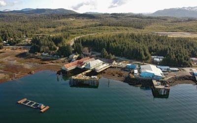
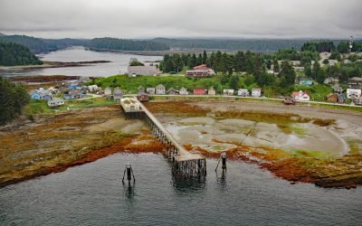
Kake, Kupreanof Island
Kake is a Tlingit village on the northeastern shore of Keku Strait, on the northwest shore of Kupreanof Island in the Alexander Archipelago of Southeast Alaska, about 95 miles (153 km) south-southeast of Juneau and 39 miles (63 km) west-northwest of Peterburg, Alaska.
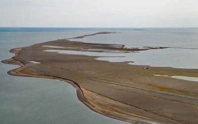
Cooper Island, Beaufort Sea
Cooper Island is an Arctic barrier island and one of the Plover Islands on Elson Lagoon on the Beaufort Sea coast, about 129 miles (208 km) northwest of Nuiqsut and 24 miles (39 km) east of Utqiaġvik, Alaska.
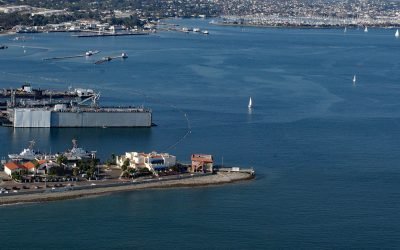
Ballast Point, San Diego Bay
Ballast Point is a peninsula that extends northwest for 0.44 miles (0.7 km) from the Point Loma Peninsula at the mouth of San Diego Bay, about 11 miles (18 km) south of La Jolla and 4 miles (6 km) southwest of downtown San Diego, California.
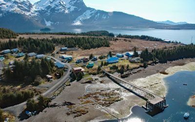
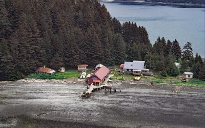
Tatitlek, Prince William Sound
Tatitlek is a small Chugach Alutiiq community located on the northeastern shore of Tatitlek Narrows across from Bligh Island and at the mouth of Boulder Bay on the eastern shore of Prince William Sound, about 24 miles (38 km) southwest of Valdez and 39 miles (63 km) northwest of Cordova, Alaska.
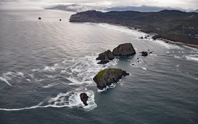
Three Arch Rocks, Oceanside
Three Arch Rocks are massive arched basalt sea stacks located south of Cape Meares and 0.5 miles (0.9 km) offshore from Maxwell Point at the community of Oceanside, about 8 miles (13 km) south-southwest of Garibaldi and 2.7 miles (4 km) northwest of Netarts, Oregon.
Angoon, Kootznahoo Inlet
Angoon is a historic Tlingit village located on an isthmus at the mouth of Kootznahoo Inlet on the eastern shore of Chatham Strait and the west coast of Admiralty Island, about 77 miles (124 km) northwest of Petersburg and 60 miles (97 km) southwest of Juneau, Alaska.
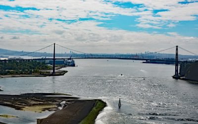
Lions Gate Bridge, Burrard Inlet
Lions Gate Bridge spans Burrard Inlet at the First Narrows, a strait about 1,312 feet (400 m) wide between Prospect Point in Stanley Park to the south and the sandy shoals of the Capilano River mouth to the north, about 2 miles (3.2 km) southeast of West Vancouver and 2 miles (3.2 km) northwest of downtown Vancouver, British Columbia.
Hogg Island, Bluefox Bay
Hogg Island is the site of a historical fox farm and herring reduction plant situated in Bluefox Bay on Shelikof Strait and the northwest coast of Afognak Island, about 91 miles (147 km) southwest of Homer and 47 miles (76 km) north-northwest of Kodiak, Alaska.
About the background graphic
This ‘warming stripe’ graphic is a visual representation of the change in global temperature from 1850 (top) to 2019 (bottom). Each stripe represents the average global temperature for one year. The average temperature from 1971-2000 is set as the boundary between blue and red. The colour scale goes from -0.7°C to +0.7°C. The data are from the UK Met Office HadCRUT4.6 dataset.
Click here for more information about the #warmingstripes.