Historical Sites
Recent Articles
More Articles
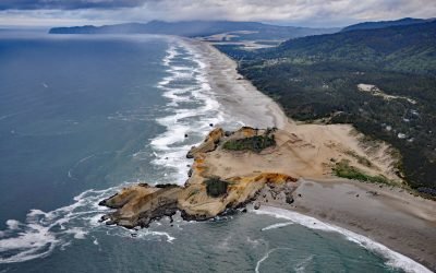
Cape Kiwanda, Pacific City
Cape Kiwanda is a sandstone headland with an elevation of 240 feet (73 m), protected by a basalt island known as Haystack Rock lying 0.5 miles (0.8 km) to the southwest, about 18 miles (29 km) south-southwest of Tillamook and 1 mile (1.6 km) northwest of Pacific City, Oregon.
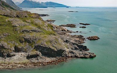
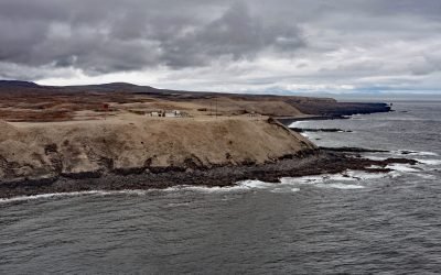
SS Farallon, Black Reef
Black Reef is on the west shore of Cook Inlet about 0.5 miles (0.8 km) offshore between North Head and Knoll Head on a peninsula between Iliamna Bay and Iniskin Bay, and the site of the SS Farallon shipwreck, about 130 miles (209 km) northeast of King Salmon and 71 miles (114 km) west of Homer, Alaska.km) west of Homer, Alaska.
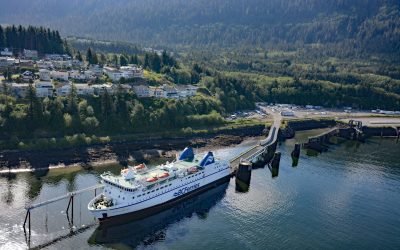
Prince Rupert, Kaien Island
Prince Rupert is a port community on Kaien Island, just north of the mouth of the Skeena River, and linked by a short bridge to the British Columbia mainland, about 465 miles (748 km) northwest of Vancouver and 90 miles (145 km) southeast of Ketchikan, Alaska.
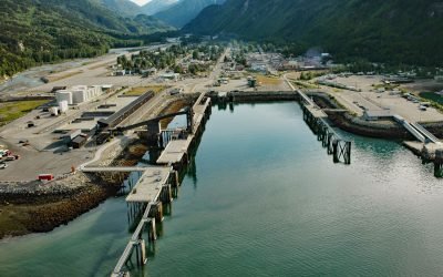
Skagway, Taiya Inlet
Skagway is a community at the mouth of the Skagway River, near the head of Taiya Inlet, about 90 miles (145 km) northwest of Juneau and 16 miles (26 km) north-northeast of Haines, Alaska.
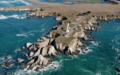
Point Arena, Mendocino Coast
Point Arena is a narrow headland about 0.5 miles (0.8 km) long with a historical lighthouse that marks a significant change in the orientation of the Mendocino Coast, about 34 miles (55 km) south of Fort Bragg and 4 miles (6.4 km) northwest of the community of Point Arena, California.
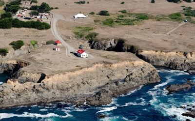
Cape Sarichef, Unimak Island
Cape Sarichef is at the southwestern end of Unimak Island, at the northwestern entrance to Unimak Pass on the Bering Sea coast, and on the northwest flank of Pogromni Volcano, about 80 miles (129 km) northeast of Dutch Harbor and 63 miles (101 km) west-southwest of False Pass, Alaska.
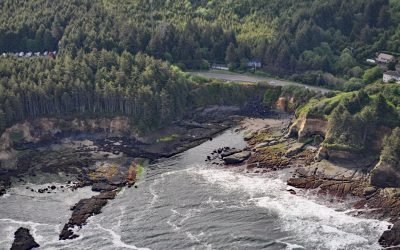
Boiler Bay Intertidal Research Reserve
Boiler Bay Intertidal Research Reserve is a rocky embayment 0.6 miles (1 km) wide between Government Point to the south and Rabbit Rock to the north, about 9 miles (14.5 km) south of Lincoln City and 1.6 miles (2.6 km) north of Depoe Bay, Oregon.
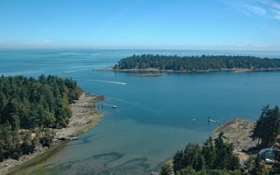
Whaler Bay, Galiano Island
Whaler Bay is located on the southeast end of Galiano Island adjacent to Sturdies Bay and across the island from Montague Harbour, about 28 miles (45 km) south-southwest of Vancouver and 18 miles (29 km) north of Sidney, British Columbia.
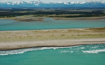
Situk River, Johnson Slough
Situk River starts at Situk Lake and flows southwest for about 18 miles (29 km) through the Yakutat Forelands in Tongass National Forest to Johnson Slough on the Gulf of Alaska, about 200 miles (322 km) northwest of Juneau and 9 miles (15 km) southeast of Yakutat, Alaska.
Point Cabrillo, Mendocino Coast
Point Cabrillo is a sandstone headland marked with a lighthouse on the Mendocino Coast between Point Arena and Cape Mendocino, about 6.7 miles (11 km) south of Fort Bragg and 1.3 miles (2 km) southwest of Caspar, California.
About the background graphic
This ‘warming stripe’ graphic is a visual representation of the change in global temperature from 1850 (top) to 2019 (bottom). Each stripe represents the average global temperature for one year. The average temperature from 1971-2000 is set as the boundary between blue and red. The colour scale goes from -0.7°C to +0.7°C. The data are from the UK Met Office HadCRUT4.6 dataset.
Click here for more information about the #warmingstripes.