Historical Sites
Recent Articles
More Articles
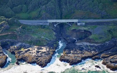
Thor’s Well, Cook’s Chasm
Thor’s Well is at Cook’s Chasm, a fissure in the rock approximately 400 feet (122 m) long and 60 feet (18 m) wide between Captain Cook Point and Cape Perpetua, about 20 miles (32 km) north of Florence and 2 miles (3.2 km) south of Yachats, Oregon.
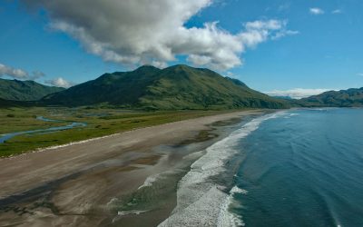
Ocean Bay, Sitkalidak Island
Ocean Bay is on the southeast shore of Sitkalidak Island in the Kodiak Archipelago, about 56 miles (90 km) southwest of Kodiak and 9 miles (15 km) southeast of the village of Old Harbor, Alaska.
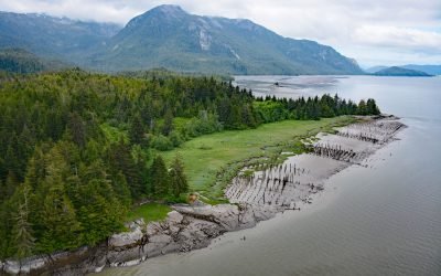
Port Essington, Skeena River
Port Essington is an abandoned cannery town on the south bank of the Skeena River estuary at the confluence of the Ecstall River, about 61 miles (98 km) southwest of Terrace and 18 miles (29 km) southeast of Prince Rupert, British Columbia.
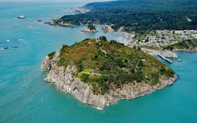
Trinidad Head, Trinidad Bay
Trinidad Head is a prominent headland joined to the mainland by a narrow isthmus adjacent to the town of Trinidad and protecting Trinidad Bay, about 48 miles (77 km) south of Crescent City and 18 miles (29 km) north of Eureka, California.
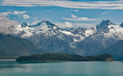
Cenotaph Island, Lituya Bay
Cenotaph Island is approximately in the middle of Lituya Bay, a fjord formed primarily by the Crillon and Lituya glaciers in Glacier Bay National Park and Preserve, about 117 miles (189 km) west-northwest of Juneau and 97 miles (156 km) southeast of Yakutat, Alaska.
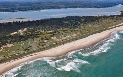
Camp Castaway, North Spit Coos Bay
Camp Castaway is a historical site on North Spit of Coos Bay, a sandy, vegetated peninsula separating the estuary of the Coos River from the Pacific Ocean, about 3.8 miles (6 km) west of North Bend and 1 mile (1.6 km) north of Charleston, Oregon.
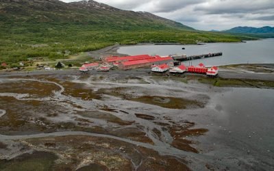
Larsen Bay Cannery, Kodiak Island
Larsen Bay is a small village and historical salmon cannery on Larsen Bay, an embayment that extends 6 miles (9.6 km) off of Uyak Bay on the west coast of Kodiak Island, about 125 miles (202 km) southeast of King Salmon and 58 miles (94 km) west-southwest of Kodiak, Alaska.
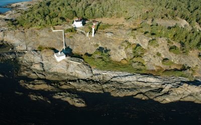
Discovery Island, Sea Bird Point
Discovery Island is part of a group of islands in Oak Bay off the southeastern tip of Vancouver Island at Sea Bird Point, about 17 miles (27 km) southeast of Sidney and 6.5 miles (10.5 km) east of downtown Victoria, British Columbia.
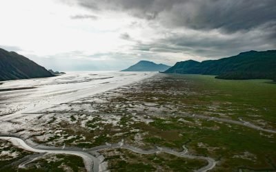
Tuxedni Bay, Cook Inlet
Tuxedni Bay is an estuary that extends southeast for 14 miles (23 km) from the mouth of Tuxedni River to Cook Inlet, at Chisik Island, about 59 miles (95 km) northwest of Homer and 57 miles (92 km) southwest of Kenai, Alaska.
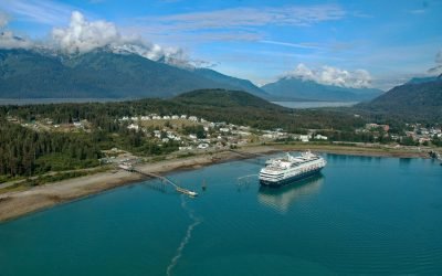
Haines, Chilkoot Inlet
Haines is a small Southeast Alaska community on the Chilkat Peninsula at the north end of Lynn Canal between Chilkat Inlet and Chilkoot Inlet, about 75 miles (121 km) north-northwest of Juneau and 15.5 miles (25 km) south-southwest of Skagway, Alaska.
About the background graphic
This ‘warming stripe’ graphic is a visual representation of the change in global temperature from 1850 (top) to 2019 (bottom). Each stripe represents the average global temperature for one year. The average temperature from 1971-2000 is set as the boundary between blue and red. The colour scale goes from -0.7°C to +0.7°C. The data are from the UK Met Office HadCRUT4.6 dataset.
Click here for more information about the #warmingstripes.