Historical Sites
Recent Articles
More Articles
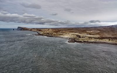
Scotch Cap Light, Unimak Pass
Scotch Cap Light is located on the southwest corner of Unimak Island, and the eastern shore of Unimak Pass, about 714 miles (1151 km) southwest of Anchorage and 81 miles (131 km) northeast of Dutch Harbor, Alaska.
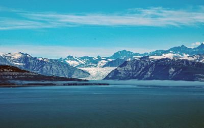
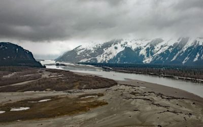
Icy Bay, Wrangell-Saint Elias National Park and Preserve
Icy Bay is on the Gulf of Alaska coast in Wrangell-Saint Elias National Park and Preserve, about 154 miles (248 km) southeast of Cordova and 65 miles (105 km) northwest of Yakutat, Alaska.
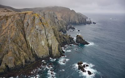
Aghiyuk, Semidi Islands
The Semidi Islands are a group of rocks, reefs, and islands lying off the coast of the Alaska Peninsula in the Gulf of Alaska, about 92 miles (148 km) east-northeast of Perryville, and 61 miles (98 km) east of Chignik, Alaska.
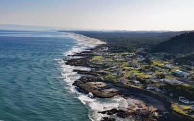
Yachats, Yachats River
Yachats is a small community at the mouth of the Yachats River on the central Oregon coast, about 54 miles (87 km) northwest of Eugene and 22 miles (35 km) south of Newport, Oregon.
Umatilla Lightship, Pennock Island
WLV-196 Umatilla was the last lightship to mark Umatilla Reef off Washington state and in 2005 was moored on the north shore of Pennock Island in Southeast Alaska, about 2.75 miles (4.4 km) northwest of Saxman and 0.75 miles (1.2 km) southwest of Ketchikan, Alaska.
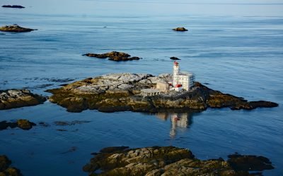
Triple Island, Brown Passage
Triple Island is the site of a large manned light station in Brown Passage, about 83 miles (134 km) south-southeast of Ketchikan and 22 miles (35 km) west-southwest of Prince Rupert, British Columbia.
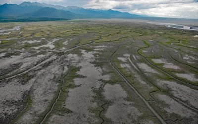
Chickaloon Bay, Turnagain Arm
Chickaloon Bay is located on the Kenai Peninsula, about 46 miles (74 km) northeast of Kenai and 22 miles (35 km) south and across Turnagain Arm from Anchorage, Alaska.
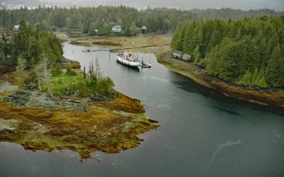
Kakwan Point, Stikine River
Kakwan Point is on the north bank of the Stikine River that starts in British Columbia and flows northwest and south for 330 miles (532 km) across the Alaska-Canada boundary to Eastern Passage, about 26 miles (42 km) southeast of Petersburg and 2 miles (3 km) north of Wrangell, Alaska.
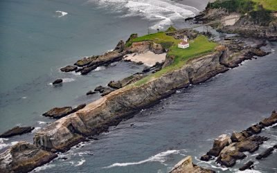
Chiefs Island, Cape Arago
Cape Arago Light is the third of a series of light towers built on Gregory Point and Chiefs Island just south of the entrance to Coos Bay, about 8 miles (13 km) west-southwest of Coos Bay and 3 miles (5 km) west of Charleston, Oregon.
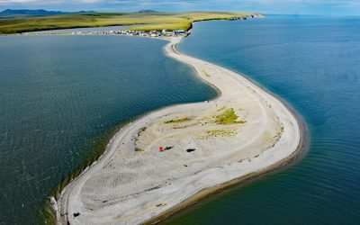
Teller, Port Clarence
Teller is an Iñupiat village located at the base of a spit separating Port Clarence Bay from Grantley Harbor, about 59 miles (95 km) northwest of Nome and 6 miles (10 km) southeast of Brevig Mission, Alaska.
About the background graphic
This ‘warming stripe’ graphic is a visual representation of the change in global temperature from 1850 (top) to 2019 (bottom). Each stripe represents the average global temperature for one year. The average temperature from 1971-2000 is set as the boundary between blue and red. The colour scale goes from -0.7°C to +0.7°C. The data are from the UK Met Office HadCRUT4.6 dataset.
Click here for more information about the #warmingstripes.