Historical Sites
Recent Articles
More Articles
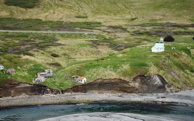
Karluk, Kodiak Island
Karluk is a historical fishing community situated on a barrier spit at the mouth of Karluk Lagoon on the west coast of Kodiak Island, about 301 miles (485 km) southwest of Anchorage and 88 miles (142 km) southwest of Kodiak, Alaska.
Ellamar, Prince William Sound
Ellamar is a historic mining camp on Virgin Bay in Prince William Sound, at the base of Ellamar Mountain, about 20 miles (32 km) southwest of Valdez and 2 miles (3.2 km) northwest of Tatitlek, Alaska.
Douglas, Katmai National Park and Preserve
Douglas is a historical village in Katmai National Park and Preserve, also called Kaguyak but not to be confused with Kaguyak on Kodiak Island, situated on the Shelikof Strait coast of the Alaska Peninsula, about 112 miles (181 km) southwest of Homer and 100 miles (161.km) east of King Salmon, Alaska.
Winter Harbor, Prince of Wales Island
Winter Harbor is an embayment about 0.3 miles (0.5 km) wide on the west coast of Prince of Wales Island, near the south entrance to Tuxekan Passage, about 66 miles (106 km) northwest of Ketchikan and 15 miles (24 km) north-northwest of Klawock, Alaska.

Point Grenville, Quinault Nation
Point Grenville is a headland with cliffs 120 feet (37 m) high, located on the Quinault Nation lands about 5.6 miles (9 km) north of Moclips and 3 miles (5 km) south-southeast of Taholah, Washington.
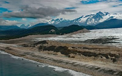
La Perouse Glacier, Fairweather Range
La Perouse Glacier descends from Mount La Perouse in the Fairweather Range and in Glacier Bay National Park and Preserve, about 116 miles (187 km) southeast of Yakutat and 40 miles (65 km) northwest of Gustavus, Alaska.
Fort Glenn, Umnak Island
Fort Glenn was a World War II military base on the northeast coast of Umnak Island in the Eastern Aleutians, about 67 miles (108 km) southwest of Dutch Harbor and 49 miles (79 km) northeast of Nikolski, Alaska.
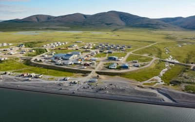
Brevig Mission, Port Clarence
Brevig Mission is an Iñupiat village located on Brevig Lagoon, on the north shore of Port Clarence, about 151 miles (244 km) southwest of Kotzebue and 81 miles (130 km) northwest of Nome, Alaska.

Mary Island, Revillagigedo Channel
Mary Island is the site of a historic lighthouse located between Felice Strait to the west and Revillagigedo Channel to the east, about 64 miles (103 km) north-northwest of Prince Rupert, British Columbia and 25 miles (40 km) southeast of Ketchikan, Alaska.

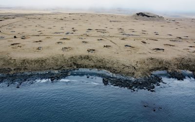
Stardust Bay, Sedanka Island
Stardust Bay is situated on the southeast coast of Sedanka Island, which is separated from Unalaska Island by Udagak Strait to the west and Beaver Inlet to the north, about 780 miles (1258 km) southwest of Anchorage and 16 miles (26 km) southeast of Dutch Harbor, Alaska.
About the background graphic
This ‘warming stripe’ graphic is a visual representation of the change in global temperature from 1850 (top) to 2019 (bottom). Each stripe represents the average global temperature for one year. The average temperature from 1971-2000 is set as the boundary between blue and red. The colour scale goes from -0.7°C to +0.7°C. The data are from the UK Met Office HadCRUT4.6 dataset.
Click here for more information about the #warmingstripes.