Historical Sites
Recent Articles
More Articles
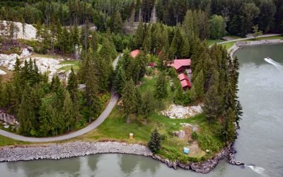
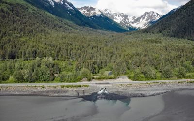
Graveyard Point, Skeena River
Graveyard Point is a historical steamboat landing and telegraph station near the confluence of the Shames River and the Skeena River, about 58 miles (94 km) east of Prince Rupert and 14 miles (23 km) southwest of Terrace, British Columbia.

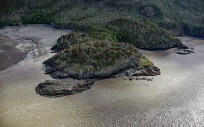
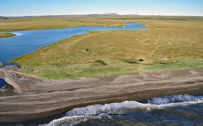
Village Islands, Uganik Bay
Village Islands is a group of six large islands and many smaller islets that extend for 1.7 miles (2.7 km) along the western shore of Uganik Bay on the northwestern coast of Kodiak Island, about 147 miles (237 km) southwest of Homer and 42 miles (68 km) due west of Kodiak, Alaska.

Klamath River, Requa
Klamath River flows for 257 miles (415 km) from a broad patchwork of lakes and marshes at the edge of the Oregon high desert, through the Cascade Range and the Klamath Mountains, and enters the Pacific Ocean at the community of Requa, about 52 miles (84 km) north of Eureka and 16 miles (26 km) south-southeast of Crescent City, California.
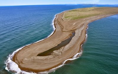
Tigara Peninsula, Chukchi Sea
Tigara Peninsula is a prominent point of land extending west for 13 miles (21 km) from the mouth of the Kukpuk River on the Cape Lisburne peninsula into the Chukchi Sea, about 320 miles (516 km) southwest of Utqiaġvik and 151 miles (244 km) northwest of Kotzebue, Alaska.
Gull Rock, Turnagain Arm
Gull Rock is a point of land on the south shore of Turnagain Arm on the Kenai Peninsula, about 18 miles (29 km) south-southeast of Anchorage and 6 miles (10 km) northwest of Hope, Alaska.
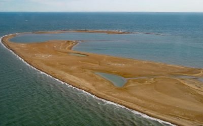
Reindeer Island, Stefansson Sound
Reindeer Island is about 2 miles (3.2 km) long and is the westernmost of the six Midway Islands in Stefansson Sound on the Beaufort Sea coast, about 196 miles (316 km) southeast of Utqiaġvik and 21 miles (34 km) north of Deadhorse, Alaska.
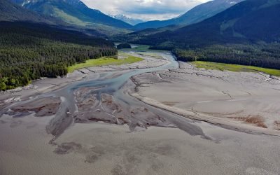
Kern Creek, Turnagain Arm
Kern Creek is between Portage and Girdwood on the northern shore of Turnagain Arm, about 35 miles (56 km) southeast of Anchorage and 16 miles (26 km) northwest of Whittier, Alaska.
Aitiligauraq Shelter Cabin, Cape Krusenstern
Aitiligauraq Shelter Cabin is in the Cape Krusenstern National Monument in northwestern Alaska and is situated on the south bank of an unnamed creek that flows west for 5 miles (8 km) from Eigaloruk Mountain to a coastal lagoon, about 110 miles (177 km) southeast of Point Hope and 40 miles (65 km) northwest of Kotzebue, Alaska.
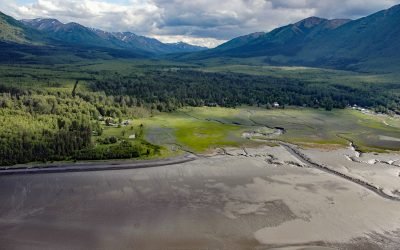
Hope, Resurrection Creek
Hope is a historic community on the Kenai Peninsula at the mouth of Resurrection Creek on the south shore of Turnagain Arm in upper Cook Inlet, about 22 miles (35.5 km) southeast of Anchorage and 18 miles (29 km) west-southwest of Girdwood, Alaska.
Sixmile Creek, Turnagain Arm
Sixmile Creek flows north for 8 miles (13 km) to the historical community of Sunrise on Turnagain Arm, about 27 miles (44 km) southeast of Anchorage and 9 miles (15 km) southwest of Girdwood, Alaska.
About the background graphic
This ‘warming stripe’ graphic is a visual representation of the change in global temperature from 1850 (top) to 2019 (bottom). Each stripe represents the average global temperature for one year. The average temperature from 1971-2000 is set as the boundary between blue and red. The colour scale goes from -0.7°C to +0.7°C. The data are from the UK Met Office HadCRUT4.6 dataset.
Click here for more information about the #warmingstripes.