Historical Sites
Recent Articles
More Articles

Neva, Kruzof Island
In 1813, the Russian exploration ship Neva wrecked near Mount Edgecumbe on Kruzof Island, about 93 miles southwest of Juneau and 10 miles west of Sitka, Alaska.
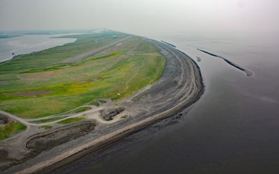
Geographic Harbor, Katmai National Park and Preserve
Geographic Harbor is in Katmai National Park and Preserve and is formed by two large bays that extend 3 miles (5 km) off Amalik Bay on Shelikof Strait, about 86 miles (139 km) southwest of King Salmon and 83 miles (134 km) northwest of Kodiak, Alaska.
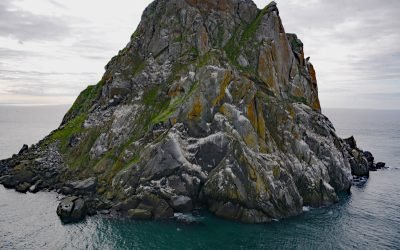
Fairway Rock, Bering Strait
Fairway Rock is located about 10 miles southeast of Little Diomede Island, and 15 miles west of Cape Prince of Wales, at the west end of the Seward Peninsula, Alaska.
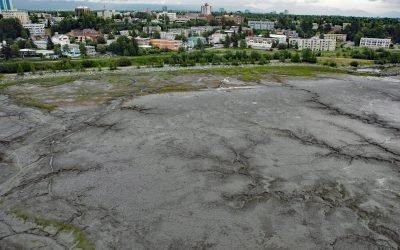
Bootleggers Cove, Anchorage
Bootleggers Cove is a coastal neighborhood located along the tidal flats of Cook Inlet between Westchester Lagoon and downtown Anchorage, Alaska.
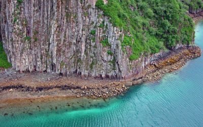
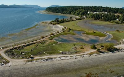
Porlier Pass, Galiano Island
Porlier Pass separates Galiano and Valdes Islands in the Southern Gulf Islands of Georgia Strait, about 28 miles (45 km) southwest of Vancouver and 10 miles (16 km) east-northeast of Ladysmith, British Columbia.
Shaktoolik, Norton Sound
Shaktoolik is a small community now located on a spit forming Shaktoolik Bay, on the eastern shore of Norton Sound, about 56 miles (90 km) southeast of Golovin and 35 miles (56 km) north-northwest of Unalakleet, Alaska.
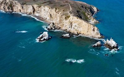
Chimney Rock, Point Reyes
Chimney Rock is an islet that lies off the eastern headland of the Point Reyes Peninsula, connected only at low tide, about 3 miles (4.8 km) east of the Point Reyes Light and 10 miles (16 km) southwest of Inverness, California.
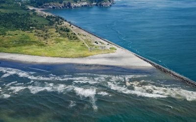
Peacock Spit, Columbia River Bar
Peacock Spit is the northern portion of a mostly submerged sand bar at the mouth of the Columbia River, about 12 miles (19 km) northwest of Astoria and 2.5 miles (4 km) south of Ilwaco, Washington.
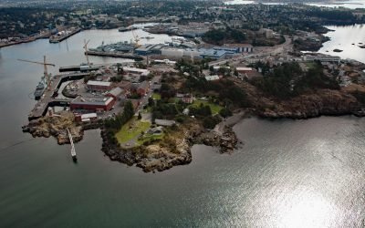
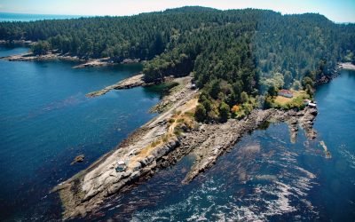
Esquimalt Harbour, Vancouver Island
Esquimalt Harbour is a sheltered embayment on the southern tip of Vancouver Island, about 21 miles (34 km) north of Port Angeles, Washington and 3 miles (4.8 km) west-northwest of downtown Victoria, British Columbia.
Penelakut Island, Trincomali Channel
Penelakut Island is located in the southern Gulf Islands between Vancouver Island and the mainland Pacific coast, about 40 miles (65 km) north-northwest of Victoria and 32 miles (52 km) southwest of Vancouver, British Columbia.
About the background graphic
This ‘warming stripe’ graphic is a visual representation of the change in global temperature from 1850 (top) to 2019 (bottom). Each stripe represents the average global temperature for one year. The average temperature from 1971-2000 is set as the boundary between blue and red. The colour scale goes from -0.7°C to +0.7°C. The data are from the UK Met Office HadCRUT4.6 dataset.
Click here for more information about the #warmingstripes.