Historical Sites
Recent Articles
More Articles
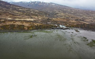
Chignik Fisheries, Chignik Lagoon
Chignik Fisheries is a facility, formerly owned and operated as a cannery by Wards Cove Packing Company, located on the northwest shore of Chignik Lagoon, southwest of Dago Point, about 44 miles (71 km) south of Port Heiden and 36 miles (58 km) northeast of Perryville, Alaska.
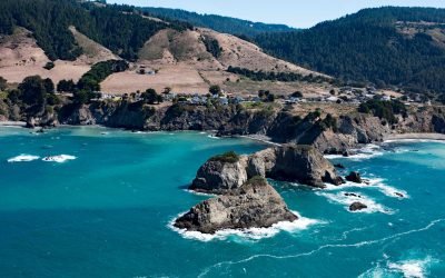
Casket Rock, Elk
Casket Rock is the outermost of three large rocks west of the community of Elk, about 22 miles (35 km) south-southeast of Fort Brag and 13 miles (21 km) north of Point Arena, California.
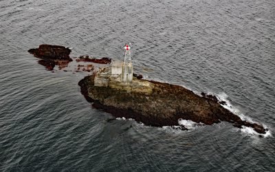
Lincoln Rock Light, Clarence Strait
Lincoln Rock and Lincoln Island are small islets in Clarence Strait in Southeast Alaska, about 63 miles (102 km) northwest of Ketchikan and 31 miles (50 km) southwest of Wrangell, Alaska.

Maple Bay, Sansum Narrows
Maple Bay is a community located on Sansum Narrows, a narrow inlet in the Salish Sea that separates Vancouver Island from Salt Spring Island, about 29 miles (47 km) northwest of Victoria and 28 miles (45 km) southeast of Nanaimo, British Columbia.
About the background graphic
This ‘warming stripe’ graphic is a visual representation of the change in global temperature from 1850 (top) to 2019 (bottom). Each stripe represents the average global temperature for one year. The average temperature from 1971-2000 is set as the boundary between blue and red. The colour scale goes from -0.7°C to +0.7°C. The data are from the UK Met Office HadCRUT4.6 dataset.
Click here for more information about the #warmingstripes.