Islands
Recent Articles
More Articles
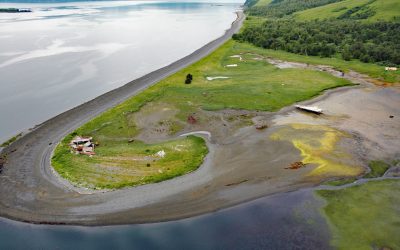
Shearwater Bay Cannery, Observation Point
Kadiak Fisheries operated a remote salmon cannery at Observation Point from 1926 until 1964 when it was destroyed by a tsunami, on the north shore of Shearwater Bay on Kodiak Island, about 36 miles (58 km) south-southwest of Kodiak and 18 miles (29 km) northeast of Old Harbor, Alaska.

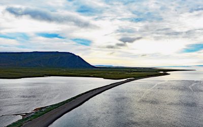
Ark Island, Aniakchak River
Ark Island is situated at the mouth of the Aniakchak River on the north shore of Aniakchak Bay and on the southeastern coast of the Alaska Peninsula, about 205 miles (330 km) southwest of Kodiak and 47 miles (75 km) northeast of Chignik, Alaska.
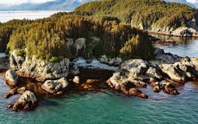
George Islands, Cross Sound
George Island, the largest of the George Islands, lies at the entrance to Port Althorp between the Inian and Althorp Peninsulas on northern Chichagof Island and on the southern coast of Cross Sound, approximately 28 miles (45 km) north-northwest of Sitka and 28 miles (45 km) southwest of Gustavus, Alaska.
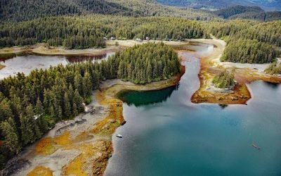
Little Tutka Bay, Kachemak Bay
Little Tutka Bay, a tidal lagoon on the south side of Kachemak Bay and the southern entrance to Tutka Bay, lies about 12 miles (19 km) south of Homer and 7 miles (11 km) east-northeast of Seldovia, Alaska.
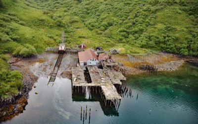
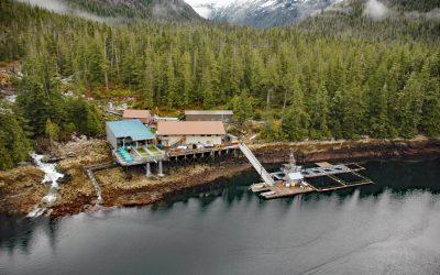
Uganik Fisheries Cannery, Northeast Arm
Uganik Fisheries is a historical salmon cannery on the north shore of Northeast Arm in Uganik Bay on the northwestern coast of Kodiak Island, about 147 miles (237 km) south-southwest of Homer and 35 miles (56 km) west of Kodiak, Alaska.
Northeast Cape, Saint Lawrence Island
Northeast Cape is a headland at the far eastern end of Saint Lawrence Island, formed by the Kinipaghulghat Mountains, between Cape Kulowye to the west and Cape Seevooka to the south, about 133 miles (214 km) southwest of Nome and 96 miles (155 km) east-southeast of Gambell, Alaska.
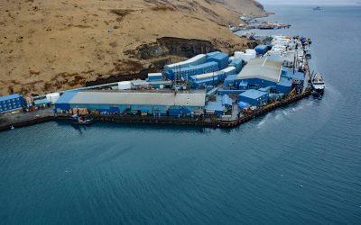
Trident Seafoods, Akutan Island
Trident Seafoods operates the largest seafood processing facility in North America on Akutan Island, one of the Krenitzen Islands in the Fox Island group of the Eastern Aleutians, about 750 miles (1210 km) southwest of Anchorage and 36 miles (58 km) northeast of Dutch Harbor, Alaska.
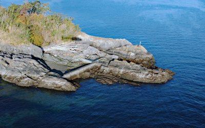
Cormorant Point, Gordon Head
Cormorant Point is a headland between Cordova Bay and Margaret Bay in Saanich’s Gordon Head neighborhood, about 11 miles (18 km) south-southeast of Sidney and 5.5 miles (8.9 km) north-northeast of Victoria, British Columbia.
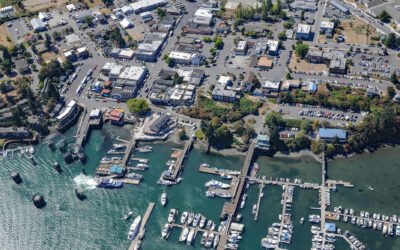
Friday Harbor, San Juan Island
Friday Harbor is a community at the head of a protected embayment on the eastern coast of San Juan Island, the archipelago’s second-largest and most populous island, about 18 miles (29 km) northeast of Victoria and 18 miles (29 km) west of Anacortes, Washington.
Burnett Inlet, Etolin Island
Burnett Inlet is a narrow, estuarine fjord that extends about 9 miles (15 km) north from Clarence Strait into the southwest coast of Etolin Island, roughly 63 miles (101 km) northwest of Ketchikan and 25 miles (40 km) south-southwest of Wrangell, Alaska.
About the background graphic
This ‘warming stripe’ graphic is a visual representation of the change in global temperature from 1850 (top) to 2019 (bottom). Each stripe represents the average global temperature for one year. The average temperature from 1971-2000 is set as the boundary between blue and red. The colour scale goes from -0.7°C to +0.7°C. The data are from the UK Met Office HadCRUT4.6 dataset.
Click here for more information about the #warmingstripes.