Islands
Recent Articles
More Articles
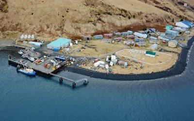
Akutan Village, Akutan Island
Akutan is a community on the northern shore of Akutan Harbor, on Akutan Island, one of the Krenitzin Islands in the Fox Islands group of the Eastern Aleutians, about 766 miles (1,233 km) southwest of Anchorage and 35 miles (56 km) east of Unalaska, Alaska.
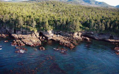
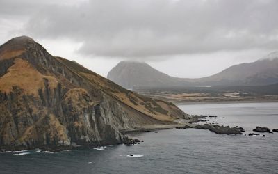
Valencia Bluffs, West Coast Trail
Valencia Bluffs are sea cliffs along the West Coast Trail in Pacific Rim National Park Reserve on Vancouver Island’s southwest shore, about 29 miles (47 km) northwest of Port Renfrew and 11 miles (18 km) southeast of Bamfield, British Columbia.
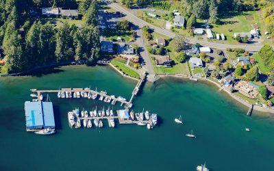
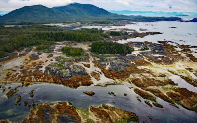
Grapeview, Case Inlet
Grapeview is a community that includes Allyn, Stretch Island, and Reach Island located on the western shore at the head of Case Inlet in South Puget Sound, about 19 miles (31 km) west-northwest of Tacoma and 16 miles (26 km) northeast of Shelton, Washington.
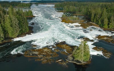
South Ledge, Wrangell Narrows
South Ledge is a navigational hazard in Wrangell Narrows, a water passage that extends generally south for about 22 miles (35 km) between Mitkof Island to the east and Kupreanof and Woewodski Islands to the west, about 25 miles (40 km) northwest of Wrangell and 12 miles (19 km) south of Petersburg, Alaska.
Randall Island, Dundas Archipelago
Randall Island is part of the Dundas Archipelago, a group of islands in Hecate Strait on the west side of Chatham Sound between Brown and Caamaño Passages, about 74 miles (119 km) southeast of Ketchikan and 22 miles (35 km) west-northwest of Prince Rupert, British Columbia.
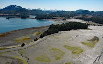
Barren Islands, Kodiak Archipelago
Barren Islands are the northernmost of the Kodiak Archipelago, located near Lower Cook Inlet, between Stevenson Entrance to the south and Kennedy Entrance to the north, about 80 miles (129 km) north of Kodiak and 56 miles (90 km) southwest of Homer, Alaska.
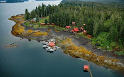
Cannery Cove, Pybus Bay
Cannery Cove is an embayment on the western shore of Pybus Bay in the Kootznoowoo Wilderness, on the southern coast of Admiralty Island, about 70 miles (113 km) south of Juneau and 24 miles (39 km) north-northwest of Kake, Alaska.
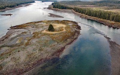
North Entrance, Big Salt Lake
North Entrance is a channel connecting Big Salt Lake to Shinaku Inlet at the head of San Alberto Bay on the west coast of Prince of Wales Island in Southeast Alaska, about 66 miles (106 km) south-southwest of Wrangell and 5 miles (8 km) north of Klawock, Alaska.
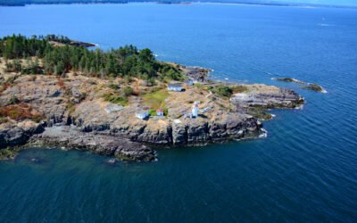
West Ballenas Island, Gulf Islands
West Balenas Island is the site of a historic lighthouse in the Balenas-Winchelsea Archipelago, and part of a proposed marine park in the Gulf Islands, about 15 miles northwest of Nanaimo and 7 miles northeast of Parksville, British Columbia.
Canoe Passage, Hawkins Island
Canoe Passage is a State of Alaska Marine Park covering 2,507 acres (1,015 ha), encompassing both shores of a small-boat passage running northwest–southeast through Hawkins Island, in southeastern Prince William Sound, about 44 miles (71 km) south-southeast of Valdez and 11 miles (18 km) west of Cordova, Alaska.
About the background graphic
This ‘warming stripe’ graphic is a visual representation of the change in global temperature from 1850 (top) to 2019 (bottom). Each stripe represents the average global temperature for one year. The average temperature from 1971-2000 is set as the boundary between blue and red. The colour scale goes from -0.7°C to +0.7°C. The data are from the UK Met Office HadCRUT4.6 dataset.
Click here for more information about the #warmingstripes.