Islands
Recent Articles
More Articles
Little Sucia Island, San Juan Islands
Little Sucia Island is part of an archipelago of ten islands including Sucia Island, Ewing, Justice, Herndon, Cluster Islands, and several smaller unnamed islands, about 20 miles (32 km) west of Bellingham and 3.5 miles (5.6 km) north of Eastsound, Washington.
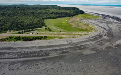
Fire Island, Cook Inlet
Fire Island is about 5.5 miles (8.9 km) long, located at the head of Cook Inlet within the Municipality of Anchorage, about 24 miles (39 km) northwest of Hope and 9 miles (14.5 km) southwest of downtown Anchorage, Alaska.
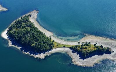
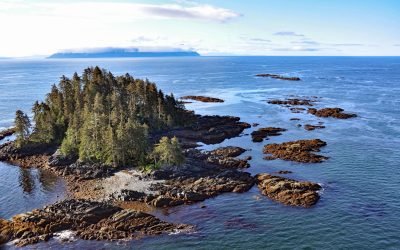
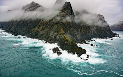
Strongtide Islet, Chatham Islands
Strongtide Islet is part of the Chatham Islands that are off the southern coast of Vancouver Island, about 5.4 miles (8.7 km) east-northeast of Victoria and 2.5 miles (4 km) northeast of Oak Bay, British Columbia.

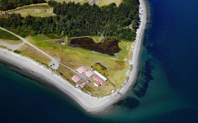
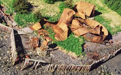
Port Vita, Raspberry Strait
Port Vita is an abandoned herring reduction plant and saltery located on Raspberry Strait, on the northeastern coast of Raspberry Island, about 31 miles (50 km) northwest of Kodiak and 15 miles (24 km) northwest of Port Lions, Alaska.
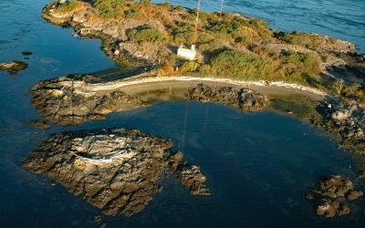
Marrowstone Point, Admiralty Inlet
Marrowstone Point is a low broad spit on Marrowstone Island that marks the entrance to Port Townsend Bay from the Admiralty Inlet, about 38 miles (61 km) north-northwest of Seattle and 3 miles (4.8 km) southeast of Port Townsend, Washington.
Chenega, Evans Island
Chenega is a village located on the western shore of Crab Bay, on the southeastern coast of Evans Island in Prince William Sound, about 84 miles (135 km) southwest of Cordova and 49 miles (79 km) east of Seward, Alaska.
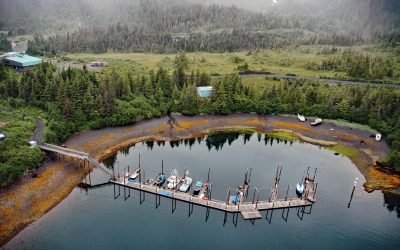
Port Wakefield, Raspberry Island
Port Wakefield is an abandoned cannery on the east coast of Raspberry Island, about 30 miles (48 km) northwest of Kodiak and 14 miles (23 km) north-northwest of Port Lions, Alaska.
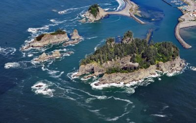
James Island, Quillayute River
James Island has an elevation of over 160 feet (50 m) and is located at the mouth of the Quillayute River, about 32 miles (52 km) south of Neah Bay and 0.6 miles (1 km) west of La Push, Washington.
Fairway Island, Affleck Canal
Fairway Island Fairway Island is on the southeastern coast of Kuiu Island, in Sumner Strait, at the entrance to Affleck Canal, about 86 miles (139 km) southeast of Sitka and 71 miles (115 km) southwest of Wrangell, Alaska.
Chankliut Island, Castle Cape
Chankliut Island is 2.9 miles (4.7 km) long and 0.9 miles (1.5 km) wide, located 6 miles (10 km) south of Castle Cape in the Pacific Ocean, about 240 miles (387 km) southwest of Kodiak and 15 miles (24 km) southeast of Chignik, Alaska.
About the background graphic
This ‘warming stripe’ graphic is a visual representation of the change in global temperature from 1850 (top) to 2019 (bottom). Each stripe represents the average global temperature for one year. The average temperature from 1971-2000 is set as the boundary between blue and red. The colour scale goes from -0.7°C to +0.7°C. The data are from the UK Met Office HadCRUT4.6 dataset.
Click here for more information about the #warmingstripes.