Islands
Recent Articles
More Articles
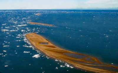
Jeanette Island, McClure Islands
Jeanette Island is a barrier island about 0.5 miles (0.8 km) long, and one of McClure Islands on the Beaufort Sea coast, about 92 miles (148 km) west-northwest of Kaktovik and 25 miles (40 km) northeast of Deadhorse, Alaska.
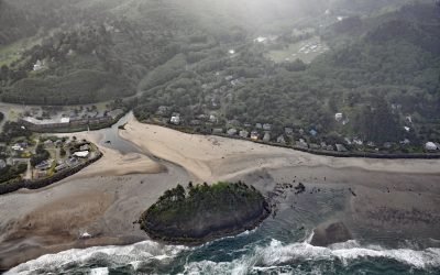
Proposal Rock, Neskowin Creek
Proposal Rock is at the mouth of the Neskowin Creek, about 10 miles (16 km) north-northeast of Lincoln City and 0.5 miles (0.8 km) south-southwest of the community of Neskowin, Oregon.
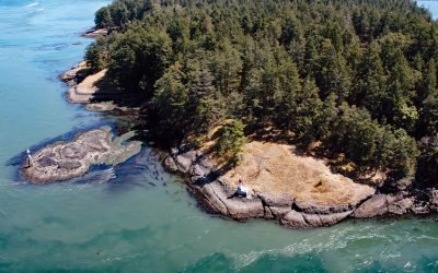
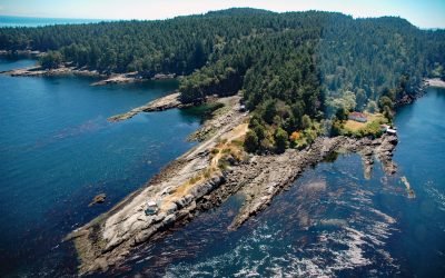
Helen Point, Mayne Island
Helen Point is located on the northwestern corner of Mayne Island, and has a light and range marker to aid navigation through Active Pass, about 32 miles (52 km) southwest of Vancouver and 14.5 miles (23 km) north-northeast of Sidney, British Columbia.
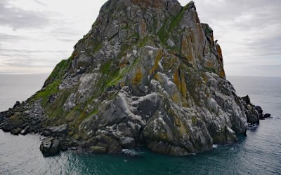
Fairway Rock, Bering Strait
Fairway Rock is located about 10 miles southeast of Little Diomede Island, and 15 miles west of Cape Prince of Wales, at the west end of the Seward Peninsula, Alaska.
Porlier Pass, Galiano Island
Porlier Pass separates Galiano and Valdes Islands in the Southern Gulf Islands of Georgia Strait, about 28 miles (45 km) southwest of Vancouver and 10 miles (16 km) east-northeast of Ladysmith, British Columbia.
Sandman Reefs, Aleutian Islands
Sandman Reefs are a group of islets, reefs, and wave-washed rocks between the Pavlof Islands and Deer Island in the north, and extending south almost to the Sanak Islands, about 78 miles (126 km) southwest of Sand Point and 24 miles (39 km) south of King Cove, Alaska.
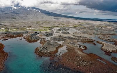
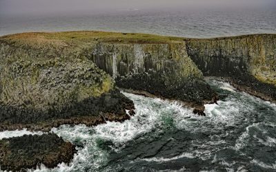
Burr Point, Augustine Volcano
Burr Point is a headland on Augustine Volcano in Cook Inlet, about 108 miles (174 km) north-northwest of Kodiak and 69 miles (111 km) southwest of Homer, Alaska.
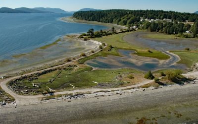
Penelakut Island, Trincomali Channel
Penelakut Island is located in the southern Gulf Islands between Vancouver Island and the mainland Pacific coast, about 40 miles (65 km) north-northwest of Victoria and 32 miles (52 km) southwest of Vancouver, British Columbia.
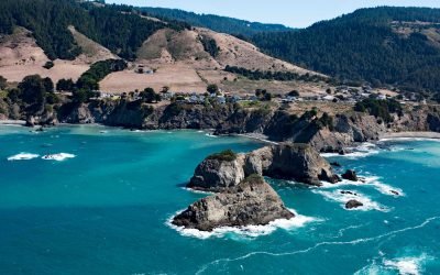
Casket Rock, Elk
Casket Rock is the outermost of three large rocks west of the community of Elk, about 22 miles (35 km) south-southeast of Fort Brag and 13 miles (21 km) north of Point Arena, California.
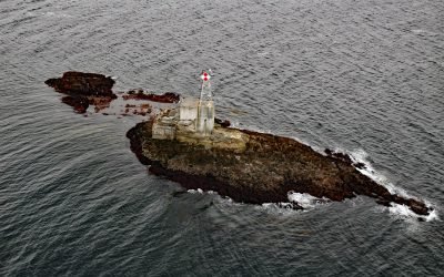
Lincoln Rock Light, Clarence Strait
Lincoln Rock and Lincoln Island are small islets in Clarence Strait in Southeast Alaska, about 63 miles (102 km) northwest of Ketchikan and 31 miles (50 km) southwest of Wrangell, Alaska.
About the background graphic
This ‘warming stripe’ graphic is a visual representation of the change in global temperature from 1850 (top) to 2019 (bottom). Each stripe represents the average global temperature for one year. The average temperature from 1971-2000 is set as the boundary between blue and red. The colour scale goes from -0.7°C to +0.7°C. The data are from the UK Met Office HadCRUT4.6 dataset.
Click here for more information about the #warmingstripes.