Islands
Recent Articles
More Articles
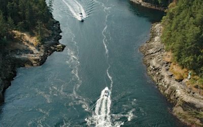
Dodd Narrows, Mudge Island
Dodd Narrows is at the northwest end of Mudge Island separating Mudge Island from Vancouver Island, about 33 miles (53 km) southwest of Vancouver and 6 miles (9.7 km) southeast of Nanaimo, British Columbia.
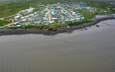
Toksook Bay, Nelson Island
Toksook Bay is a Yup’ik community on Nelson Island, in the Yukon-Kuskokwim Delta, about 112 miles (181 km) west-southwest of Bethel and 13.5 miles (22 km) west-northwest of Nightmute, Alaska.
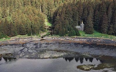
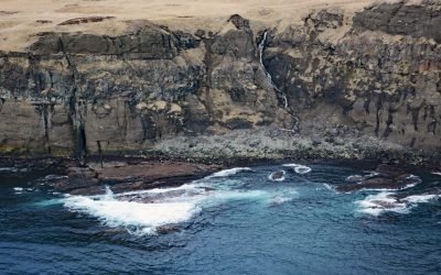
Monks Lagoon, Spruce Island
Monks Lagoon is on Icon Bay, a bight about 1 mile (1.6 km) across, on the southeastern shore of Spruce Island, about 6.6 miles (10.6 km) north of Kodiak and 5.7 miles (9 km) south-southeast of Ouzinkie, Alaska.

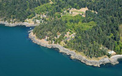
James Island, Southern Gulf Islands
James Island is one of the Southern Gulf Islands located in Haro Strait between Cordova Channel to the west and Sidney Channel to the east, about 12 miles (19 km) north of Victoria and 4 miles (6.5 km) southeast of Sidney, British Columbia.
Cross Island, Beaufort Sea
Cross Island is an Arctic barrier island, about 2 miles (3.2 km) long, located between McClure Islands to the southeast and Midway Islands to the west on the Beaufort Sea coast, about 74 miles (119 km) northeast of Nuiqsut and 24 miles (40 km) north-northeast of Deadhorse, Alaska.
Doe Bay, Orcas Island
Doe Bay is a small community on the southeastern shore of Orcas Island in the San Juan Islands of Puget Sound, about 7 miles (11.3 km) southeast of the community of Eastsound, and 3 miles (4.8 km) northeast of Olga, Washington.
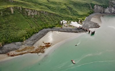
Snug Harbor, Chisik Island
Snug Harbor is a historical cannery located along a bight on the west coast of Chisik Island, at the southern end of Tuxedni Channel, on the western shore of Cook Inlet, about 51 miles (82 km) northwest of Homer and 56 miles (90 km) southwest of Kenai, Alaska.
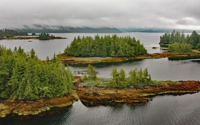
Coco Harbor, Dall Island
Coco Harbor is an estuary that extends west for 3 miles (4.8 km) from Baldy Bay, off Tlevak Strait, on the east coast of Dall Island, Alaska.
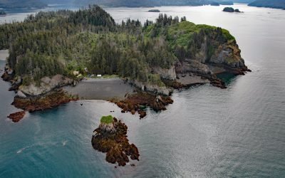
Hesketh Island, Kachemak Bay
Hesketh Island is about 1.2 miles (1.9 km) long, located on the southern shore of Kachemak Bay, 9.5 miles (15 km) south of Homer and 8 miles (13 km) northeast of Seldovia, Alaska.
Ugamak Island, Krenitzin Islands
Ugamak Island is approximately 5.2 miles (8.4 km) long and located in the Krenitzen Islands group, about 75 miles (121 km) northeast of Unalaska and 36 miles (58 km) east of Akutan, Alaska.
About the background graphic
This ‘warming stripe’ graphic is a visual representation of the change in global temperature from 1850 (top) to 2019 (bottom). Each stripe represents the average global temperature for one year. The average temperature from 1971-2000 is set as the boundary between blue and red. The colour scale goes from -0.7°C to +0.7°C. The data are from the UK Met Office HadCRUT4.6 dataset.
Click here for more information about the #warmingstripes.