Islands
Recent Articles
More Articles
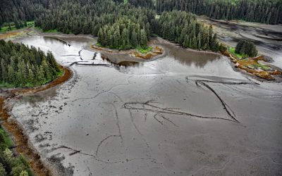
Port Camden, Kuiu Island
Port Camden is an embayment on the northeast coast of Kuiu Island, about 36 miles (58 km) south-southwest of Petersburg, and 61 miles (98 km) northwest of Wrangell, Alaska.
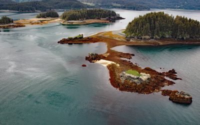
Herring Islands, Kachemak Bay
The Herring Islands are located at the entrance to Tutka Bay, on the southern shore of Kachemak Bay, 11 miles (18 km) south of Homer and 8 miles (13 km) northeast of Seldovia, Alaska.
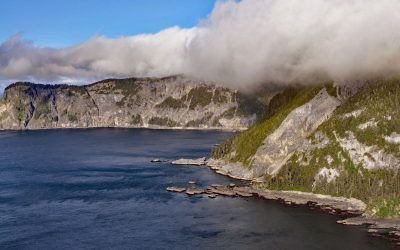
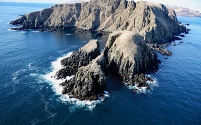
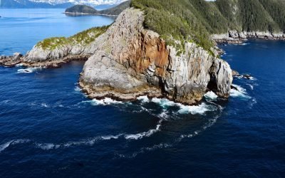
Star of Bengal, China Cove
Star of Bengal is a shipwreck near China Cove, a small embayment about 1.7 miles (2.7 km) wide on the southeastern coast of Coronation Island, situated between Chatham and Sumner Straits, 93 miles (150 km) south-southeast of Sitka and 106 miles (171 km) northwest of Ketchikan, Alaska.
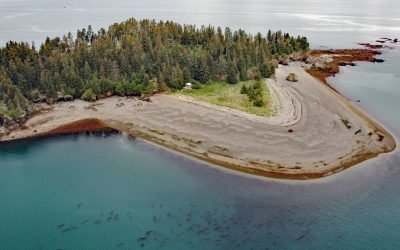
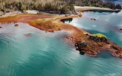
Cohen Island, Kachemak Bay
Cohen Island is about 0.3 miles (0.5 km) across, located at the north entrance to Eldred Passage, on the eastern shore of Kachemak Bay, 8 miles (13 km) south of Homer, Alaska.

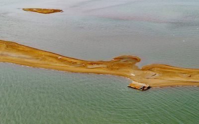
Oldmans Bay, Kalgin Island
Oldmans Bay is about 3 miles (4.8 km) across, located on the west coast of Kalgin Island in Cook Inlet, 55 miles (89 km) northwest of Homer and 30 miles (48 km) west-southwest of Kenai, Alaska.
Egg Island, Sedanka Pass
Egg Island is about 0.7 miles (1.1 km) wide, located 2 miles (3.2 km) northeast across Sedanka Pass from Cape Sedanka on Sedanka Island and 1.4 miles (2.3 km) southeast of Old Man Rocks in the Fox Islands of the Aleutian Archipelago, about 22 miles (35 km) southwest of Akutan and 20 miles (32 km) east-southeast of Dutch Harbor, Alaska.
Igalik Island, Dease Inlet
Igalik Island is an Arctic barrier island, the easternmost of the Plover Islands, approximately 2.5 miles (4 km) long, located at the entrance to Dease Inlet, about 36 miles (58 km) east-southeast of Utqiagvik, Alaska.
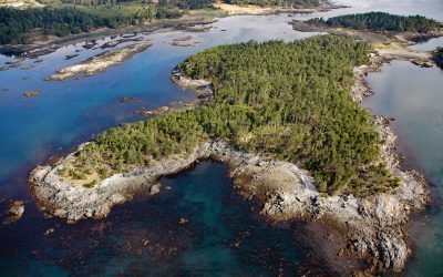
Yukon Island, Kachemak Bay
Yukon Island, approximately 1.5 miles (2.4 km) long, is situated on the southeastern shore of Kachemak Bay, about 9 miles (14.5 km) south of Homer, Alaska.
Bentinck Island, Cape Calver
Bentinck Island is situated between Cape Calver and Race Rocks in the Strait of Juan de Fuca, approximately 10 miles (16 km) southeast of Sooke and 11 miles (18 km) southwest of Victoria, British Columbia.
Kitten Pass, Pye Islands
Kitten Pass is a water passage between Rabbit Island and Outer Island, in the Pye Islands group of the Alaska Maritime Wildlife Refuge, about 48 miles (77 km) east-southeast of Seldovia, and 63 miles (102 km) southwest of Seward, Alaska.
About the background graphic
This ‘warming stripe’ graphic is a visual representation of the change in global temperature from 1850 (top) to 2019 (bottom). Each stripe represents the average global temperature for one year. The average temperature from 1971-2000 is set as the boundary between blue and red. The colour scale goes from -0.7°C to +0.7°C. The data are from the UK Met Office HadCRUT4.6 dataset.
Click here for more information about the #warmingstripes.