
LAST MONTH
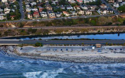
San Elijo Lagoon, Cardiff
San Elijo Lagoon is 915 acres (370 ha) of tidal wetlands formed by Escondido Creek that drains a watershed of 54,000 acres (22,000 ha) and flows generally southwest for 26 miles (42 km) to the Pacific Ocean at Cardiff, or Cardiff-by-the-Sea, a beach community in Encinitas, about 89 miles (144 km) southeast of Los Angeles and 21 miles (34 km) north-northwest of San Diego, California.
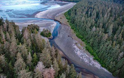
Roller Bay, Noyes Island
Roller Bay is located on the west coast of Noyes Island near a prehistoric rock shelter on Cape Addington to the south, and Cape Ulitka to the north, about 122 miles (196 km) southeast of Sitka and 24 miles (39 km) west of Craig, Alaska.
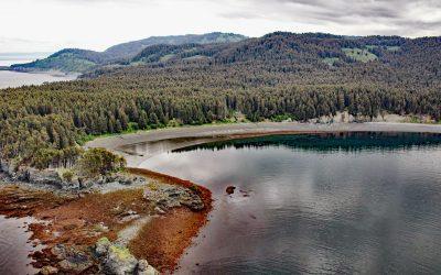
Coal Cove, Port Graham
Coal Cove is the site of a historic Russian coal mine at Dangerous Cape on the north shore entrance to Port Graham near the southern end of the Kenai Peninsula, about 7 miles (11 km) southwest of Seldovia and 3 miles (5 km) north-northeast of Nanwalek, Alaska.

Sheringham Point, Strait of Juan de Fuca
Sheringham Point is the site of a historic lighthouse located on the southern shore of Vancouver Island and on the Strait of Juan de Fuca, between Otter Point to the east and Point No Point to the west, about 26 miles (42 km) west-southwest of Victoria and 7 miles (11 km) southeast of Jordon River, British Columbia.
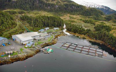
Lake Bay, Esther Island
Lake Bay is the site of a salmon hatchery on the southern coast of Esther Island in northwestern Prince William Sound, and the deglaciated fjord extends 1.5 miles (2.4 km) northwest from Wells Passage, about 63 miles (101 km) west-southwest of Valdez and 20 miles (32 km) east of Whittier, Alaska.
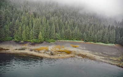
Admiralty Trading Company, Gambier Bay
Gambier Bay is the site of an infamous shipwreck and a historical salmon cannery operated by Admiralty Trading Company near Stephens Passage on the east coast of Admiralty Island, about 61 miles ( km) northwest of Petersburg and 59 miles (km) south-southeast of Juneau, Alaska.
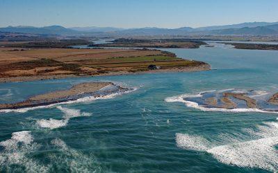
Eel River Delta, Eel River
A delta of 33,000 acres (13,355 ha) is formed by the Eel River, which starts at an elevation of 6,245 feet (1,903 m) on the southern flank of Bald Mountain in Mendocino National Forest and flows generally northwest for 196 miles (315 km) draining a watershed of 2,357,761 acres (954,152 ha) in the California Coast Ranges, about 13 miles (21 km) south-southwest of Eureka and 5 miles (8 km) northwest of Ferndale, California.
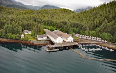
Waterfall Cannery, Ulloa Channel
Waterfall is a historic cannery situated on the west coast of Prince of Wales Island on Ulloa Channel, adjacent to Port Refugio on Suemez Island, approximately 145 miles (234 km) southeast of Sitka and 60 miles (97 km) west of Ketchikan, Alaska.
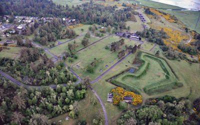
Fort Stevens, Point Adams
Fort Stevens was constructed during the American Civil War as an earthwork battery on the south shore at the mouth of the Columbia River on Point Adams, about 15 miles (24 km) north of Seaside and 6 miles (10 km) west-northwest of Astoria, Oregon.
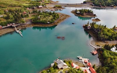
Halibut Cove, Ismailof Island
Halibut Cove is a small community lining the shores of The Narrows, a protected waterway separating Ismailof Island to the north from the Kenai Peninsula to the south, on the southeastern shore of Kachemak Bay, about 20 miles (32 km) northeast of Seldovia and 11 miles (18 km) east-southeast of Homer, Alaska.

Lawyer Island, Malacca Passage
Lawyer Islands are located in Malacca Passage, part of the Canadian Inside Passage between Porcher Island to the south and the Tsimpsean Peninsula to the north and just off the mouth of the Skeena River, about 102 miles (165 km) southeast of Ketchikan and 13 miles (20 km) south of Prince Rupert, British Columbia.

Cape Hinchinbrook, Hinchinbrook Island
Cape Hinchinbrook is a headland with a light station on the southwestern point of Hinchinbrook Island in Prince William Sound, about 79 miles (127 km) southeast of Whittier and 37 miles (60 km) southwest of Cordova, Alaska.