
LAST MONTH
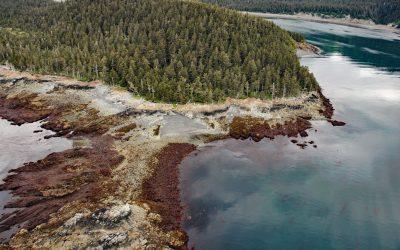
Claim Point, Chrome Bay
Claim Point forms the western shore of Chrome Bay at the northern entrance to Port Chatham on the Kenai Peninsula, the site of a historical chromite mine, about 100 miles (162 km) north-northwest of Kodiak and 33 miles (53 km) south-southwest of Homer, Alaska.
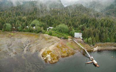
Gwent Cove, Pearse Canal
Gwent Cove is a small community at the site of the historical Hidden Inlet fishing village and cannery located adjacent to and west of the entrance to Hidden Inlet, an estuary that trends generally north for 6 miles (9.7 km) from the western shore of Pearse Canal, 45 miles (72 km) north of Prince Rupert and 61 miles (98 km) southeast of Ketchikan, Alaska.
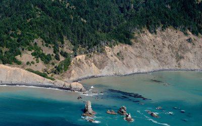
Cluster Cone Rocks, Bear Harbor
Cluster Cone Rocks are at Bear Harbor, the site of a historical lumber wharf built over the rocky point that protects a small south-facing embayment with a sandy beach in Sinkyone Wilderness State Park on the Mendocino coast, about 21 miles (34 km) north-northwest of Westport and 12 miles (19 km) west-northwest of Leggett, California.

Guard Islands, Tongass Narrows
Guard Islands are separated from Vallenar Point at the northern tip of Gravina Island by Inside Passage, a channel that connects the northern entrance of Tongass Narrows to the east from Clarence Strait to the west, and are part of an island chain that includes Vallenar Rocks, about 73 miles (118 km) south-southeast of Wrangell and 10 miles (16 km) northwest of Ketchikan, Alaska.
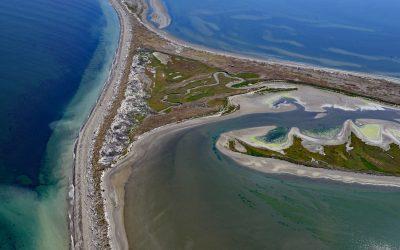
Dungeness Bay, Strait of Juan de Fuca
Dungeness Bay is formed by a complex of depositional features that partially enclose the embayment including Dungeness Spit, Graveyard Spit, Cline Spit, and the Dungeness River delta located on the southern shore of the Strait of Juan de Fuca and the northern coast of the Olympic Peninsula, about 19 miles (31 km) west-northwest of Port Townsend and 14 miles (23 km) east-northeast of Port Angeles, Washington.
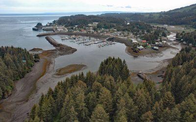
Seldovia, Kachemak Bay
Seldovia is a community situated on the eastern shore of Seldovia Bay and on the southern shore of Kachemak Bay in Cook Inlet, about 136 miles (219 km) southwest of Anchorage and 15 miles (24 km) southwest of Homer, Alaska.
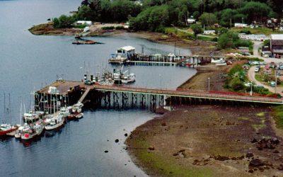
Coal Harbour, Holberg Inlet
Coal Harbour is a community located on the north side of Holberg Inlet in Quatsino Sound, about 220 miles (355 km) northwest of the city of Vancouver and 11 miles (18 km) southwest of Port Hardy, British Columbia.
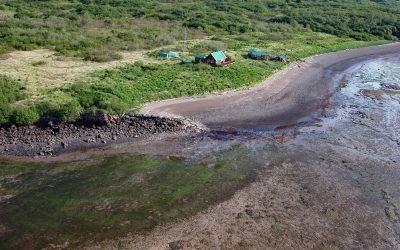
Old Kukak Village, Devils Cove
Old Kukak was a historical Sugpiaq Alutiiq village located on Kukak Point that forms the northern shore of Devils Cove on the Alaska Peninsula in Katmai National Park and Preserve, about 94 miles (152 km) southwest of King Salmon and 74 miles (119 km) northwest of Kodiak, Alaska.
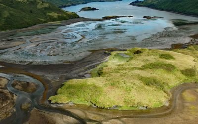
Viekoda Bay, Kodiak National Wildlife Refuge
Viekoda Bay is a deglaciated fjord that extends southeast for 18 miles (29 km) from Shelikof Strait on the northwestern coast of Kodiak Island, with the southern shore in the Kodiak National Wildlife Refuge, about 134 miles (216 km) southwest of Homer and 26 miles (42 km) west-northwest of Kodiak, Alaska.
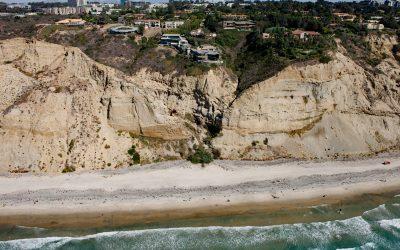
Black’s Beach, Torrey Pines
Black’s Beach is the secluded southern section of Torrey Pines State Beach, which starts at the mouth of Los Peñasquitos Lagoon to the north and extends south for about 4.5 miles (7.2 km) to Scripps Beach, about 10 miles (16 km) south of Encinitas and 4 miles (6.5 km) north-northeast of La Jolla, California.

Cordova Rose, Odiak Slough
Cordova Rose is a landlocked barge that was converted to a guest lodge on the southern shore of Odiak Slough, a tidal embayment on Orca Inlet in Prince William Sound and adjacent to Eyak Lake, about 46 miles (74 km) south-southeast of Valdez and 0.5 miles (0.8 km) south of Cordova, Alaska.
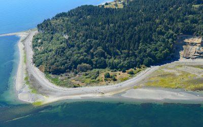
Lily Point, Boundary Bay
Lily Point Marine Reserve is a park located on Boundary Bay at the southeastern tip of Point Roberts, an exclave of the United States on the southern coast of the Tsawwassen Peninsula, about 22 miles (35 km) south-southeast of Vancouver and 30 miles (48 km) northwest of Bellingham, Washington.