
LAST MONTH
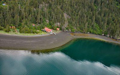
Sadie Cove, Kachemak Bay
Sadie Cove is a deglaciated fjord that extends generally northwest for 6.4 miles (10 km) from the mouth of the Sadie River to Eldred Passage on the southeastern shore of Kachemak Bay on the Kenai Peninsula, about 11 miles (18 km) southeast of Homer and 10 miles (16 km) northeast of Seldovia, Alaska.
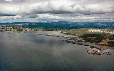
Esquimalt Lagoon, Royal Roads
Esquimalt Lagoon is formed by the Coburg Peninsula, a sand and gravel barrier spit 1.2 miles (1.9 km) long at Royal Roads on Vancouver Island, about 4.4 miles (7.3 km) west of Victoria in the city of Colwood, British Columbia.
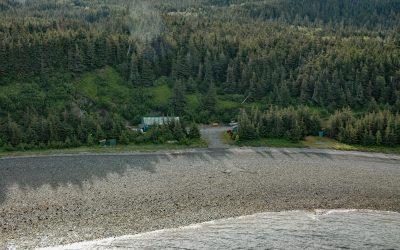
Kensington Mine, Lynn Canal
Kensington is a complex of underground mines and associated milling facilities on the southern flank of Lions Head Mountain in the Kakuhan Range between Lynn Canal to the west and Berners Bay to the east, about 47 miles (76 km) west-northwest of Juneau and 28 miles (45 km) south-southeast of Haines, Alaska.
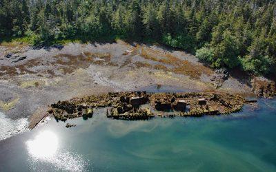
Ship Cove, Port Conclusion
Ship Cove is on the southern shore of Port Conclusion, an embayment at the southern tip of Baranof Island that extends south-southwest for 3 miles (4.8 km) from Chatham Strait, about 60 miles (97 km) south-southeast of Sitka and 1 mile (1.6 km) northwest of Port Alexander, Alaska.
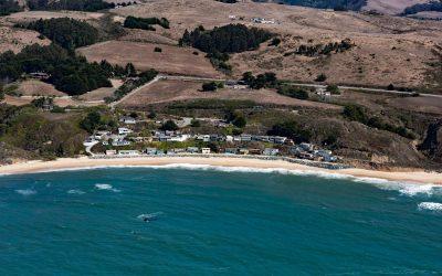
Martins Beach, Half Moon Bay
Martins Beach is a public beach adjacent to a private gated community protected from erosion by a seawall, about 6 miles (10 km) south of the community of Half Moon Bay and 0.7 miles (1.1 km) southwest of Lobitos, California.

Old Chenega Village, Chenega Island
Old Chenega is a historical village at the head of Chenega Cove on the southern tip of Chenega Island in western Prince William Sound, which is part of the traditional territory of the Chugach Sugpiaq people, about 82 miles (132 km) west-southwest of Cordova and 40 miles (64 km) southeast of Whittier, Alaska.

Coal Point, Homer Spit
Coal Point forms the tip of the Homer Spit in Kachemak Bay on the southern Kenai Peninsula, about 15 miles (24 km) northeast of Seldovia and 5.7 miles (9 km) southeast of Homer, Alaska.

Cape Scott, Cape Scott Provincial Park
Cape Scott is a headland about 500 feet (150 m) high at the extreme northwestern point of Vancouver Island in Cape Scott Provincial Park, about 256 miles 412 km) south-southeast of Prince Rupert and 41 miles (66 km) west of Port Hardy, British Columbia.
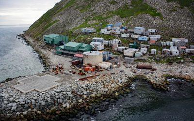
Diomede Village, Little Diomede Island
Diomede is an Iñupiaq village situated on the west coast of Little Diomede Island, less than 1 mile (1.6 km) from the International Date Line and 2.4 miles (3.9 km) east from the Russian island of Big Diomede, about 194 miles (312 km) southwest of Kotzebue and 27 miles (44 km) northwest of Wales, Alaska.

Port William, Shuyak Island
Port William is a historical salmon cannery in an embayment on the southern coast of Shuyak Island that extends 0.5 miles (0.8 km) north from Shuyak Strait, between Port Lawrence to the west and Daylight Harbor to the east, about 88 miles (142 km) southwest of Homer and 50 miles (81 km) north of Kodiak, Alaska.
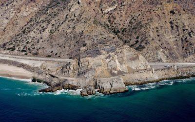
Mugu Rock, Point Mugu State Park
Mugu Rock is a distinctive feature at Point Mugu, a headland in Point Mugu State Park, situated between Thornhill Broome Beach to the east and Mugu Beach to the west in Santa Monica National Recreation Area, about 17 miles (27 km) west-northwest of Malibu, and 9 miles (14.5 km) southeast of Port Hueneme, California.

Strogonof Point, Port Heiden
Port Heiden is an embayment on the northern coast of the Alaska Peninsula that extends 9 miles (15 km) southeast from Bristol Bay between Strogonof Point and the community of Port Heiden, to the mouth of the Meshik River, about 147 miles (237 km) south of Dillingham and 45 miles (72 km) north-northwest of Chignik, Alaska.