
LAST MONTH

Bradley River, Kachemak Bay
Bradley River is located on the Kenai Peninsula and flows generally northwest for 7 miles (11 km) from Bradley Lake at an elevation of 1,090 feet (332 m) to Kachemak Bay, about 31 miles (50 km) southeast of Ninilchik and 25 miles (40 km) northeast of Homer, Alaska.
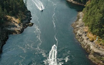
Dodd Narrows, Mudge Island
Dodd Narrows is at the northwest end of Mudge Island separating Mudge Island from Vancouver Island, about 33 miles (53 km) southwest of Vancouver and 6 miles (9.7 km) southeast of Nanaimo, British Columbia.

Red River, Lake Clark National Park and Preserve
Red River starts from the terminus of Red Glacier on the eastern flank of Mount Iliamna and flows southeast for 7 miles (11.3 km) through Lake Clark National Park and Preserve to the western shore of Cook Inlet, about 126 miles (203 km) southwest of Anchorage and 48 miles (77 km) northwest of Homer, Alaska.

Kukak Cannery, Katmai National Park and Preserve
Kukak Bay is the site of a historical razor clam cannery on the western shore of Shelikof Strait, in Katmai National Park and Preserve, about 132 miles (212 km) southwest of Homer and 77 miles (124 km) northwest of Kodiak, Alaska.

USS Milwaukee, Samoa Beach
The USS Milwaukee was a U.S. Navy cruiser that in 1917 was overcome by wind and waves close to shore and was beached at the community of Samoa on the northern peninsula of Humboldt Bay, about 7 miles (11 km) southwest of Arcata and 1.5 miles (2.4 km) west of Eureka, California.
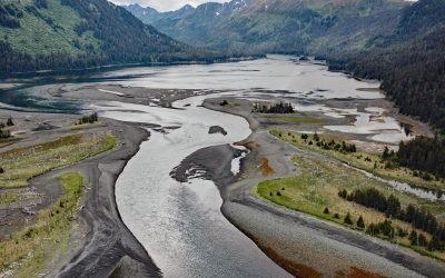
Koyuktolik Bay, Cook Inlet
Koyuktolik Bay, also known as Dogfish or Dog Salmon Bay, is about 2 miles (3.2 km) wide and located near the entrance to Kachemak Bay on the southeastern shore of Cook Inlet at the southwest tip of the Kenai Peninsula, about 30 miles (48 km) southwest of Homer and 15 miles (24 km) southwest of Seldovia, Alaska.

Gonzales Bay, Victoria
Gonzales Bay is on Vancouver Island and the northern shore of the Strait of Juan de Fuca, situated between Ross Bay to the west and McNeill Bay to the east, and is also the name of a neighborhood about 1.4 miles (2.3 km) southwest of Oak Bay and 2 miles (3.2 km) southeast of downtown Victoria, British Columbia.
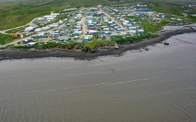
Toksook Bay, Nelson Island
Toksook Bay is a Yup’ik community on Nelson Island, in the Yukon-Kuskokwim Delta, about 112 miles (181 km) west-southwest of Bethel and 13.5 miles (22 km) west-northwest of Nightmute, Alaska.
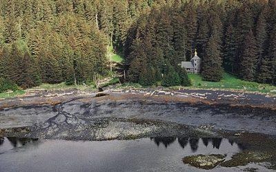
Monks Lagoon, Spruce Island
Monks Lagoon is on Icon Bay, a bight about 1 mile (1.6 km) across, on the southeastern shore of Spruce Island, about 6.6 miles (10.6 km) north of Kodiak and 5.7 miles (9 km) south-southeast of Ouzinkie, Alaska.
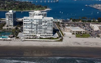
SS Monte Carlo, Coronado Shores
The shipwreck of the SS Monte Carlo is occasionally exposed by shifting sands during the winter on Coronado Shores, a wide sandy beach also known as South Beach, on Coronado Island about 4.5 miles (7.3 km) east of Point Loma and 3.4 miles (5.5 km) south of San Diego, California.
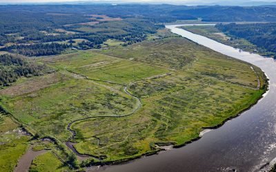
Coquille River Estuary, Bandon
The Coquille River, located in the Coast Range near Bandon, drains a watershed of 37,760 acres (15,281 ha), and flows to the Pacific Ocean approximately 20 miles (32 km) north of Cape Blanco, Oregon.
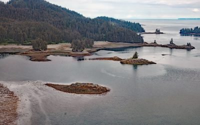
Jakolof Bay, Kachemak Bay
Jakolof Bay is on the Kenai Peninsula, on the southeastern Shore of Kachemak Bay, about 13 miles (21 km) south of Homer and 6.5 miles (10.5 km) east-northeast of Seldovia, Alaska.