
LAST MONTH
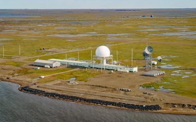
Oliktok Point, Beaufort Sea
Oliktok Point marks the eastern entrance to Harrison Bay on the Beaufort Sea, situated approximately 16 miles (26 km) west of Beechey Point, 35 miles (56 km) northeast of Nuiqsut, and 35 miles (56 km) northwest of Prudhoe Bay, Alaska.
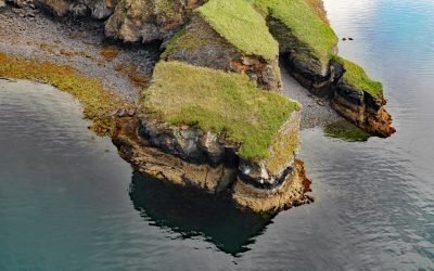
Uyak Bay, Kodiak Island
Uyak Bay extends south-southeast for 40 miles (65 km) from Shelikof Strait on the northwest coast of Kodiak Island, about 59 miles (95 km) west-southwest of Kodiak, Alaska.
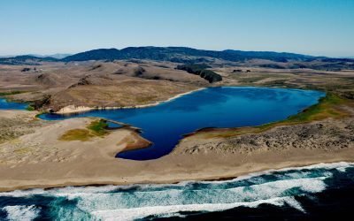
Abbotts Lagoon, Point Reyes National Seashore
Abbotts Lagoon is a two-stage lagoon on the northwestern coast of the Point Reyes National Seashore, 9 miles (14.5 km) south-southeast of Tomales Point, 5.5 miles (8.9 km) west-northwest of Inverness, California.
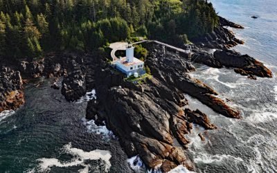
Cape Decision, Kuiu Island
Cape Decision is a headland on the southern end of Kuiu Island in Southeast Alaska, 105 miles (169 km) northwest of Ketchikan and 75 miles (121 km) southwest of Wrangell, Alaska.
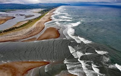
Salishan Spit, Lincoln City
Salishan Spit separates the Pacific Ocean from Siletz Bay and is located 2.5 miles (4 km) south of Lincoln City and 3 miles (4.8 km) north of Gleneden Beach, Oregon.
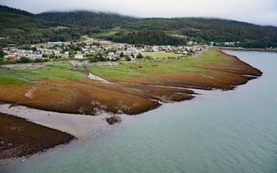
Kitamaat Village, Kitimat Arm
Kitamaat Village is located on the eastern shore of the Kitimat Arm extension of Douglas Channel, about 71 miles (115 km) southeast of Prince Rupert and 6 miles (10 km) south of the community of Kitimat, British Columbia.

Oldmans Bay, Kalgin Island
Oldmans Bay is about 3 miles (4.8 km) across, located on the west coast of Kalgin Island in Cook Inlet, 55 miles (89 km) northwest of Homer and 30 miles (48 km) west-southwest of Kenai, Alaska.
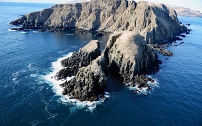
Egg Island, Sedanka Pass
Egg Island is about 0.7 miles (1.1 km) wide, located 2 miles (3.2 km) northeast across Sedanka Pass from Cape Sedanka on Sedanka Island and 1.4 miles (2.3 km) southeast of Old Man Rocks in the Fox Islands of the Aleutian Archipelago, about 22 miles (35 km) southwest of Akutan and 20 miles (32 km) east-southeast of Dutch Harbor, Alaska.
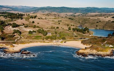
Arroyo de Los Frijoles, Bean Hollow State Park
Arroyo de Los Frijoles and Pebble Beach are in Bean Hollow State Park, located 17.5 miles (28.2 km) south of Half Moon Bay and 3 miles (4.8 km) south of Pescadero, California.
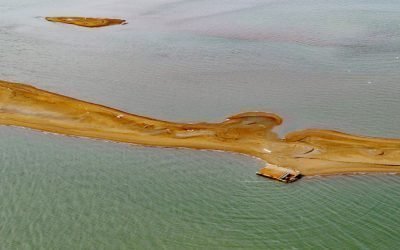
Igalik Island, Dease Inlet
Igalik Island is an Arctic barrier island, the easternmost of the Plover Islands, approximately 2.5 miles (4 km) long, located at the entrance to Dease Inlet, about 36 miles (58 km) east-southeast of Utqiagvik, Alaska.
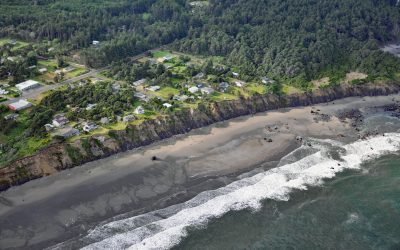
Nesika Beach, Geisel Monument
Nesika Beach is a community located at the south end of the Nesika strand, and the site of the Geisel Monument, about 6 miles (10 km) north of Gold Beach and 4 miles (6 km) south-southeast of Ophir, Oregon.
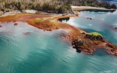
Yukon Island, Kachemak Bay
Yukon Island, approximately 1.5 miles (2.4 km) long, is situated on the southeastern shore of Kachemak Bay, about 9 miles (14.5 km) south of Homer, Alaska.