
LAST MONTH
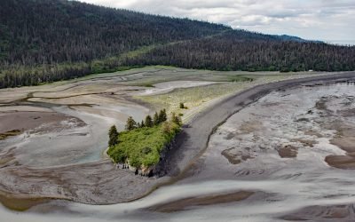
Mermaid Island, Neptune Bay
Mermaid Island is located on McKeon Flats, a tidal flat formed by the Wosnesenski River as it flows into Neptune Bay, about 13 miles (21 km) northeast of Seldovia and 8 miles (13 km) south-southeast of Homer, Alaska.
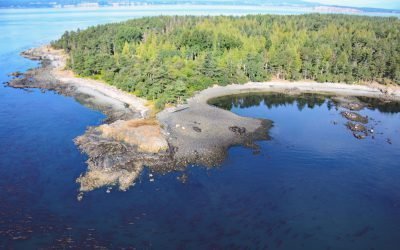
D’Arcy Island, Southern Gulf Islands
D’Arcy Island, part of the Southern Gulf Islands in Haro Strait, covers approximately 205 acres (83 hectares), about 30 miles (48 km) west of Anacortes and 10 miles (16 km) north-northeast of Victoria, British Columbia.
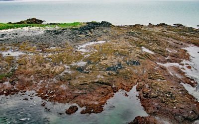
Shakun Islets, Swikshak Bay
Shakun Islets is a group of grass-covered islands and submerged reefs extending 1.8 miles (2.9 km) north to south at the entrance of Swikshak Bay in Shelikof Strait, about 108 miles (174 km) southwest of Homer and 57 miles (92 km) northwest of Kodiak, Alaska.
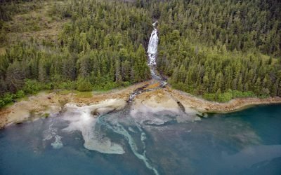
Sahlin Falls, Sheep Bay
Sahlin Falls is located at the base of Sahlin Creek on the northern shore of Sheep Bay, approximately 33 miles (53 km) southeast of Valdez and 13 miles (21 km) northwest of Cordova, Alaska.
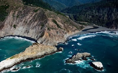
Cottoneva Creek, Rockport Bay
Cottoneva Creek originates at an elevation of approximately 1,300 feet (400 m) in the Coast Range and flows generally south-southwest for 7 miles (11 km) to Rockport Bay, about 11 miles (18 km) southwest of Leggett and 7 miles (11 km) north-northwest of Westport, California.
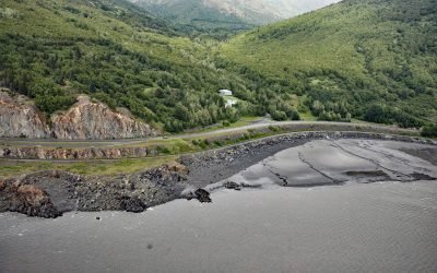
Rainbow Valley, Turnagain Arm
Rainbow Valley is a watershed located on Turnagain Arm between Rainbow Peak to the west and Indianhouse Mountain to the east, approximately 17 miles (27 km) south-southeast of Anchorage and 17 miles (27 km) west-northwest of Girdwood, Alaska.
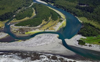
Queets River, Olympic National Park
The Queets River flows approximately 53 miles (85 km), mostly through Olympic National Park, to the Pacific Ocean, about 60 miles (96 km) southwest of Aberdeen and 5 miles (8 km) south of Kalaloch, Washington.
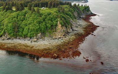
Seldovia Point, Kachemak Bay
Seldovia Point is a headland on the Kenai Peninsula at the northeast entrance to Seldovia Bay on the southern shore of Kachemak Bay, about 13.5 miles (22 km) southwest of Homer and 2.2 miles (3.5 km) north of Seldovia, Alaska.
HMCS Mackenzie, Cornet Island
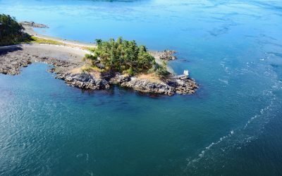
HMCS Mackenzie was a destroyer scuttled in Haro Strait, between Cornet and Gooch Islands in the Southern Gulf Islands, approximately 18 miles (29 km) north-northeast of Victoria and 5 miles (8 km) east-northeast of Sidney, British Columbia.
Whitman Creek, Revillagigedo Island
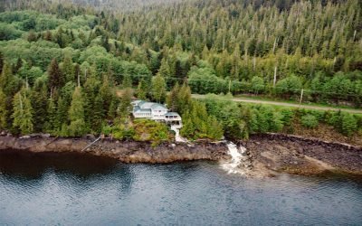
Whitman Creek is on the southeast coast of Revillagigedo Island, about 14 miles (23 km) north of Metlakatla and 7 miles (11 km) east-southeast of Ketchikan, Alaska.
Fossil Bluffs, Kuiu Island
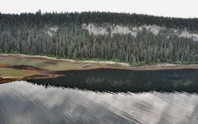
Fossil Bluffs is on the northeast shore of Halleck Harbor near the northern entrance of Saginaw Bay on Kuiu Island, about 42 miles (68 km) southeast of Sitka and 17 miles (27 km) southwest of Kake, Alaska.
Border Field State Park, Playas de Tijuana
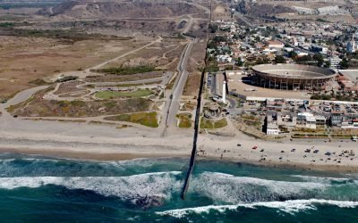
Border Field State Park is part of the Tijuana River National Estuarine Research Reserve, adjacent to the urban neighborhood of Playas de Tijuana, Mexico, located about 12 miles (19 km) south of San Diego, it lies within the city limits of Imperial Beach, California.